
Advanced Search for Maps
Showing 31-40 of 153
Official, Map sheet or poster
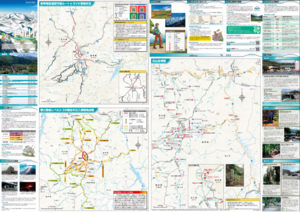
Fujisan Eruption Evacuation Route Map
Fujisan Eruption Evacuation Route Map
Official, Figure in hazard assessment
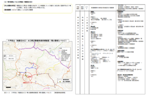
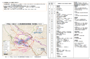
Hakkodasan (Jigokunuma crater) eruption warning regulation map (volcanic alert level 2)
Figure 3-2 in: Hakkodasan Volcanic Hazards Mitigation Committee. (2019). Hakkoda volcano evacuation plan. Aomori Prefecture, Aomori City, Towada City, Kuroishi City, and Hirakawa City.
Official, Figure in hazard assessment
Hakkodasan (Odake Crater) Eruption Warning Area Map (Eruption Warning Level 4-5)
Figure 3-4 in: Hakkodasan Volcanic Hazards Mitigation Committee. (2019). Hakkoda volcano evacuation plan. Aomori Prefecture, Aomori City, Towada City, Kuroishi City, and Hirakawa City.
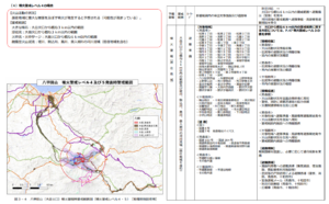
Official, Figure in hazard assessment
Hakkodasan (Odake crater) eruption warning regulation map (volcanic alert level 2)
Figure 3-1 in: Hakkodasan Volcanic Hazards Mitigation Committee. (2019). Hakkoda volcano evacuation plan. Aomori Prefecture, Aomori City, Towada City, Kuroishi City, and Hirakawa City.
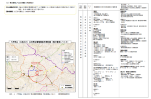
Official, Figure in hazard assessment
Hakkodasan (Odake crater) eruption warning regulation map (volcanic alert level 3)
Figure 3-3 in: Hakkodasan Volcanic Hazards Mitigation Committee. (2019). Hakkoda volcano evacuation plan. Aomori Prefecture, Aomori City, Towada City, Kuroishi City, and Hirakawa City.
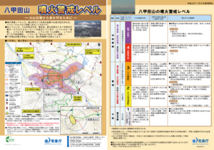
Official, Flyer, brochure, short fact-sheet, or handout
Hakkodasan Volcanic Alert Levels
Japan Meteorological Agency. (2019). Hakkodasan Volcanic Alert Levels. Volcano Monitoring and Warning Center, Volcano Division, Earthquake and Volcano Department.
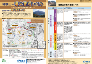
Official, Flyer, brochure, short fact-sheet, or handout
Hakoneyama Volcanic Alert Levels
Japan Meteorological Agency. (2017). Hakoneyama Volcanic Alert Levels. Volcano Monitoring and Warning Center, Volcano Division, Earthquake and Volcano Department.
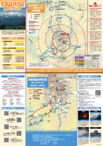
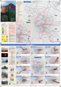
Official, Hiking or trail map
Hakusan Volcanic Disaster Prevention Map
Ishikawa Prefecture. (2019). Hakusan Volcanic Disaster Prevention Map.
Official, Hiking or trail map
Hakusan volcanic disaster prevention map (mobile version for climbers)
Gifu Prefecture Hakusan Volcano Disaster Prevention Council. (2018). Hakusan volcanic disaster prevention map (mobile version for climbers).
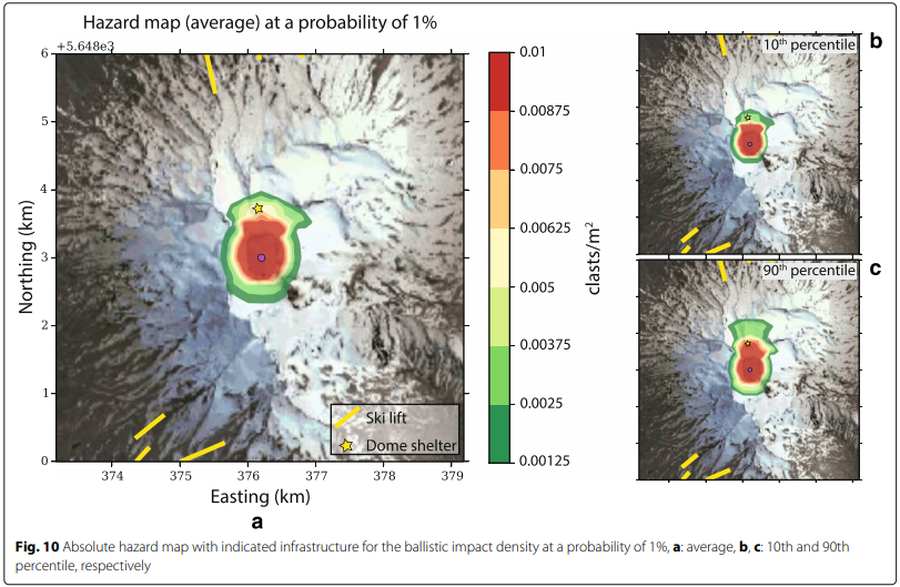
Figure in a journal article
Hazard map (average) at a probability of 1%
Figure 10 in: Strehlow, K., Sandri, L., Gottsmann, J. H., Kilgour, G., Rust, A. C., & Tonini, R. (2017). Phreatic eruptions at crater lakes: occurrence statistics and probabilistic hazard forecast. Journal of Applied Volcanology, 6(1), 4. https://doi.org/10.1186/s13617-016-0053-2