
Advanced Search for Maps
Showing 11-20 of 104
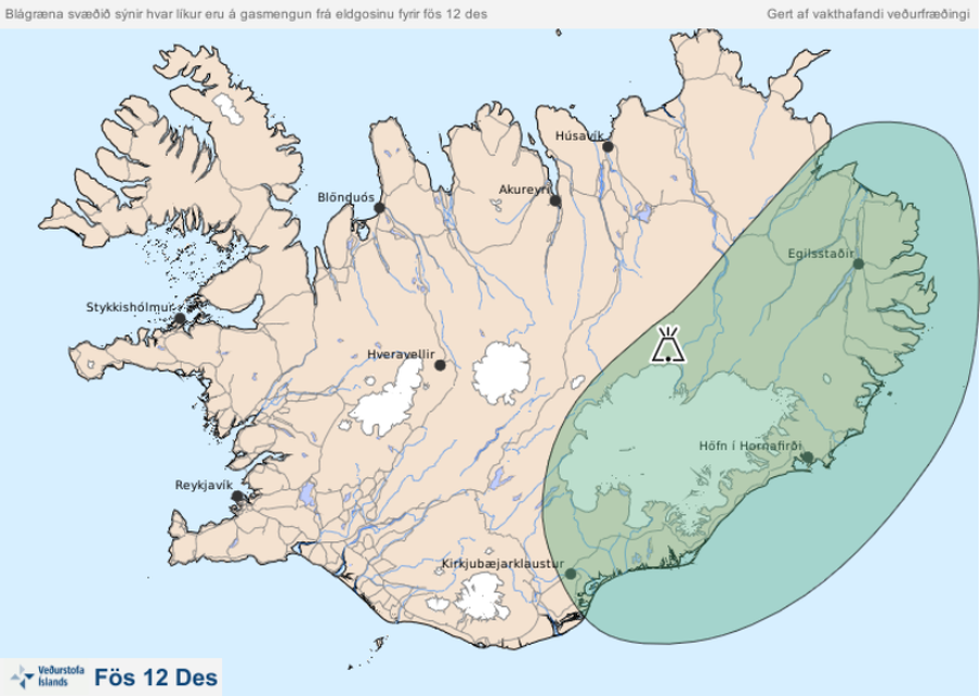
Official, Map in an information statement
Blágræna svæðið sýnir hvar líkur eru á gasmengun frá eldgosinu fyrir fös 12 des
(The blue-green area shows the probability of gas pollution from the eruption before Fri Dec 12)
Iceland Meteorological Office (IMO). (2014). Blágræna svæðið sýnir hvar líkur eru á gasmengun frá eldgosinu fyrir fös 12 des
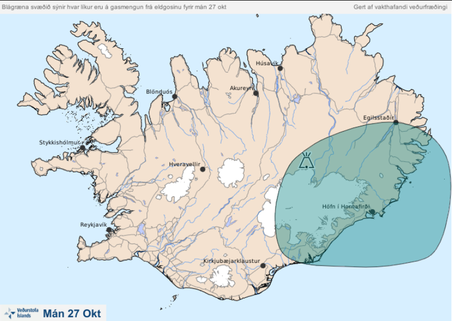
Official, Map in an information statement
Blágræna svæðið sýnir hvar líkur eru á gasmengun frá eldgosinu fyrir mán 27 okt
(The blue-green area shows the likelihood of gas pollution from the eruption before Mon Oct 27)
Iceland Meteorological Office (IMO). (2014). Blágræna svæðið sýnir hvar líkur eru á gasmengun frá eldgosinu fyrir mán 27 okt
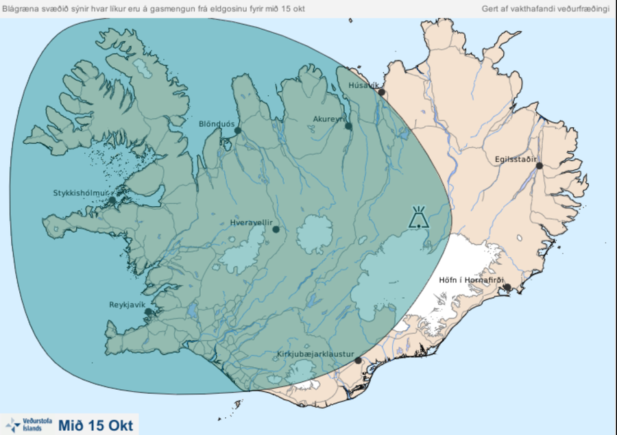
Official, Map in an information statement
Blágræna svæðið sýnir hvar líkur eru á gasmengun frá eldgosinu fyrir mið 15 okt.
(The blue-green area shows the probability of gas pollution from the volcanic eruption by mid-15 oct.)
Iceland Meteorological Office (IMO). (2014). Blágræna svæðið sýnir hvar líkur eru á gasmengun frá eldgosinu fyrir mið 15 okt.
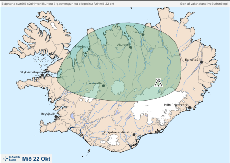
Official, Map in an information statement
Blágræna svæðið sýnir hvar líkur eru á gasmengun frá eldgosinu fyrir mið 22 okt.
(The blue-green area shows the probability of gas pollution from the eruption by mid-22 October.)
Iceland Meteorological Office (IMO). (2014). Blágræna svæðið sýnir hvar líkur eru á gasmengun frá eldgosinu fyrir mið 22 okt.
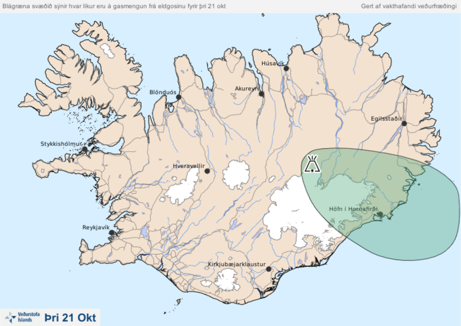
Official, Map in an information statement
Blágræna svæðið sýnir hvar líkur eru á gasmengun frá eldgosinu fyrir mið þri 21 okt.
(The blue-green area shows the probability of gas pollution from the volcanic eruption by Mon Oct 21.)
Iceland Meteorological Office (IMO). (2014). Blágræna svæðið sýnir hvar líkur eru á gasmengun frá eldgosinu fyrir mið þri 21 okt.
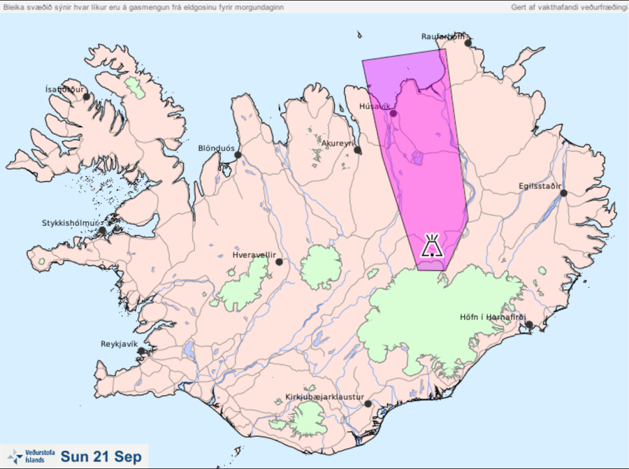
Official, Map in an information statement
Bleika svæðið sýnir hvar líkur eru á gasmengun frá eldgosinu fyrir morgundaginn Sun 21 Sep
(The pale area shows the probability of gas pollution from the eruption before tomorrow Sun 21 Sep)
Iceland Meteorological Office (IMO). (2014). Bleika svæðið sýnir hvar líkur eru á gasmengun frá eldgosinu fyrir morgundaginn Sun 21 Sep
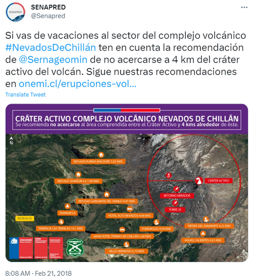
Official, Map in an information statement
Cráter Activo Complejo Volcánico Nevados de Chillán
(Nevados de Chillán Active Crater Complex )
Servicio Nacional de Geología y Minería (SERNAGEOMIN) & Oficina Nacional de Emergencia del Ministerio del Interior y Seguridad Pública (ONEMI). (2018). Cráter Activo Complejo Volcánico Nevados de Chillán. Twitter. https://twitter.com/Senapred/status/966343871520215040
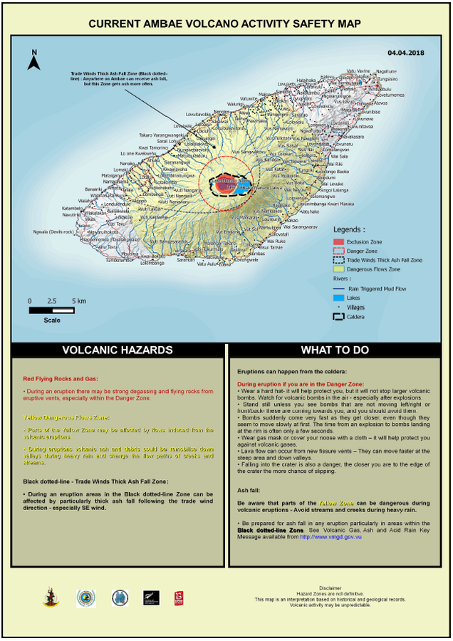
Official, Map in an information statement
Current Ambae Volcano Activity Safety Map
Vanuatu Meteorology & Geo-Hazards Department. (2018). Current Ambae Volcano Activity Safety Map 04.04.2018. Government of Vanuatu, Vanuatu Meteorology & Geo-Hazards Department, Vanuatu National Disaster Risk Management Office, New Zealand Foreign Affairs & Trade Aid Programme, GNS Science.
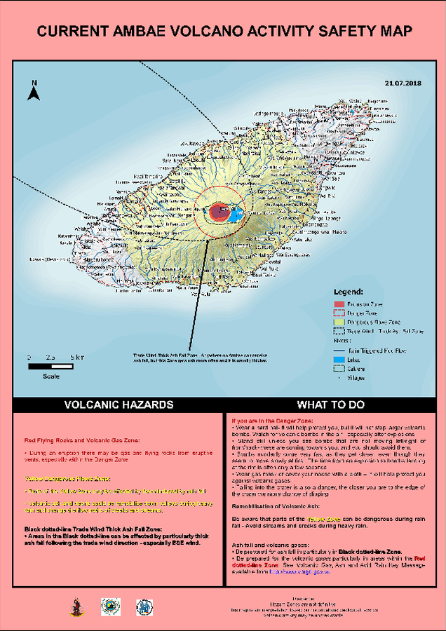
Official, Map in an information statement
Current Ambae Volcano Activity Safety Map
Vanuatu Meteorology & Geo-Hazards Department. (2018). Current Ambae Volcano Activity Safety Map 21.07.2018. Government of Vanuatu, Vanuatu Meteorology & Geo-Hazards Department, Vanuatu National Disaster Risk Management Office, New Zealand Foreign Affairs & Trade Aid Programme, GNS Science.
Holuhraun (Askja) & Bárdarbunga, Iceland
Official, Map in an information statement
Dæmi um verulegt sprengigos í Dyngjujökli, jafnþykktarlínur gjóskufalls
(Example of a major explosive eruption in Dyngjujökli, equal thickness lines of tephra)
Kort Jarðvísindastofnun HÍ. (2014). Dæmi um verulegt sprengigos í Dyngjujökli, jafnþykktarlínur gjóskufalls.