
Advanced Search for Maps
Showing 31-40 of 104
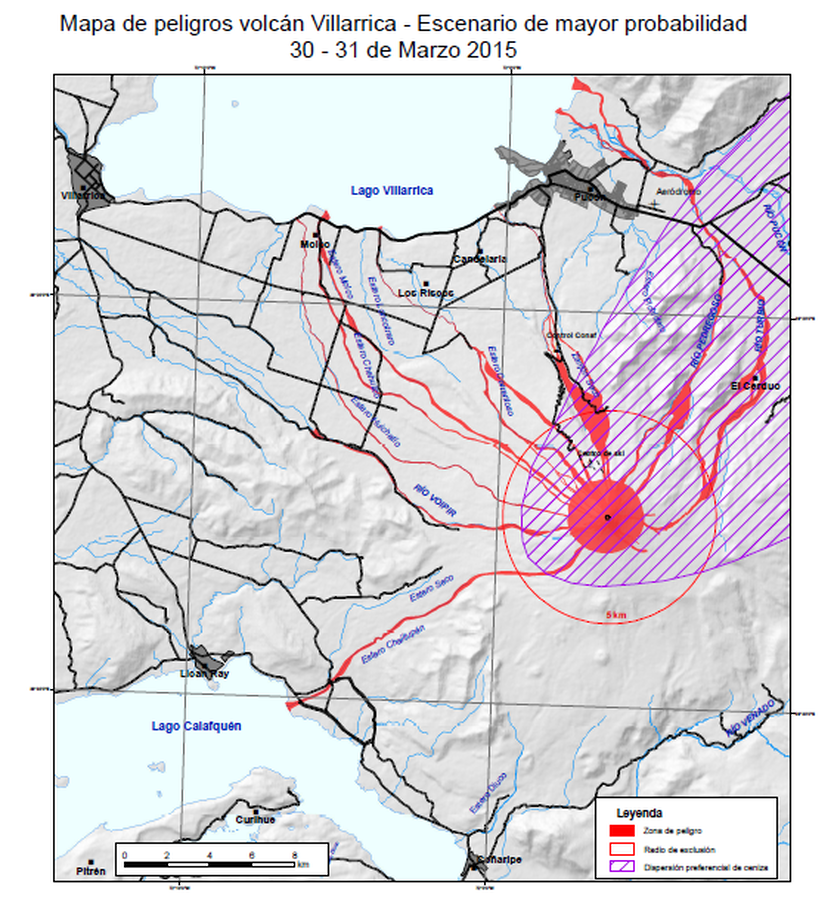
Official, Map in an information statement
Mapa de peligros volcán Villarrica- Escenario de mayor probabilidad - 30-31 de Marzo 2015
(Villarrica volcano hazard map - Most likely scenario - March 30-31, 2015)
Servicio Nacional de Geología y Minería (SERNAGEOMIN) Observatorio Volcanológico de los Andes del Sur (OVDAS). (2015). Reporte de Actividad Volcánica (RAV), 31-03-2015, RAV Región de la Araucanía - Los Ríos Año 2015 Marzo - Volumen 25. Observatorio Volcanológico de los Andes del Sur (OVDAS).
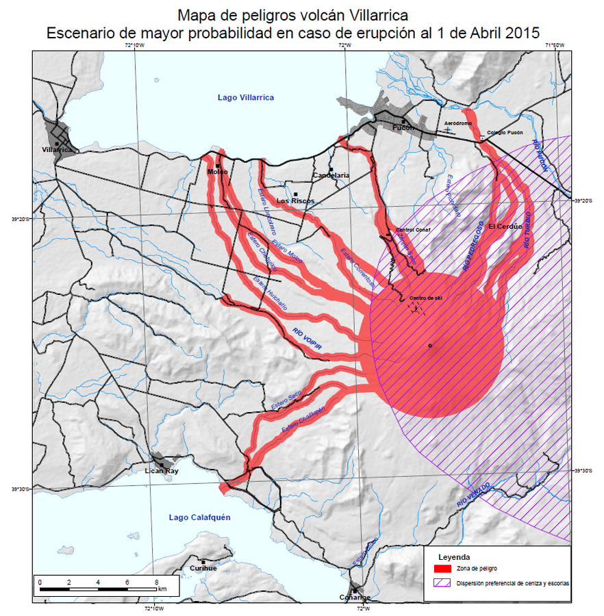
Official, Map in an information statement
Mapa de peligros volcán Villarrica- Escenario de mayor probabilidad en caso de erupcion al 1 de Abril 2015
(Villarrica volcano hazard map - Most likely scenario in case of eruption on April 1, 2015)
Servicio Nacional de Geología y Minería (SERNAGEOMIN) Observatorio Volcanológico de los Andes del Sur (OVDAS). (2015). Reporte de Actividad Volcánica (RAV), 1-04-2015, RAV Región de la Araucanía - Los Ríos Año 2015 Abril - Volumen 26. Observatorio Volcanológico de los Andes del Sur (OVDAS).
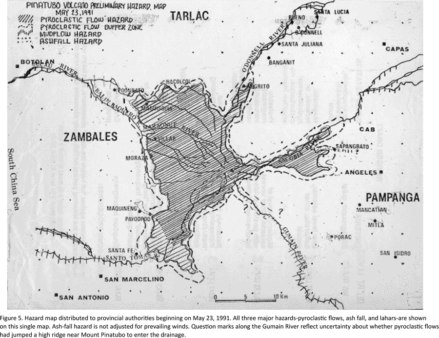
Official, Map in an information statement
Pinatubo Volcano Preliminary Hazard Map (May 23, 1991)
Figure 5 in: Punongbayan, R.S., Newhall, C.G., Bautista, L.P., Garcia, D., Harlow, D.H., Hoblitt, R.P., Sabit, J.P., & Solidum, R.U. (1996). Eruption hazard assessments and warnings. In: Newhall, C.G. & Punongbayan, R.S. (Eds.) Fire and Mud: Eruptions and Lahars of Mount Pinatubo, Philippines. Philippine Institute of Volcanology and Seismology, Quezon City; University of Washington Press, Seattle.
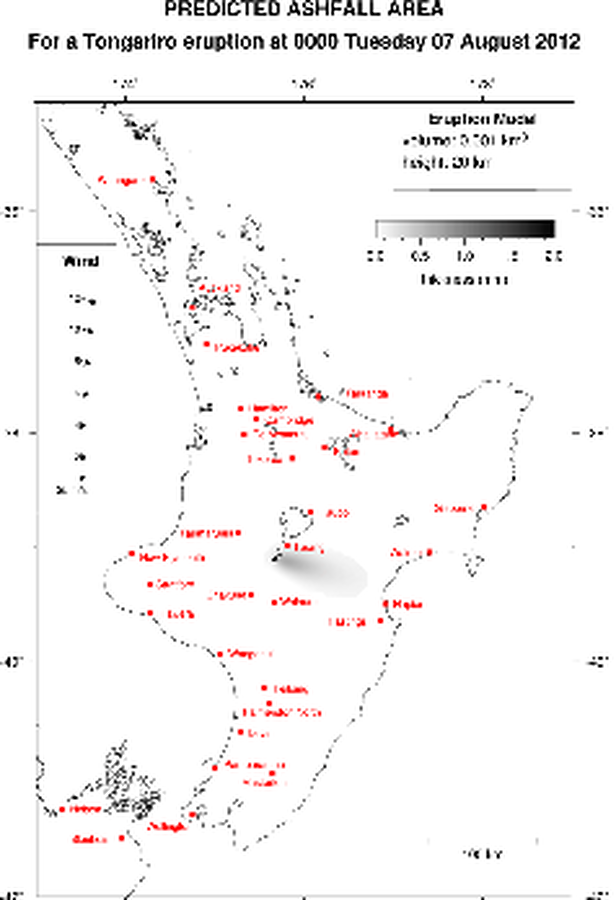
Official, Map in an information statement
Predicted Ashfall Area for a Tongariro eruption at 0000 Tuesday 07 August 2012
GNS Science. (2012). Volcanic Alert Bulletin TON2012-06.
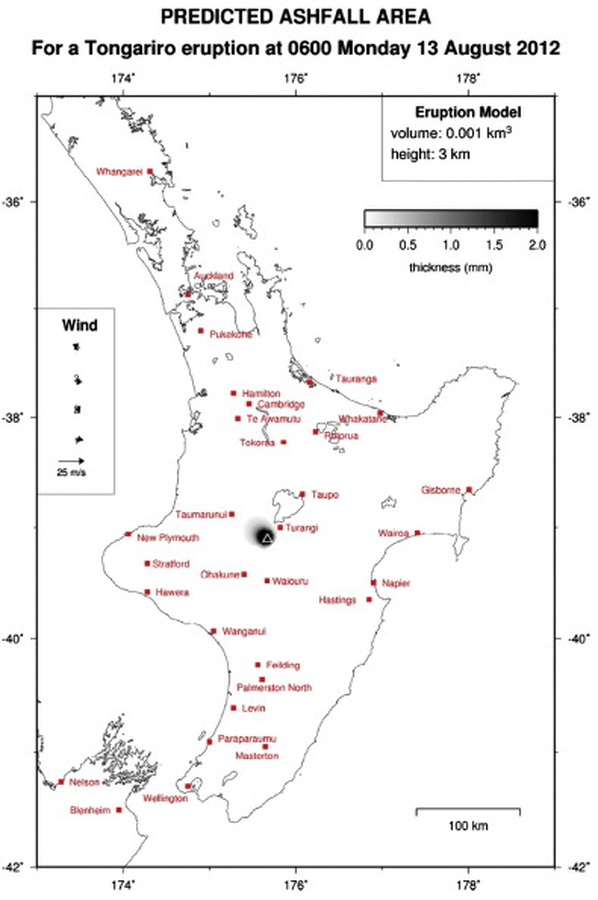
Official, Map in an information statement
Predicted Ashfall Area for a Tongariro eruption at 0600 Monday 13 August 2012
GNS Science. (2012). Volcanic Alert Bulletin TON2012-17. (Reprinted in: Leonard, G. S., Stewart, C., Wilson, T. M., Procter, J. N., Scott, B. J., Keys, H. J., Jolly, G.E., Wardman, J.B., Cronin. S.J. & McBride, S. K. (2014). Integrating multidisciplinary science, modelling and impact data into evolving, syn-event volcanic hazard mapping and communication: a case study from the 2012 Tongariro eruption crisis, New Zealand. Journal of Volcanology and Geothermal Research, 286, p. 208-232. https://doi.org/10.1016/j.jvolgeores.2014.08.018)
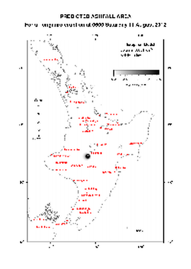
Official, Map in an information statement
Predicted Ashfall Area for a Tongariro eruption at 0600 Saturday 11 August 2012
GNS Science. (2012). Volcanic Alert Bulletin TON2012-14.
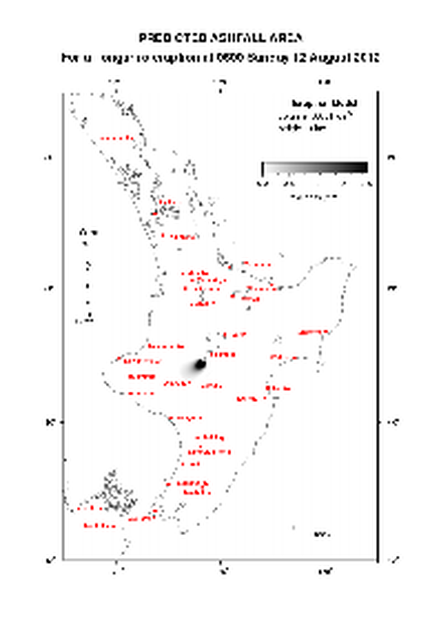
Official, Map in an information statement
Predicted Ashfall Area for a Tongariro eruption at 0600 Sunday 12 August 2012
GNS Science. (2012). Volcanic Alert Bulletin TON2012-16.
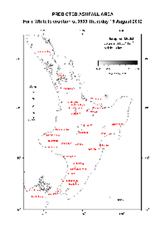
Official, Map in an information statement
Predicted Ashfall Area for a Tongariro eruption at 0600 Thursday 16 August 2012
GNS Science. (2012). Volcanic Alert Bulletin TON2012-21.

Official, Map in an information statement
Predicted Ashfall Area for a Tongariro eruption at 0600 Tuesday 14 August 2012
GNS Science. (2012). Volcanic Alert Bulletin TON2012-19.

Official, Map in an information statement
Predicted Ashfall Area for a Tongariro eruption at 0600 Wednesday 15 August 2012
GNS Science. (2012). Volcanic Alert Bulletin TON2012-20.