
Advanced Search for Maps
Showing 1-9 of 9
Official, Map in an information statement
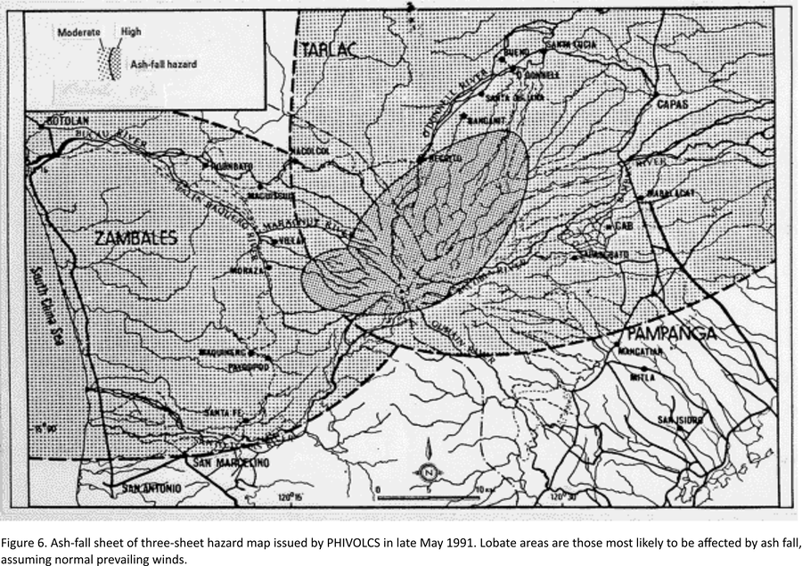
Ash-fall sheet of three-sheet hazard map issued by PHIVOLCS in late May 1991
Figure 6 in: Punongbayan, R.S., Newhall, C.G., Bautista, L.P., Garcia, D., Harlow, D.H., Hoblitt, R.P., Sabit, J.P., & Solidum, R.U. (1996). Eruption hazard assessments and warnings. In: Newhall, C.G. & Punongbayan, R.S. (Eds.) Fire and Mud: Eruptions and Lahars of Mount Pinatubo, Philippines. Philippine Institute of Volcanology and Seismology, Quezon City; University of Washington Press, Seattle.
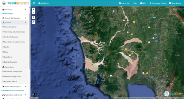
Official, Interactive web-based map
HazardHunterPH Pinatubo
GeoRisk Philippines. HazardHunterPH.
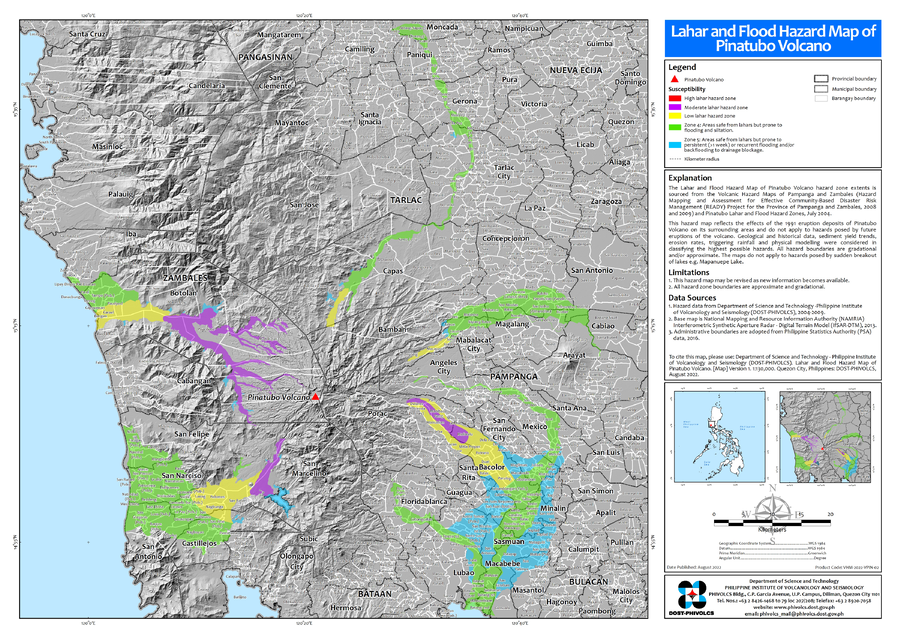
Official, Map sheet or poster
Lahar and Flood Hazard Map of Pinatubo Volcano
Department of Science and Technology-Philippine Institute of Volcanology and Seismology (DOST-PHIVOLCS). (2022). Lahar and Flood Hazard Map of Pinatubo Volcano. Version 1. 1:30,000. Quezon City, Philippines.
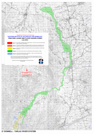
Official, Map sheet or poster
Pinatubo Lahar and Flood Hazard Zones
Philippine Institute of Volcanology and Seismology – Department of Science and Technology (PHIVOLCS-DOST). (2004). Pinatubo Lahar and Flood Hazard Zones. O'Donnell-Tarlac River System.
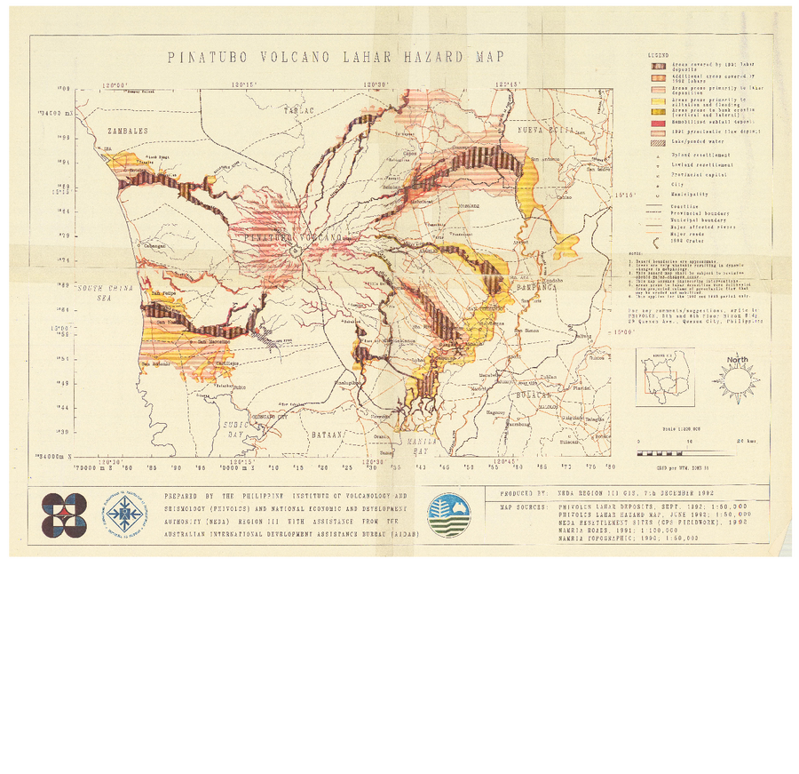
Official, Map sheet or poster
Pinatubo Volcano Lahar Hazard Map
Philippine Institute of Volcanology and Seismology (PHIVOLCS). (1992). Pinatubo Volcano Lahar Hazard Map. Philippine Institute of Volcanology and Seismology (PHIVOLCS), NEDA Region III GIS, Quezon City.
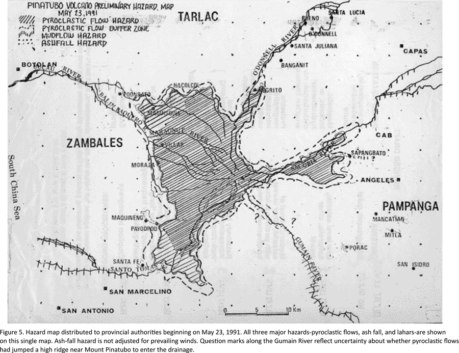
Official, Map in an information statement
Pinatubo Volcano Preliminary Hazard Map (May 23, 1991)
Figure 5 in: Punongbayan, R.S., Newhall, C.G., Bautista, L.P., Garcia, D., Harlow, D.H., Hoblitt, R.P., Sabit, J.P., & Solidum, R.U. (1996). Eruption hazard assessments and warnings. In: Newhall, C.G. & Punongbayan, R.S. (Eds.) Fire and Mud: Eruptions and Lahars of Mount Pinatubo, Philippines. Philippine Institute of Volcanology and Seismology, Quezon City; University of Washington Press, Seattle.
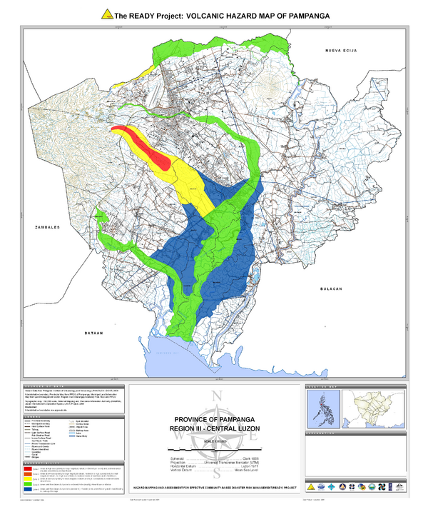
Official, Map sheet or poster
The READY Project: Volcanic Hazard Map of Pampanga
Philippine Institute of Volcanology and Seismology – Department of Science and Technology (PHIVOLCS-DOST). (2009). The Ready Project: Volcanic Hazard Map of Pampanga. Province of Pampanga, Region III-Central Luzon. Hazards Mapping and Assessment for Effective Community-Based Disaster Risk Management (READY) Project
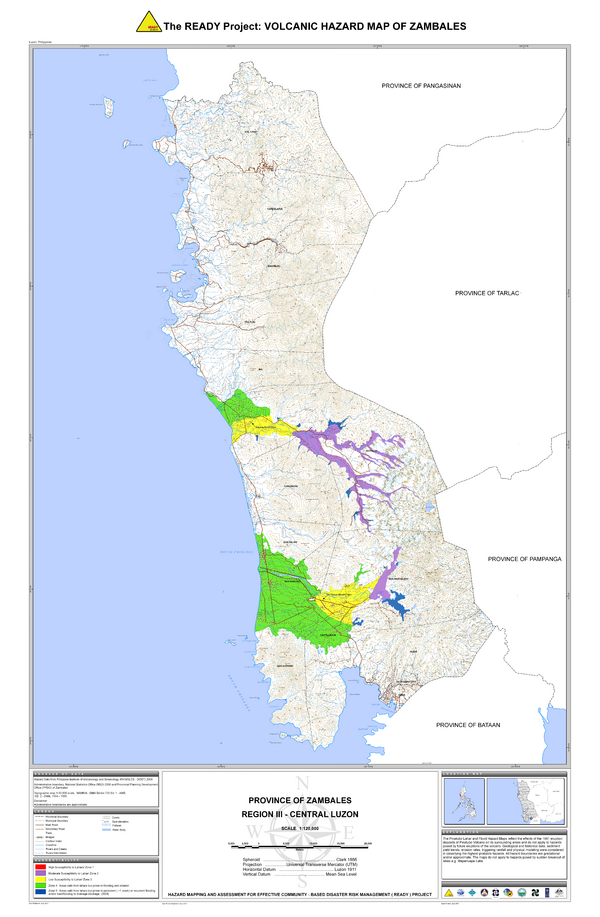
Official, Map sheet or poster
The READY Project: Volcanic Hazard Map of Zambales
Philippine Institute of Volcanology and Seismology – Department of Science and Technology (PHIVOLCS-DOST). (2011). The Ready Project: Volcanic Hazard Map of Zambales. Province of Zambales, Region III-Central Luzon. Hazards Mapping and Assessment for Effective Community-Based Disaster Risk Management (READY) Project
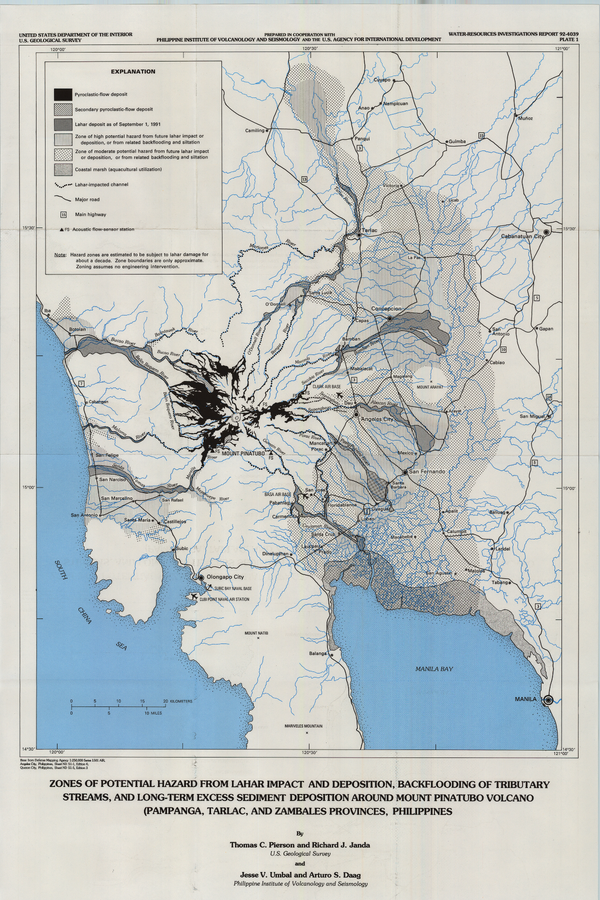
Official (foreign agency), Insert/poster-size map with accompanying report
Zones of Potential Hazard from Lahar Impact and Deposition, Backflooding of Tributary Streams, and Long-Term Excess Sediment Deposition Around Mount Pinatubo Volcano (Pampanga, Tarlac, and Zambales Provinces, Philippines)
Plate 1 in: Pierson, T.C., Janda, R.J., Umbal, J.V., & Daag, A.S. (1992). Immediate and long-term hazards from lahars and excess sedimentation in rivers draining Mount Pinatubo, Philippines. U.S. Geological Survey, Water-Resources Investigations Report 92-4039, 35 p., 1 plate. https://doi.org/10.3133/wri924039