
Advanced Search for Maps
Showing 1-10 of 502
Official, Insert/poster-size map with accompanying report
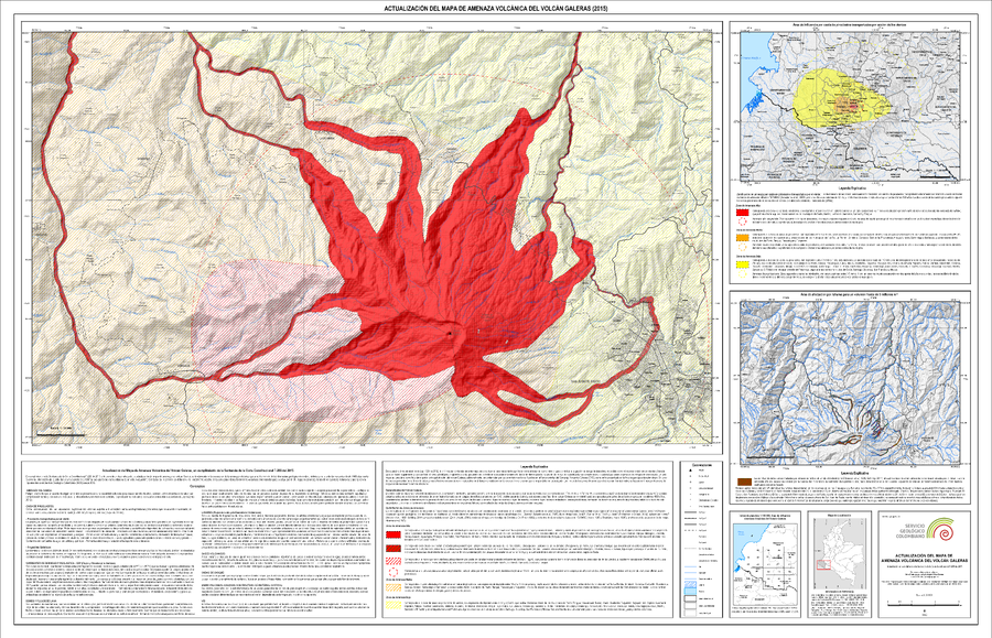
Actualización del Mapa de Amenaza Volcánica del Volcán Galeras (2015)
(Update of the Volcanic Hazard Map of the Galeras Volcano (2015))
Pocket insert in: Servicio Geológico Colombiano (SGC) Direccion de Geoamenazas. (2015). Actualización del Mapa de Amenaza Volcánica del Volcán Galeras - Colombia. En cumplimiento a la Sentencia de la Corte Constitucional T-269 de 2015.
Official, Figure in hazard assessment
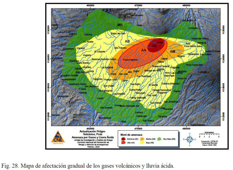
Actualización Peligro Volcánico, Poás. Amenaza por Gases y Lluvia Ácida
(Volcanic Danger Update, Poás. Hazard due to Gases and Acid Rain.)
Figure 28 in: Alvarado, G.E., Esquivel, L., Sánchez, B.E., & Alfaro, J.C. (2020). Actualización del Peligro Volcánico del Poás, Costa Rica. Comisión Nacional de Prevención de Riesgos y Atención de Emergencias (CNE). Febrero 2020.
Official, Flyer, brochure, short fact-sheet, or handout
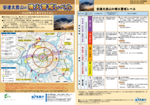
Adatarayama Volcanic Alert Levels
Japan Meteorological Agency. (2019). Adatarayama Volcanic Alert Levels. Volcano Monitoring and Warning Center, Volcano Division, Earthquake and Volcano Department.
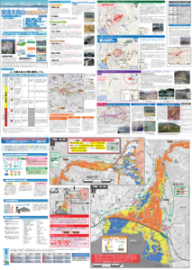
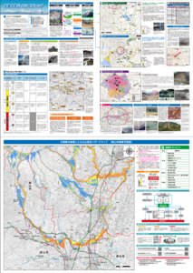
Official, Map sheet or poster
Adatarayama Volcano Disaster Prevention Map [Fukushima City]
Inawashiro Town. (2016). Adatarayama Volcano Disaster Prevention Map [Inawashiro Town].
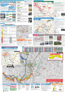
Official, Map sheet or poster
Adatarayama Volcano Disaster Prevention Map [Koriyama City]
Koriyama City. (2016). Adatarayama Volcano Disaster Prevention Map [Koriyama City].
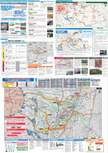
Official, Map sheet or poster
Adatarayama Volcano Disaster Prevention Map [Motomiya City]
Motomiya City. (2016). Adatarayama Volcano Disaster Prevention Map [Motomiya City].
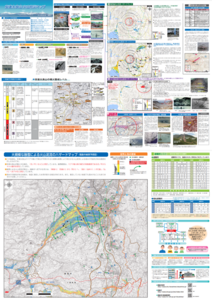
Official, Map sheet or poster
Adatarayama Volcano Disaster Prevention Map [Nihonmatsu City]
Nihonmatsu City. (2016). Adatarayama Volcano Disaster Prevention Map [Nihonmatsu City].
Official, Map sheet or poster
Adatarayama Volcano Disaster Prevention Map [Otama Village]
Fukushima City. (2016). Adatarayama Volcano Disaster Prevention Map [Fukushima City].
Official, Map sheet or poster
Adatarayama Volcano Disaster Prevention Map [Otama Village]
Otama Village. (2016). Adatarayama Volcano Disaster Prevention Map [Otama Village].
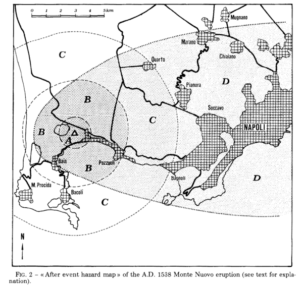
Figure in a journal article
After event hazard map of the A.D. 1538 Monte Nuevo eruption
Figure 2 in: Rosi, M., & Santacroce, R. (1984). Volcanic hazard assessment in the Phlegraean Fields: a contribution based on stratigraphic and historical data. Bulletin Volcanologique, 47(2), p. 359-370. https://doi.org/10.1007/BF01961567