
Advanced Search for Maps
Showing 541-550 of 2217
Official, Figure on website
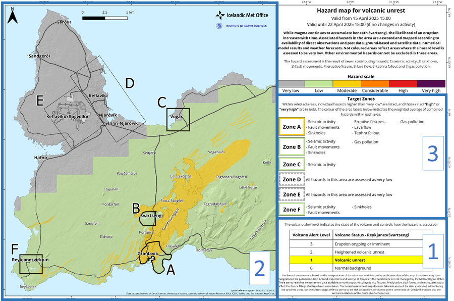
Hazard map for volcanic unrest
Icelandic Meteorological Office (IMO). (2025). New hazard map covering a larger area, 15 April 2025. https://en.vedur.is/about-imo/news/uplift-continues-beneath-svartsengi
Official, Map in a booklet, long fact-sheet, or handbook
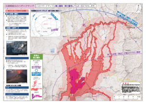
Hazard map of large-scale eruption
Asamayama Volcanic Disaster Prevention Committee. (2019). Asamayama Volcanic Disaster Prevention Map. Tsumagoi Village.
Official, Map in a booklet, long fact-sheet, or handbook
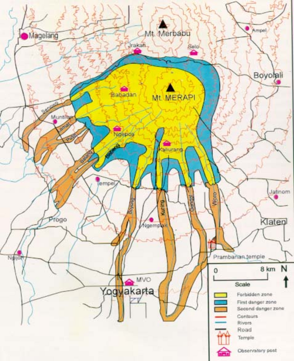
Hazard Map of Merapi
Purbawinata, M. A., Ratdomopurbo, A., Sinulingga, I. K., Sumarti, S., & Suharno, I. (1996). Merapi volcano – guide book. Volcanological Survey of Indonesia (VSI), Bandung. (Reprinted in: Gerstenecker, C., Läufer, G., Steineck, D., Tiede, C., & Wrobel, B. (2005). Validation of digital elevation models around Merapi Volcano, Java, Indonesia. Natural Hazards and Earth System Sciences, 5(6), 863-876. https://doi.org/10.5194/nhess-5-863-2005)
Official, Map in a booklet, long fact-sheet, or handbook
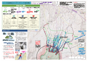
Hazard map of small to medium-scale eruptions (snow season)
Asamayama Volcanic Disaster Prevention Committee. (2019). Asamayama Volcanic Disaster Prevention Map. Tsumagoi Village.
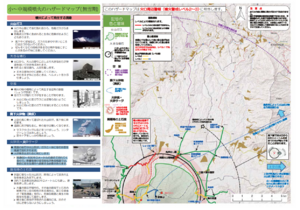
Official, Map in a booklet, long fact-sheet, or handbook
Hazard map of small to medium-scale eruptions (snowless period)
Asamayama Volcanic Disaster Prevention Committee. (2019). Asamayama Volcanic Disaster Prevention Map. Tsumagoi Village.
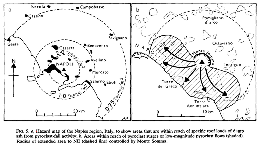
Figure in a journal article
Hazard map of the Naples region, Italy
Figure 5 in: Booth, B. (1979). Assessing volcanic risk. Journal of the Geological Society, 136(3), 331-340.
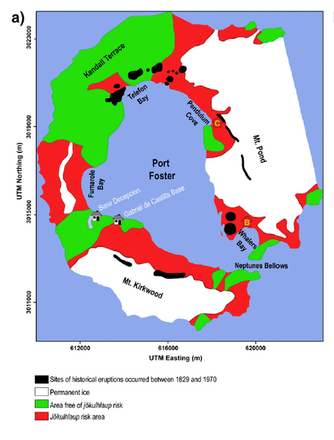
Figure in a journal article
Hazard map presented by Roobol (1982)
Figure 5 (in reprint) in: Roobol, M.J. (1982). The volcanic hazard at Deception Island, South Shetland Islands. British Antarctic Survey. 51, 237-245. (Reprinted in: Bartolini, S., Geyer, A., Martí, J., Pedrazzi, D., & Aguirre-Díaz, G. (2014). Volcanic hazard on Deception Island (South Shetland Islands, Antarctica). Journal of Volcanology and Geothermal Research, 285, p. 150-168. https://doi.org/10.1016/j.jvolgeores.2014.08.009)
Official, Figure in hazard assessment
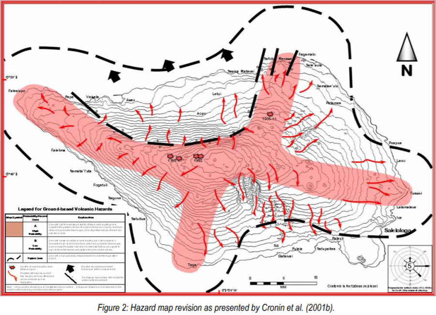
Hazard map revision as presented by Cronin et al. (2001b)
Figure 2 in: Cronin, S., Bonte-Grapentin, M. & Nemeth, K. (2006). Samoa technical report - Review of volcanic hazard maps for Savai'i and Upolu. Pacific Islands Applied Geoscience Commission (SOPAC) Project Report 59.
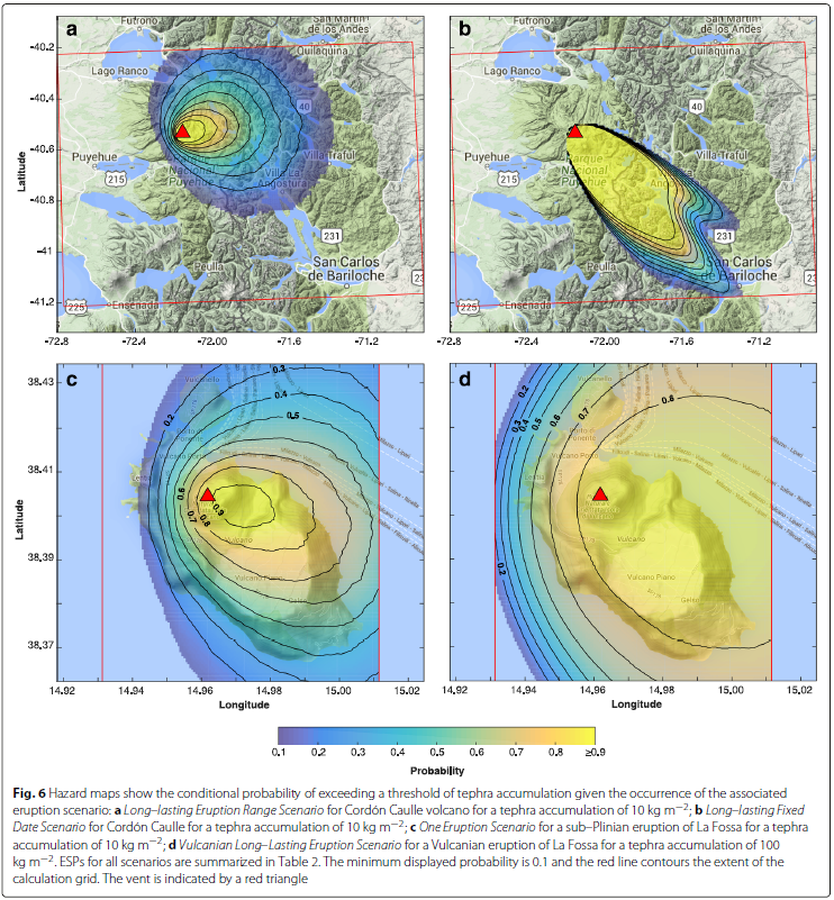
Figure in a journal article
Hazard maps show the conditional probability of exceeding a threshold of tephra accumulation given the occurrence of the associated eruption scenario
Figure 6 in: Biass, S., Bonadonna, C., Connor, L., & Connor, C. (2016). TephraProb: a Matlab package for probabilistic hazard assessments of tephra fallout. Journal of Applied Volcanology, 5(1), 1-16. https://doi.org/10.1186/s13617-016-0050-5
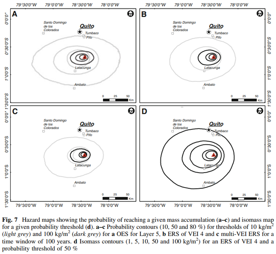
Figure in a journal article
Hazard maps showing the probability of reaching a given mass accumulation (a–c) and isomass map for a given probability threshold (d)
Figure 7 in: Biass, S., & Bonadonna, C. (2013). A fast GIS-based risk assessment for tephra fallout: the example of Cotopaxi volcano, Ecuador. Natural Hazards, 65, 477-495. https://doi.org/10.1007/s11069-012-0378-z