
Advanced Search for Maps
Showing 591-600 of 2217
Official, Figure in a journal article
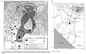
Hazards map of pyroclastic flows produced by central dome explosions based on four recognized events during the past 40 k.y., and small-size landslides produced by flank instability, and debris and hyperconcentrated flows produced by syneruptive or posteruptive processes.
Figure 14 in: Macias, J. L., Espíndola, J. M., Garcia-Palomo, A., Scott, K. M., Hughes, S., & Mora, J. C. (2000). Late Holocene Peléan-style eruption at Tacaná volcano, Mexico and Guatemala: Past, present, and future hazards. Geological Society of America Bulletin, 112(8), p. 1234-1249. https://doi.org/10.1130/0016-7606(2000)112%3C1234:LHPEAT%3E2.0.CO;2
Official, Figure on website
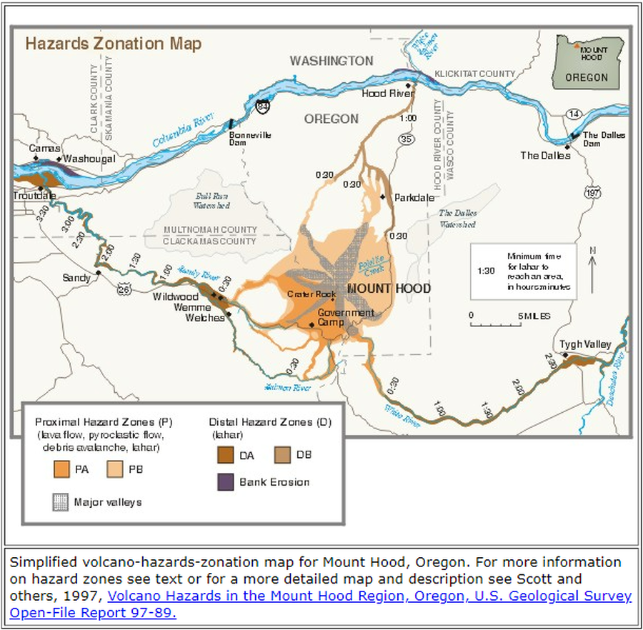
Hazards Zonation Map
Gardner, C.A., Scott, W.E., Major, J.J., & Pierson, T.C. (2000). Hazards Zonation Map. Mount Hood—History and Hazards of Oregon's Most Recently Active Volcano. U.S. Geological Survey, Fact Sheet 060-00 (Online Version 1.0). https://doi.org/10.3133/fs06000
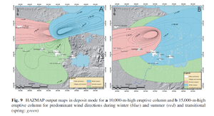
Figure in a journal article
HAZMAP output maps in deposit mode for a 10,000-m-high eruptive column and b 15,000-m-high eruptive column for predominant wind directions during winter (blue) and summer (red) and transitional (spring: green)
Figure 9 in: Sieron, K., Capra, L., & Rodríguez-Elizararrás, S. (2014). Hazard assessment at San Martín volcano based on geological record, numerical modeling, and spatial analysis. Natural hazards, 70(1), 275-297. https://doi.org/10.1007/s11069-013-0807-7
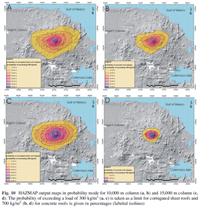
Figure in a journal article
HAZMAP output maps in probability mode for 10,000 m column (a, b) and 15,000 m column (c, d).
Figure 10 in: Sieron, K., Capra, L., & Rodríguez-Elizararrás, S. (2014). Hazard assessment at San Martín volcano based on geological record, numerical modeling, and spatial analysis. Natural hazards, 70(1), 275-297. https://doi.org/10.1007/s11069-013-0807-7
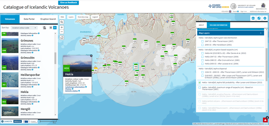
Official, Interactive web-based map
Hekla - Vatnafjöll, tephra fall probability - After Larsen and Gíslason (2013)
Larsen, G. & Thordarson, T. (2019). Hekla. In: Oladottir, B., Larsen, G. & Guðmundsson, M. T. Catalogue of Icelandic Volcanoes. Iceland Meteorological Office (IMO), Univeristy of Iceland, and Civil Protection Department of the National Commissioner of the Iceland Police (CPD-NCIP). (Simplified from: Larsen & Gíslason 2013)
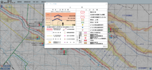
Official, Interactive web-based map
Higashikawa Town Disaster Hazard Map (web version)
Higashikawa Town. (2020). Higashikawa Town Disaster Hazard Map (web version).
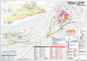
Official, Map sheet or poster
Higashikawa Town Flood Hazard (largest scale) and Daisetsu-san (Asahi-dake) Volcano Disaster Prevention Map
Higashikawa Town. (2020). Higashikawa Town Flood Hazard (largest scale) and Daisetsu-san (Asahi-dake) Volcano Disaster Prevention Map. Hokkaido Map Co., Ltd. Asahikawa Branch.
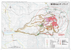
Official, Map in a booklet, long fact-sheet, or handbook
Higashikawa Town Volcano Hazard Map
Higashikawa Town Hall. (2020). Higashikawa Town Disaster Prevention Hazard Map. Hokkaido Map Co., Ltd. 30 p.
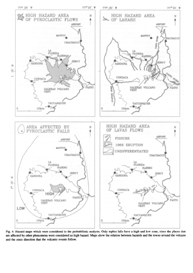
Official, Figure in a journal article
High Hazard Area of Pyroclastic Flows. High Hazard Area of Lahars. Area Affedted by Pyroclastic Falls. High Hazard Area of Lavas Flows.
Figure 4 in: Artunduaga, A.D.H., & Jiménez, G.P.C. (1997). Third version of the hazard map of Galeras Volcano, Colombia. Journal of Volcanology and Geothermal research, 77(1-4), p. 89-100. https://doi.org/10.1016/S0377-0273(96)00088-1
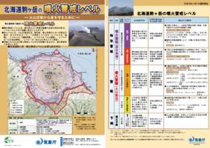
Official, Flyer, brochure, short fact-sheet, or handout
Hokkaido Komagatake Volcanic Alert Levels
Japan Meteorological Agency. (2016). Hokkaido Komagatake Volcanic Alert Levels. Volcano Monitoring and Warning Center, Volcano Division, Earthquake and Volcano Department.