
Advanced Search for Maps
Showing 561-570 of 2217
Official, Figure in hazard assessment
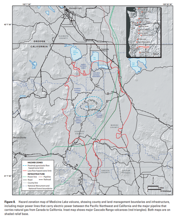
Hazard zonation map of Medicine Lake volcano, showing county and land-management boundaries and infrastructure
Figure 8 in: Donnelly-Nolan, J.M., Nathenson, M., Champion, D.E., Ramsey, D.W., Lowenstern, J.B., & Ewert, J.W. (2007). Volcano Hazards Assessment for Medicine Lake Volcano, Northern California. Scientitic Investigations Report 2007-5174-A. Plate 1. https://doi.org/10.3133/sir20075174A

Figure in a journal article
Hazard zonation map showcasing the three preliminary hazard zones in Santorini.
Figure 7 in: Katsigera, A., Nomikou, P., & Pavlopoulos, K. (2024). A preliminary hazard assessment of Kolumbo Volcano (Santorini, Greece). GeoHazards, 5(3), 816-832. https://doi.org/10.3390/geohazards5030041
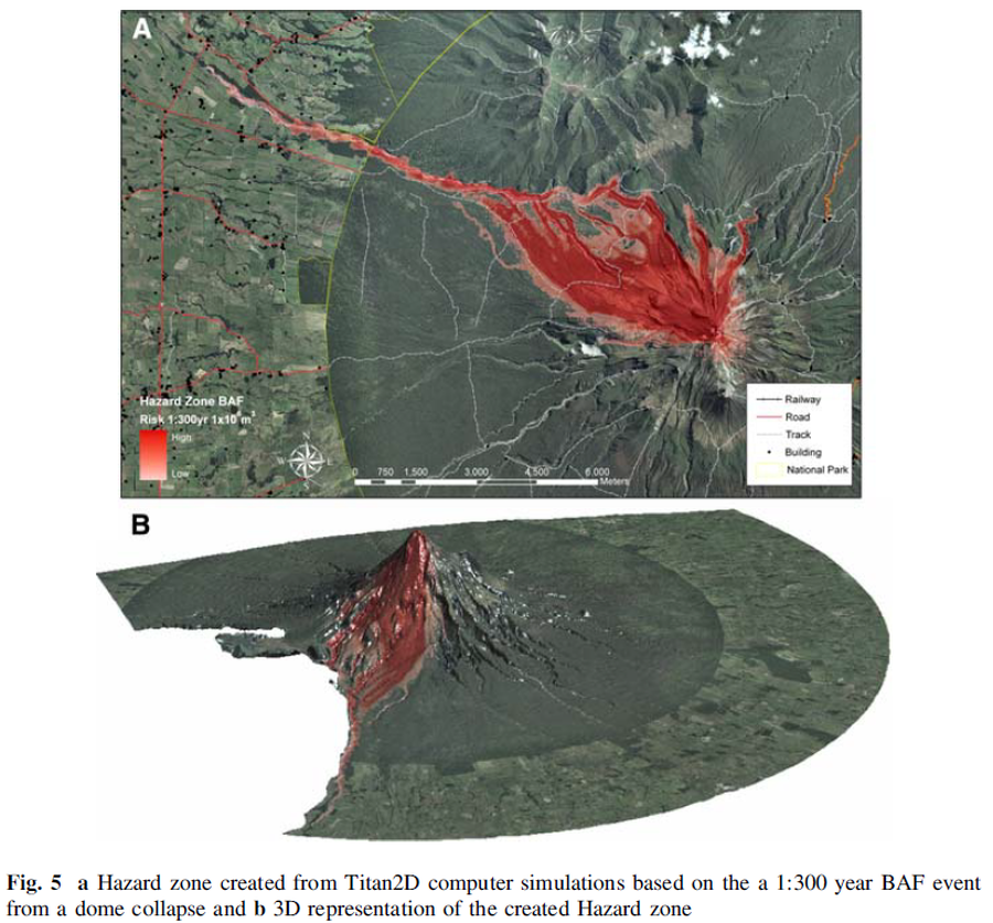
Figure in a journal article
Hazard zone created from Titan2D computer simulations based on the 1:300 year BAF event from a dome collapse and 3D representation of the created Hazard zone
Figure 5 in: Procter, J. N., Cronin, S. J., Platz, T., Patra, A., Dalbey, K., Sheridan, M., & Neall, V. (2010). Mapping block-and-ash flow hazards based on Titan 2D simulations: a case study from Mt. Taranaki, NZ. Natural Hazards, 53, 483-501.
Figure in a journal article
Hazard zones 1 (highest hazard) to 6 (lowest hazard, but highest vulnerability) based on the volcanological parameters of past eruptions, high vent density areas, and present day morphology
Figure 6 in: Behncke, B., Neri, M., & Nagay, A. (2005). Lava flow hazard at Mount Etna (Italy): new data from a GIS-based study. In: Manga, M. and Ventura, G. Kinematics and Dynamics of Lava Flows. Geological Society of America, Special Paper 396. https://doi.org/10.1130/0-8137-2396-5.189
Official, Unknown format
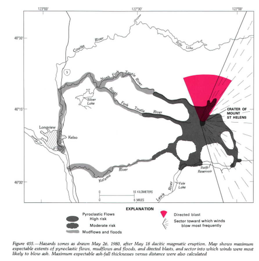
Hazard zones as drawn May 26, 1980, after May 18 dacitic magmatic eruption.
Figure 455 in: Miller, C.D., Mullineaux, D.R. & Crandell, D.R. (1981). Hazards assessments at Mount St. Helens. In: Lipman, P. W. & Mullineaux, D. R. (Eds.) The 1980 eruptions of Mount St. Helens, Washington. U.S. Geological Survey, Professional Paper 1250, p. 789-802. https://doi.org/10.3133/pp1250
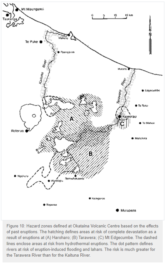
Official, Figure in hazard assessment
Hazard zones defined at Okataina Volcanic Centre based on the effects of past eruptions
Figure 10 in: Nairn, I.A. (1993). Volcanic hazards at Okataina Centre. 3rd ed. Ministry of Civil Defence, Palmerston North, NZ. Volcanic hazards information series 2. 29 p. Reproduced on website: https://www.gns.cri.nz/Home/Learning/Science-Topics/Volcanoes/New-Zealand-Volcanoes/Volcano-Geology-and-Hazards/Okataina-Volcanic-Centre-Geology

Official, Map in a booklet, long fact-sheet, or handbook
Hazard zones for debris flows, lahars, lava flows, and pyroclastic flows from Mount Rainier
Page 3 in: Driedger, C.L. & Scott, W.E. (2008). Mount Rainier: living safely with a volcano in your backyard. U.S. Geological Survey, Fact Sheet 2008-3062, 4 p. https://doi.org/10.3133/fs20083062
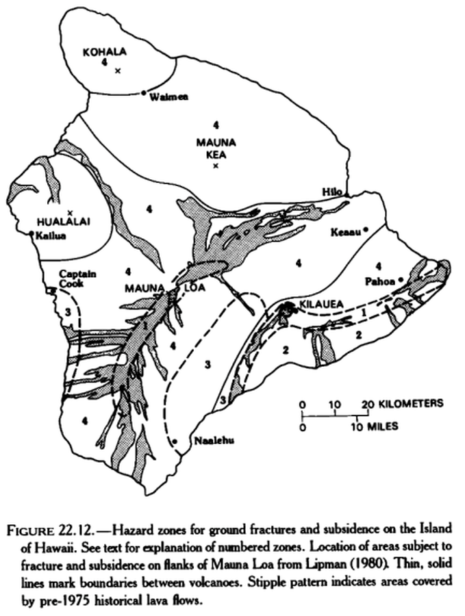
Official, Figure in hazard assessment
Hazard zones for ground fractures and subsidence on the Island of Hawaii
Figure 22.12 in: Mullineaux, D.R., Peterson, D.W., & Crandell, D.R. (1987). Volcanic hazards in the Hawaiian Islands. In: Decker, R.W., Wright, T.L., & Stauffer, P.H. (Eds.) Volcanism in Hawaii. US Geological Survey Professional Paper 1350, Chapter 22, p. 599-621. https://doi.org/10.3133/pp1350
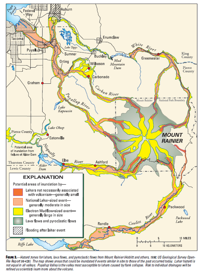
Official, Map in a booklet, long fact-sheet, or handbook
Hazard zones for lahars, lava flows, and pyroclastic flows from Mount Rainier
Figure 3 in: Driedger, C.L. & Scott, K.M. (2002). Mount Rainier: learning to live with volcanic risk. U.S. Geological Survey, Fact Sheet 034-02, 4 p. https://doi.org/10.3133/fs03402
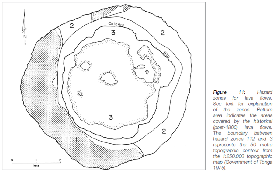
Official, Figure in hazard assessment
Hazard zones for lava flows
Figure 11 in: Taylor, P.W. (2016). Niuafo’ou, Tonga: Volcanic Hazards and the Risk From Future Activity. In: Taylor, P.W. (Ed.) Volcanic Hazards and Emergency Management in the Southwest Pacific, SPC Technical Bulletin, SPC00017, p. 132-150