
Advanced Search for Maps
Showing 51-60 of 93

Official, Map in a booklet, long fact-sheet, or handbook
Mudflow Hazard Zones Map
Page 18 in: Crandell, D.R. & Nichols, D.R. (1989). Volcanic hazards at Mount Shasta, California. U.S. Geological Survey, General Information Product, 22 p. https://doi.org/10.3133/70039409
Official, Insert/poster-size map with accompanying report
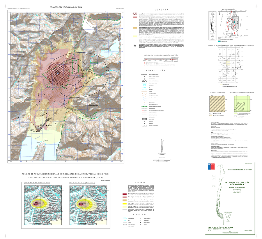
Peligros del Volcán Hornopirén, Región de Los Lagos
(Hazards of the Hornopirén Volcano, Los Lagos Region)
Mella, M., Toloza, V., and Bertin, L. (2021). Peligros del volcán Hornopirén, región de Los Lagos. Servicio Nacional de Geología y Minería, Carta Geológica de Chile, Serie Geología Ambiental 37: 51 p., 1 mapa escala 1:50.000. Santiago.
Official, Map sheet or poster
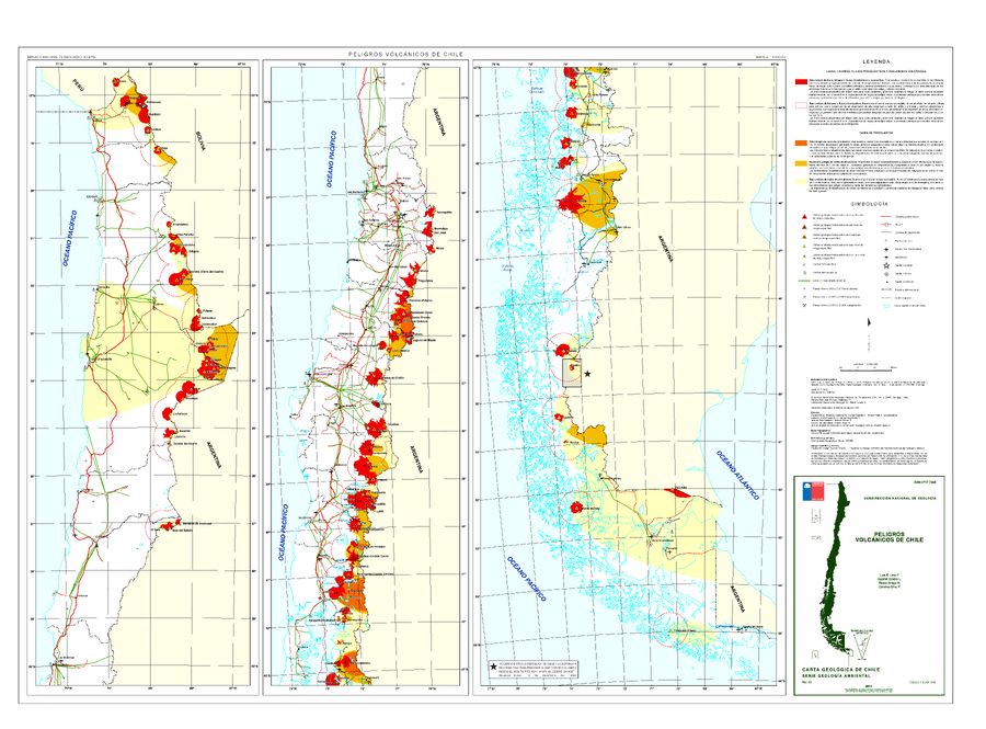
Peligros Volcanicos de Chile
(Volcanic Hazards of Chile)
Lara, L.E., Orozco G., Amigo A. & Silva C. (2011). Peligros Volcanicos de Chile. Servicio Nacional de Geología y Minería (SERNAGEOMIN), Carte Geologica de Chile, Serie Geologia Ambiental, No. 13: 34 p., 1 mapa escala 1:2.000.000. Santiago.
Official, Map in an information statement
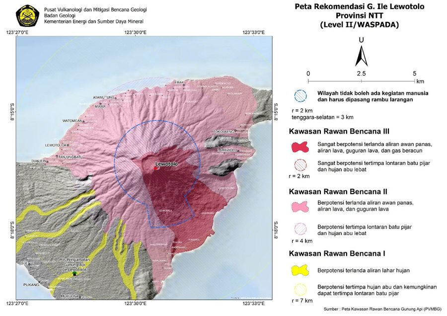
Peta Rekomendasi G. Ile Lewotolo Provinsi NTT (Level II/WASPADA)
(Recommended Map of G. Ile Lewotolo NTT Province (Level II/ALERT))
Pusat Vulanologi dan Mitigasi Bencana Geologi (PVMBG). (2024). Peta Rekomendasi G. Ile Lewotolo Provinsi NTT (Level II/WASPADA). Press Release PERLUASAN JARAK REKOMENDASI GUNUNGAPI ILI LEWOTOLOK 24 FEBRUARI 2024 PUKUL 17:00 WITA. https://vsi.esdm.go.id/press-release/press-release-perluasan-jarak-rekomendasi-gunungapi-ili-lewotolok-24-februari-2024-pukul-1700-wita
Official, Map in an information statement
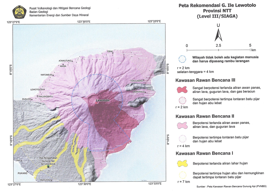
Peta Rekomendasi G. Ile Lewotolo Provinsi NTT (Level III/SIAGA)
(Recommended Map of G. Ile Lewotolo NTT Province (Level III/STANDBY))
Pusat Vulanologi dan Mitigasi Bencana Geologi (PVMBG). (2024). Peta Rekomendasi G. Ile Lewotolo Provinsi NTT (Level III/SIAGA). Penyampaian Peningkatan Tingkat Aktivitas G. Ili Lewotolok, Nusa Tenggara Timur dari Level I (Waspada) ke Level I (Siaga) tanggal 27 Februari 2024 Pukul 10:00 WITA. https://vsi.esdm.go.id/press-release/penyampaian-peningkatan-tingkat-aktivitas-g-ili-lewotolok-nusa-tenggara-timur-dari-level-i-waspada-ke-level-i-siaga-tanggal-27-februari-2024-pukul-1000-wita
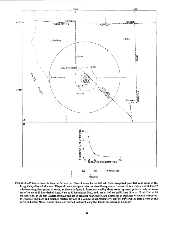
Official, Figure in hazard assessment
Potential hazards from airfall ash
Figure 3 in: Miller, C.D., Mullineaux, D.R., Crandell, D.R. & Bailey, R.A. (1982). Potential hazards from future volcanic eruptions in the Long Valley-Mono Lake area, east-central California and southwest Nevada; a preliminary assessment. U.S. Geological Survey, Circular 877, 10 p. https://doi.org/10.3133/cir877
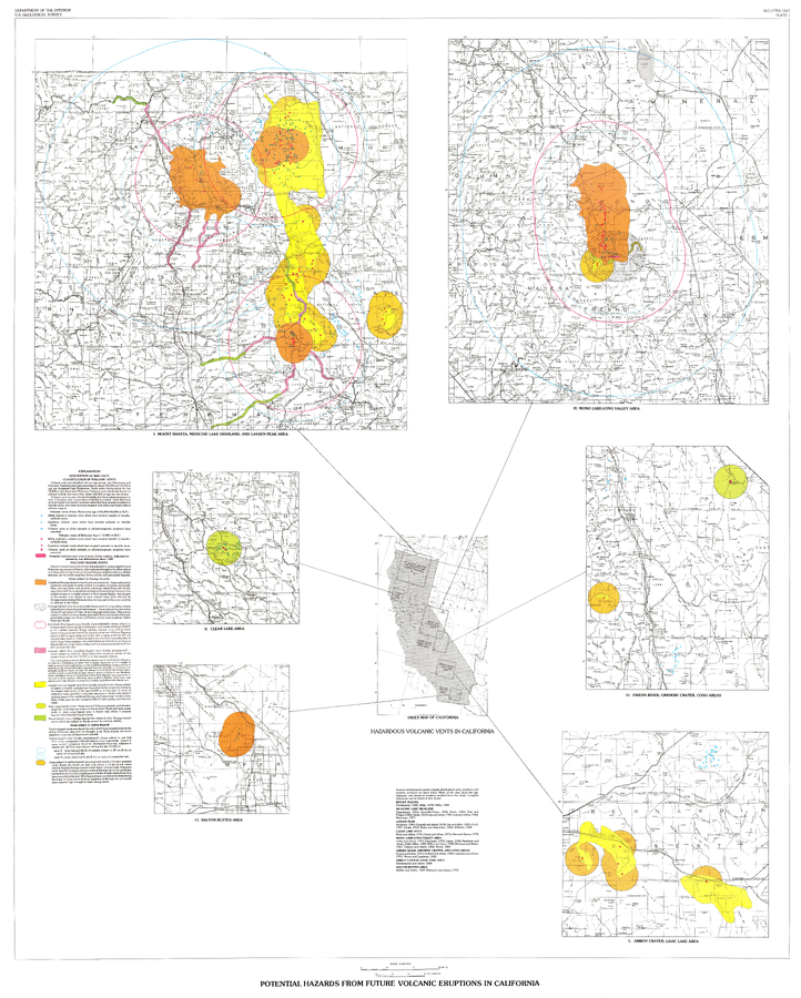
Official, Insert/poster-size map with accompanying report
Potential Hazards from future volcanic eruptions in California
Plate 1 in: Miller, C.D. (1989). Potential hazards from future volcanic eruptions in California. U.S. Geological Survey, Bulletin 1847, 17 p., 2 tables, 1 plate, scale 1:500,000.
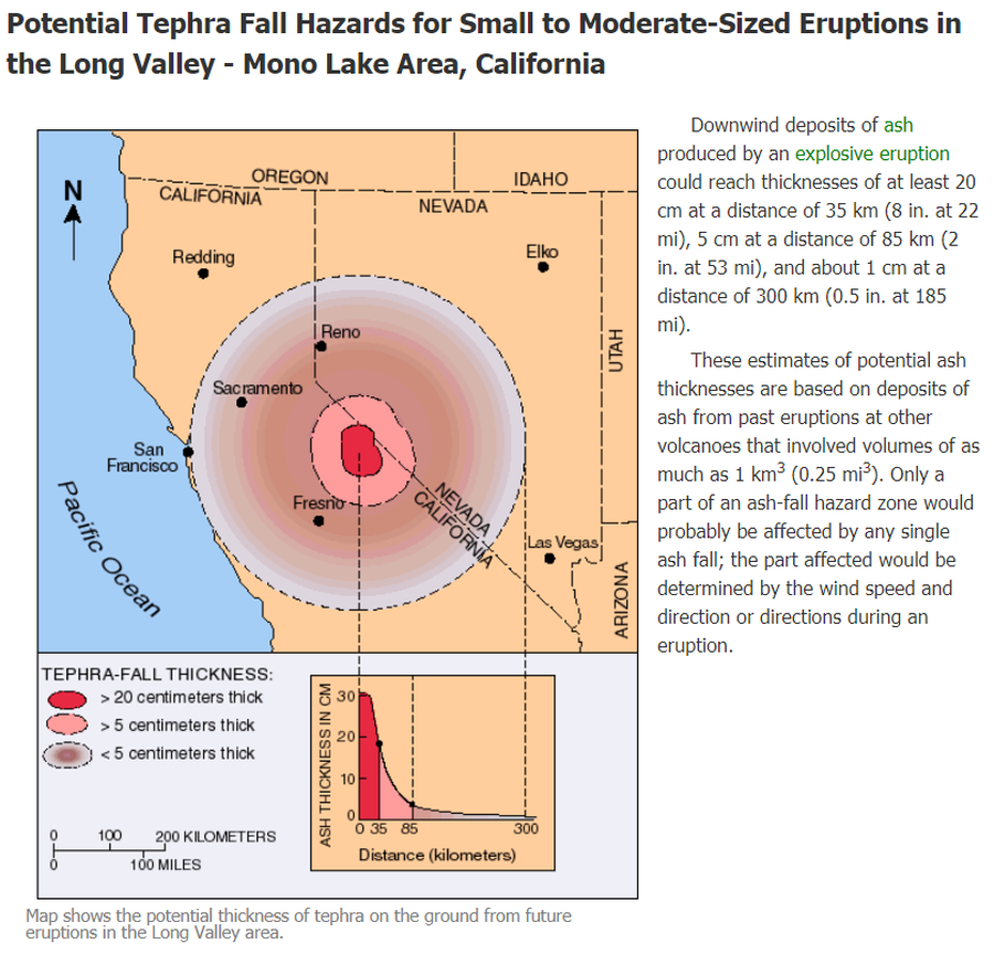
Official, Figure on website
Potential Tephra Fall Hazards for Small to Moderate-Sized Eruptions in the Long Valley - Mono Lake Area, California
U.S. Geological Survey (USGS). (2012). Potential Tephra Fall Hazards for Small to Moderate-Sized Eruptions in the Long Valley - Mono Lake Area, California. U.S. Geological Survey. Long Valley Caldera, Volcano Hazards in the Long Valley - Mono Lake Area, California. https://www.usgs.gov/volcanoes/long-valley-caldera/volcano-hazards-long-valley-mono-lake-area-california
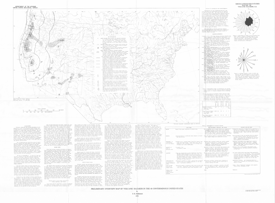
Official, Map sheet or poster
Preliminary Overview Map of Volcanic Hazards in the 48 Coterminous United States
Mullineaux, D.R. (1978). Preliminary overview map of volcanic hazards in the 48 conterminous United States. U.S. Geological Survey, Miscellaneous Field Studies Map 786. https://doi.org/10.3133/mf786
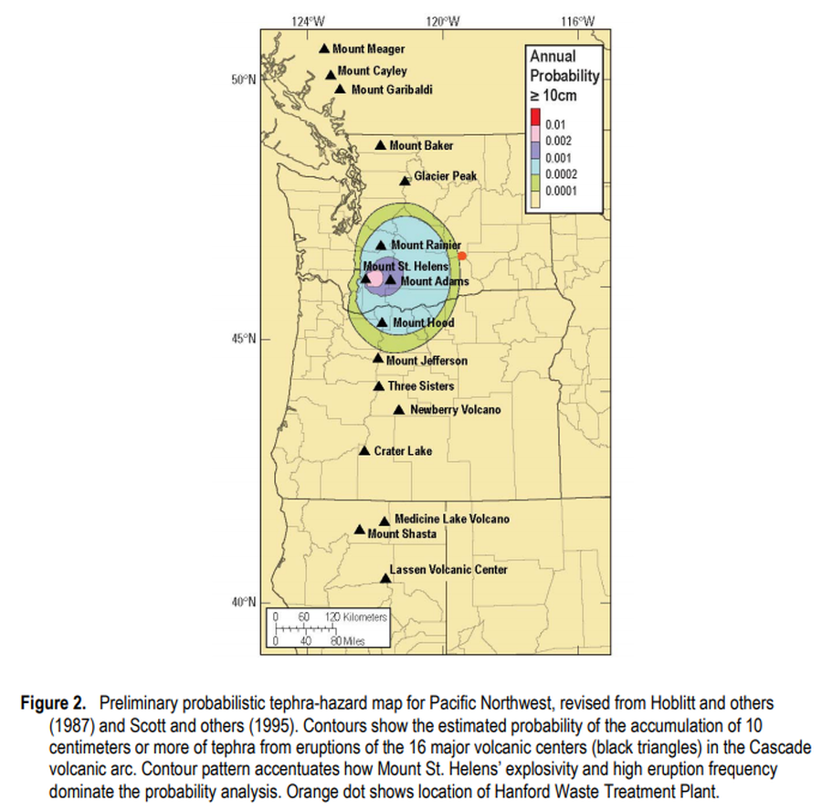
Official, Figure in hazard assessment
Preliminary probabilistic tephra-hazard map for Pacific Northwest
Figure 2 in: Hoblitt, R.P., & Scott, W.E. (2011). Estimate of tephra accumulation probabilities for the U.S. Department of Energy's Hanford Site, Washington. U.S. Geological Survey, Open-File Report 2011-1064, 15 p. https://doi.org/10.3133/ofr20111064