
Advanced Search for Maps
Showing 21-30 of 139
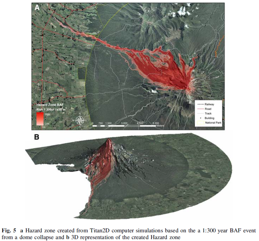
Figure in a journal article
Hazard zone created from Titan2D computer simulations based on the 1:300 year BAF event from a dome collapse and 3D representation of the created Hazard zone
Figure 5 in: Procter, J. N., Cronin, S. J., Platz, T., Patra, A., Dalbey, K., Sheridan, M., & Neall, V. (2010). Mapping block-and-ash flow hazards based on Titan 2D simulations: a case study from Mt. Taranaki, NZ. Natural Hazards, 53, 483-501.
Official, Figure on website
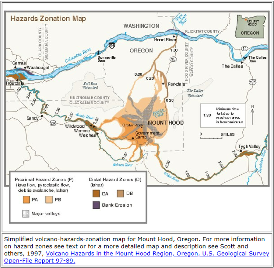
Hazards Zonation Map
Gardner, C.A., Scott, W.E., Major, J.J., & Pierson, T.C. (2000). Hazards Zonation Map. Mount Hood—History and Hazards of Oregon's Most Recently Active Volcano. U.S. Geological Survey, Fact Sheet 060-00 (Online Version 1.0). https://doi.org/10.3133/fs06000
Official, Interactive web-based map
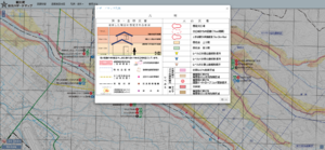
Higashikawa Town Disaster Hazard Map (web version)
Higashikawa Town. (2020). Higashikawa Town Disaster Hazard Map (web version).
Official, Map sheet or poster
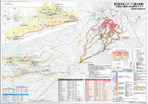
Higashikawa Town Flood Hazard (largest scale) and Daisetsu-san (Asahi-dake) Volcano Disaster Prevention Map
Higashikawa Town. (2020). Higashikawa Town Flood Hazard (largest scale) and Daisetsu-san (Asahi-dake) Volcano Disaster Prevention Map. Hokkaido Map Co., Ltd. Asahikawa Branch.
Official (foreign agency), Insert/poster-size map with accompanying report
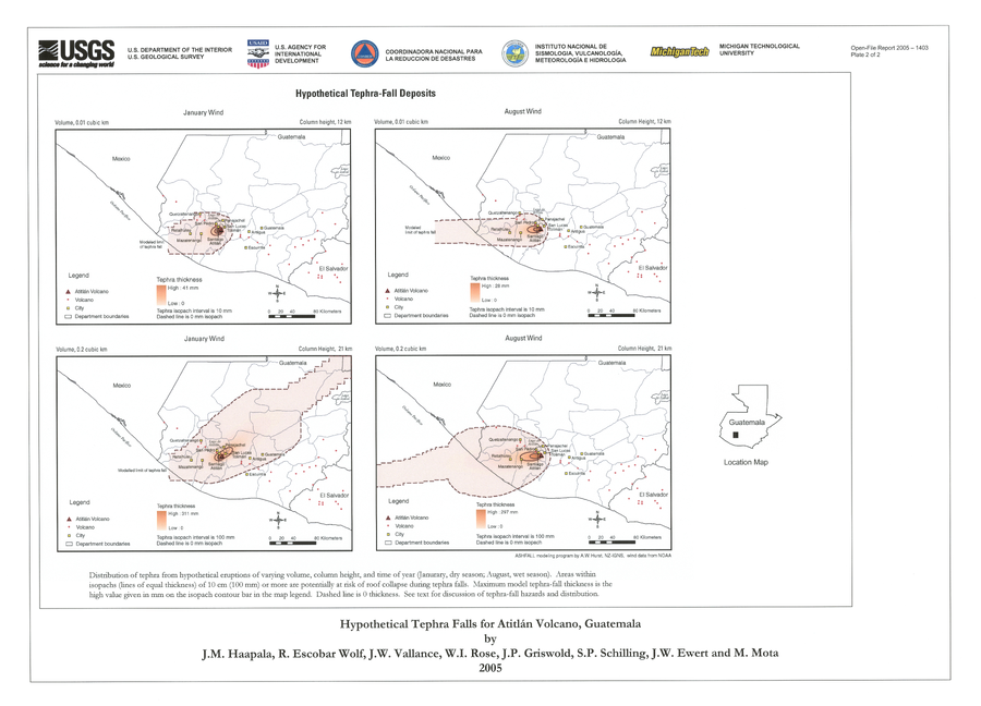
Hypothetical Tephra-fall Deposits
Plate 2 in: Haapala, J. M., Escobar Wolf, R., Vallance, J. W., Rose, W. I., Griswold, J. P., Schilling, S. P., Ewert, J.W., & Mota, M. (2005). Volcanic hazards at Atitlan volcano, Guatemala. U.S. Geological Survey, Open-File Report, 1403. https://doi.org/10.3133/ofr20051403
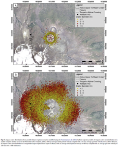
Figure in a journal article
Impact crater distributions from possible future eruption scenarios modelled using the Tsunematsu et al. (2013) ballistic trajectory model
Figure 11 in: Fitzgerald, R. H., Tsunematsu, K., Kennedy, B. M., Breard, E. C. P., Lube, G., Wilson, T. M., Jolly, A.D., Pawson, J., Rosenburg, M.D., & Cronin, S. J. (2014). The application of a calibrated 3D ballistic trajectory model to ballistic hazard assessments at Upper Te Maari, Tongariro. Journal of volcanology and geothermal research, 286, p. 248-262. https://doi.org/10.1016/j.jvolgeores.2014.04.006
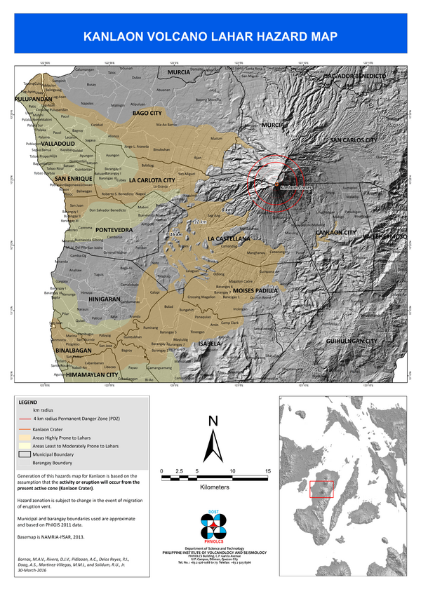
Official, Map sheet or poster
Kanlaon Volcano Lahar Hazard Map
Bornas, M.A.V., Rivera, D.J.V., Pidlaoan, A.C., Delos Reyes, P.J., Daag, A.S., Martinez-Villegas, M.M.L., & Solidum Jr., R.U. (2016). Kanlaon Volcano Lahar Hazard Map. Philippines Institute of Volcanology and Seismology (PHIVOLCS).
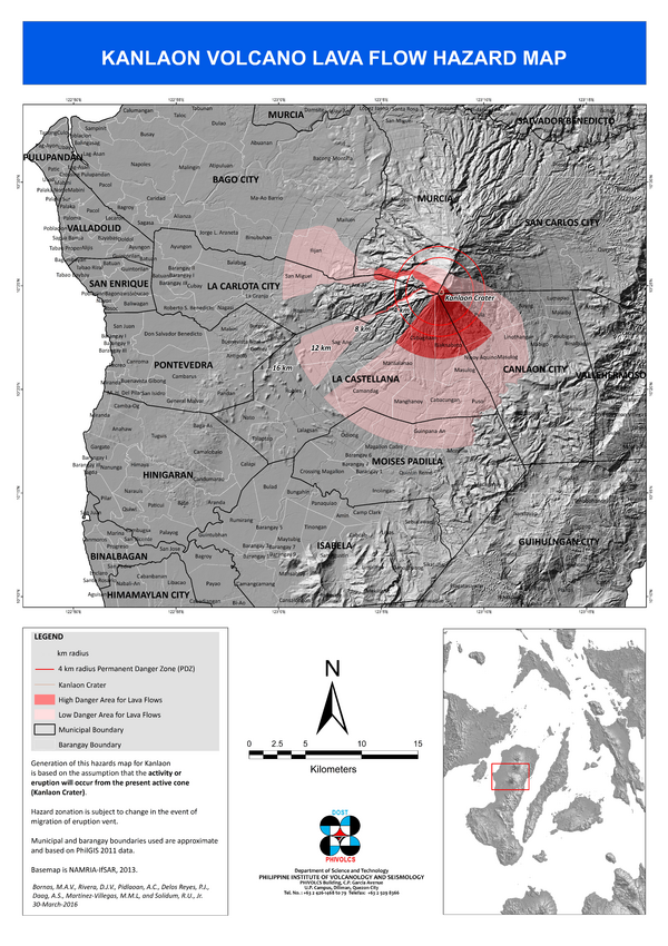
Official, Map sheet or poster
Kanlaon Volcano Lava Flow Hazard Map
Bornas, M.A.V., Rivera, D.J.V., Pidlaoan, A.C., Delos Reyes, P.J., Daag, A.S., Martinez-Villegas, M.M.L., & Solidum Jr., R.U. (2016). Kanloan Volcano Lava Flow Hazard Map. Philippines Institute of Volcanology and Seismology (PHIVOLCS).
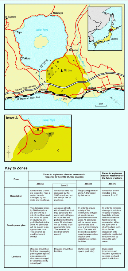
Figure in a journal article
Land use zoning map for areas around Mount Usu
Figure 3 in: Becker, J.S., Saunders, W.S.A., Robertson, C.M., Leonard, G.S., & Johnston, D.M. (2010). A synthesis of challenges and opportunities for reducing volcanic risk through land use planning in New Zealand. The Australasian Journal of Disaster and Trauma Studies, 2010-1. (Simplified from: Nakao 2005)
Official, Figure in hazard assessment
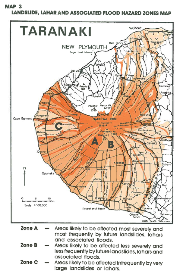
Landslide, Lahar and Associated Flood Hazard Zones Map
Map 3, Page 20 in: Neall, V.E. & Alloway, B.V. (1993). Volcanic hazards at Egmont volcano. Volcanic Hazards Working Group of the Scientific Advisory Committee, Ministry of Civil Defence. Volcanic Hazards Information Series, Number One, 2nd ed. 31 p.