
Advanced Search for Maps
Showing 61-63 of 63
Official, Map in a booklet, long fact-sheet, or handbook
Volcanic mud flow
Page 15 in: Towada Volcanic Hazards Mitigation Committee. (2018). Towada Volcano Hazard Expected Impact Area Map. Omori Prefecture Disaster Risk Management Division, Akita Prefecture Disaster Prevention Division, Nagano City General Affairs Division, Kosaka Town General Affairs Division.

Official, Map in a booklet, long fact-sheet, or handbook
Volcanic-Ash Hazard Area Map
Page 14 in: Crandell, D.R. & Nichols, D.R. (1989). Volcanic hazards at Mount Shasta, California. U.S. Geological Survey, General Information Product, 22 p. https://doi.org/10.3133/70039409
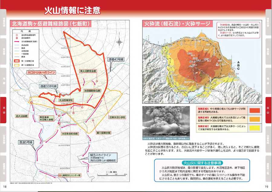
Official, Map in a booklet, long fact-sheet, or handbook
Volcano Information
Nanae Town. (2020). Disaster Prevention Hazard Map for Nanae Town. https://www.town.nanae.hokkaido.jp/hotnews/detail/00009274.html