
Advanced Search for Maps
Showing 11-20 of 63
Official, Map in a booklet, long fact-sheet, or handbook
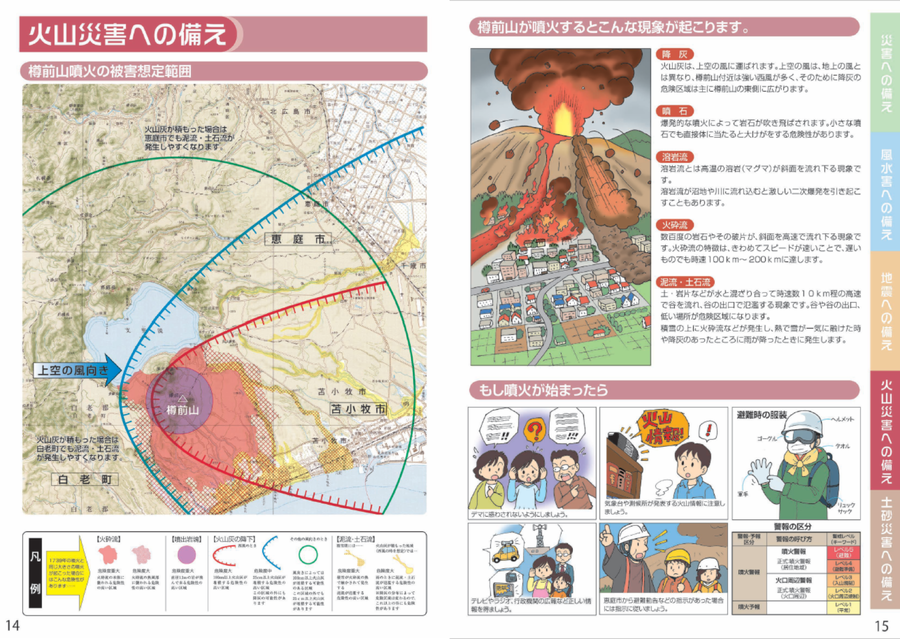
Estimated damage range of a Tarumaeyama eruption
Page 14 in: Eniwa City Hall General Affairs Department. (2021). Eniwa City Disaster Prevention Guidebook. 19 p.
Official, Map in a booklet, long fact-sheet, or handbook
Evacuation facilities
Asamayama Volcanic Disaster Prevention Committee. (2019). Asamayama Volcanic Disaster Prevention Map. Tsumagoi Village.
Official, Map in a booklet, long fact-sheet, or handbook
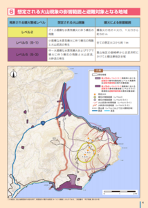
Expected scope of volcanic phenomena and areas targeted for evacuation
Page 4 in: Hakodate City. (2016). Disaster Prevention Handbook of Esan. 12 p.
Official, Map in a booklet, long fact-sheet, or handbook
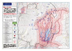
Hazard map of large-scale eruption
Asamayama Volcanic Disaster Prevention Committee. (2019). Asamayama Volcanic Disaster Prevention Map. Tsumagoi Village.
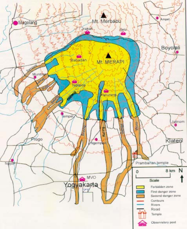
Official, Map in a booklet, long fact-sheet, or handbook
Hazard Map of Merapi
Purbawinata, M. A., Ratdomopurbo, A., Sinulingga, I. K., Sumarti, S., & Suharno, I. (1996). Merapi volcano – guide book. Volcanological Survey of Indonesia (VSI), Bandung. (Reprinted in: Gerstenecker, C., Läufer, G., Steineck, D., Tiede, C., & Wrobel, B. (2005). Validation of digital elevation models around Merapi Volcano, Java, Indonesia. Natural Hazards and Earth System Sciences, 5(6), 863-876. https://doi.org/10.5194/nhess-5-863-2005)
Official, Map in a booklet, long fact-sheet, or handbook
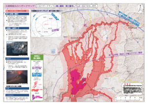
Hazard map of small to medium-scale eruptions (snow season)
Asamayama Volcanic Disaster Prevention Committee. (2019). Asamayama Volcanic Disaster Prevention Map. Tsumagoi Village.
Official, Map in a booklet, long fact-sheet, or handbook
Hazard map of small to medium-scale eruptions (snowless period)
Asamayama Volcanic Disaster Prevention Committee. (2019). Asamayama Volcanic Disaster Prevention Map. Tsumagoi Village.

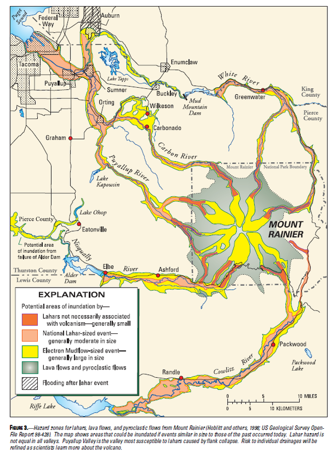
Official, Map in a booklet, long fact-sheet, or handbook
Hazard zones for debris flows, lahars, lava flows, and pyroclastic flows from Mount Rainier
Page 3 in: Driedger, C.L. & Scott, W.E. (2008). Mount Rainier: living safely with a volcano in your backyard. U.S. Geological Survey, Fact Sheet 2008-3062, 4 p. https://doi.org/10.3133/fs20083062
Official, Map in a booklet, long fact-sheet, or handbook
Hazard zones for lahars, lava flows, and pyroclastic flows from Mount Rainier
Figure 3 in: Driedger, C.L. & Scott, K.M. (2002). Mount Rainier: learning to live with volcanic risk. U.S. Geological Survey, Fact Sheet 034-02, 4 p. https://doi.org/10.3133/fs03402
Hualalai, United States
Official, Map in a booklet, long fact-sheet, or handbook
Hazard zones for lava flows on Hualalai
Page 30 in: U.S. Geological Survey (USGS). (1997). Volcanic and Seismic Hazards on the Island of Hawaii. U.S. Geological Survey, Unumbered Series, 48 p. https://doi.org/10.3133/7000036 (Simplified from: Wright 1992)