
Advanced Search for Maps
Showing 41-50 of 63
Official, Map in a booklet, long fact-sheet, or handbook
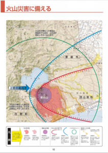
Prepare for a Volcanic Disaster
Page 10-11 in: Eniwa City Disaster Prevention Division. (2013). Disaster Prevention Guidebook. 21 p.
Official, Map in a booklet, long fact-sheet, or handbook
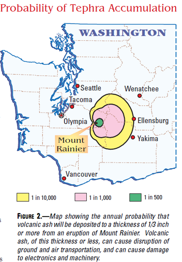
Probability of Tephra Accumulation
Figure 2 in: Driedger, C.L. & Scott, K.M. (2002). Mount Rainier: learning to live with volcanic risk. U.S. Geological Survey, Fact Sheet 034-02, 4 p. https://doi.org/10.3133/fs03402

Official, Map in a booklet, long fact-sheet, or handbook
Pyroclastic Flow and Lateral Blast Hazard Map
Page 15 in: Crandell, D.R. & Nichols, D.R. (1989). Volcanic hazards at Mount Shasta, California. U.S. Geological Survey, General Information Product, 22 p. https://doi.org/10.3133/70039409
Official, Map in a booklet, long fact-sheet, or handbook
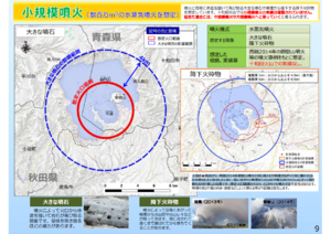
Small-scale eruption (assuming a steam eruption of several million m³)
Page 9 in: Towada Volcanic Hazards Mitigation Committee. (2018). Towada Volcano Hazard Expected Impact Area Map. Omori Prefecture Disaster Risk Management Division, Akita Prefecture Disaster Prevention Division, Nagano City General Affairs Division, Kosaka Town General Affairs Division.

Official, Map in a booklet, long fact-sheet, or handbook
Steam eruption risk area prediction map (ash fall, volcanic blocks only)
Page 6 in: Nasudake Volcano Disaster Prevention Council. (2014). Nasudake Volcano Disaster Prevention Handbook.

Official, Map in a booklet, long fact-sheet, or handbook
Steam eruption risk area prediction map (ash fall, volcanic blocks only)
Page 6 in: Nasudake Volcano Disaster Prevention Council. (2010). Volcanic disaster prevention handbook of Mt. Nasudake.
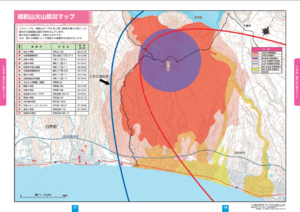
Official, Map in a booklet, long fact-sheet, or handbook
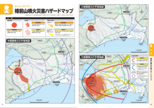
Tarumaesan Eruption Disaster Hazard Map
Page 37-38 in: Tomakomai City. (2018). Disaster Prevention Handbook of Tomakomai City.
Official, Map in a booklet, long fact-sheet, or handbook
Tarumaeyama Volcano Disaster Prevention Map
Page 27-28 in: Shiraoi Town. (2013). Shiraoi Town Disaster Prevention Map. 36 p.
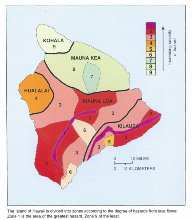
Official, Map in a booklet, long fact-sheet, or handbook
The Island of Hawaii is divided into zones according to the degree of hazards from lava flows
Page 22 in: U.S. Geological Survey (USGS). (1997). Volcanic and Seismic Hazards on the Island of Hawaii. U.S. Geological Survey, Unumbered Series, 48 p. https://doi.org/10.3133/7000036 (Simplified from: Wright 1992)

Official, Map in a booklet, long fact-sheet, or handbook
Traffic regulations and evacuation routes (When volcanic alert level 5 [5-1] (evacuation) is announced)
Page 7-8 in: Hakodate City. (2016). Disaster Prevention Handbook of Esan. 12 p.