
Advanced Search for Maps
Showing 11-20 of 240
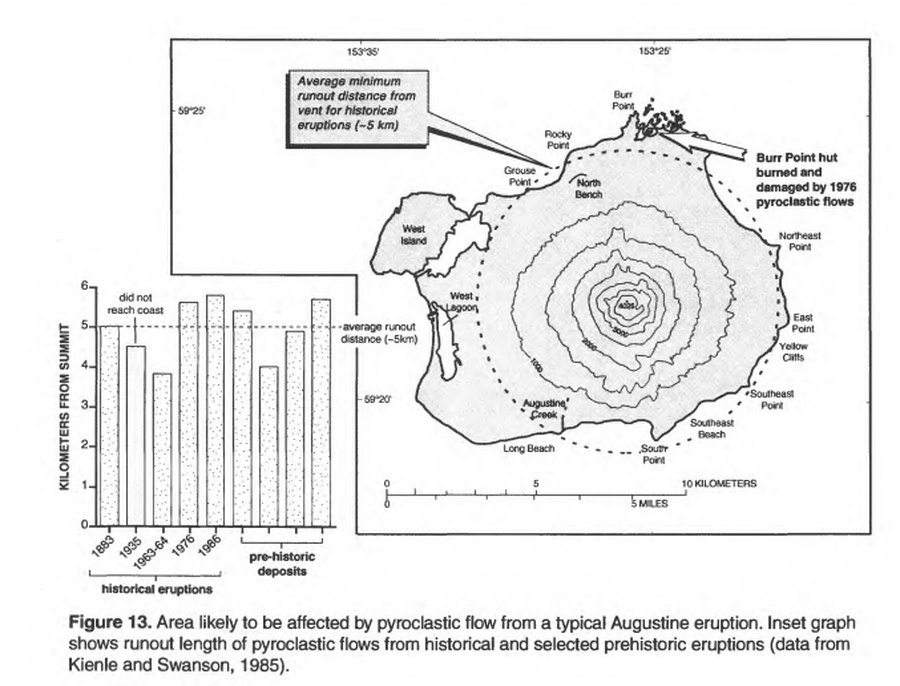
Official, Figure in hazard assessment
Area likely to be affected by pyroclastic flow from a typical Augustine eruption
Figure 13 in: Waythomas, C.F. & Waitt, R. (1998). Preliminary volcano-hazard assessment for Augustine Volcano, Alaska. U.S. Geological Survey, Open-File Report 98-106. https://doi.org/10.3133/ofr98106
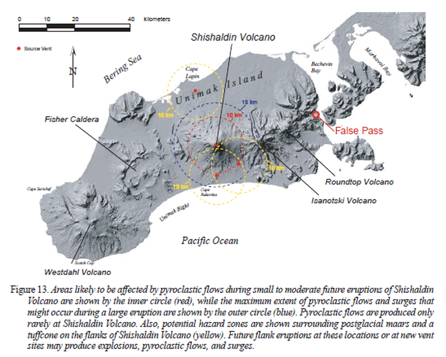
Official, Figure in hazard assessment
Areas likely to be affected by pyroclastic flows during small to moderate future eruptions of Shishaldin Volcano
Figure 13 in: Beget, J.E., Nye, C.J., Schaefer, J.R. & Stelling, P.L. (2003). Preliminary volcano-hazard assessment for Shishaldin Volcano, Alaska. Alaska Division of Geological & Geophysical Surveys, Report of Investigations 2002-4, 28 p., 1 sheet, scale 1:500,000. http://doi.org/10.14509/2872
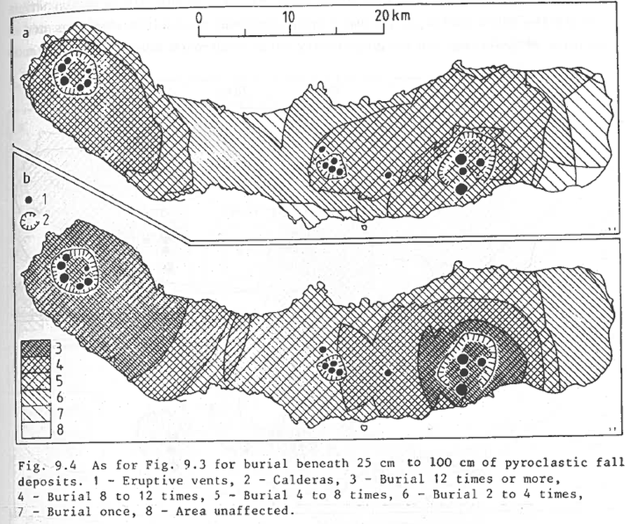
Figure in a journal article
As for Fig. 9.3 for burial beneath 25 to 100 cm of pyroclastic fall deposits
Figure 9.4 in: Booth, B., Croasdale, R., & Walker, G.L. (1983). Volcanic hazard on Sao Miguel, Azores. In: Tazieff, H. & Sabroux, J.C. (eds.). Forecasting Volcanic Events. Elsevier, Amsterdam. p. 99-109.

Figure in a journal article
Ash fallout simulations (thickness) with a 5-km column height and volume of 0.3 km³
Figure 10 in: Bartolini, S., Geyer, A., Martí, J., Pedrazzi, D., & Aguirre-Díaz, G. (2014). Volcanic hazard on Deception Island (South Shetland Islands, Antarctica). Journal of Volcanology and Geothermal Research, 285, p. 150-168. https://doi.org/10.1016/j.jvolgeores.2014.08.009
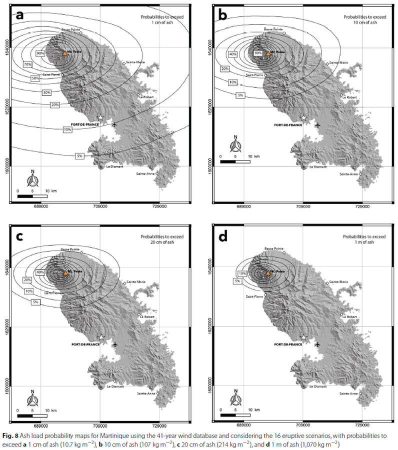
Figure in a journal article
Ash load probability maps for Martinique using the 41-year wind database and considering the 16 eruptive scenarios
Figure 8 in: Michaud-Dubuy, A., Carazzo, G., & Kaminski, E. (2021). Volcanic hazard assessment for tephra fallout in Martinique. Journal of Applied Volcanology, 10(1), 1-20. https://doi.org/10.1186/s13617-021-00106-7.
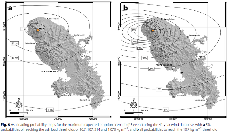
Figure in a journal article
Ash loading probability maps for the maximum expected eruption scenario
Figure 5 in: Michaud-Dubuy, A., Carazzo, G., & Kaminski, E. (2021). Volcanic hazard assessment for tephra fallout in Martinique. Journal of Applied Volcanology, 10(1), 1-20. https://doi.org/10.1186/s13617-021-00106-7.
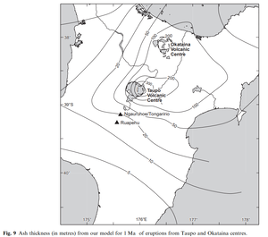
Official, Figure in a journal article
Ash thickness (in metres) from our model for 1 Ma of eruptions from Taupo and Okataina centres
Figure 9 in: Hurst, T. & Smith, W. (2010). Volcanic ashfall in New Zealand–probabilistic hazard modelling for multiple sources. New Zealand Journal of Geology and Geophysics, 53(1), 1-14. https://doi.org/10.1080/00288301003631129
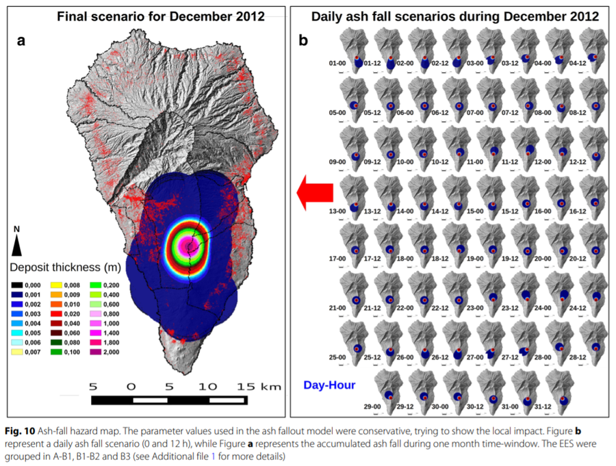
Figure in a journal article
Ash-fall hazard map
Figure 10 in: Marrero, J. M., García, A., Berrocoso, M., Llinares, Á., Rodríguez-Losada, A., & Ortiz, R. (2019). Strategies for the development of volcanic hazard maps in monogenetic volcanic fields: the example of La Palma (Canary Islands). Journal of Applied Volcanology, 8(1), 6. https://doi.org/10.1186/s13617-019-0085-5
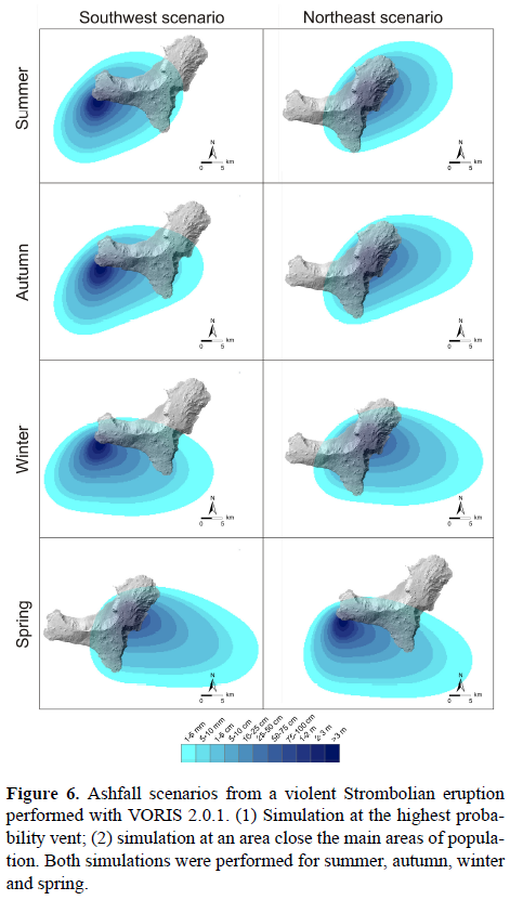
Figure in a journal article
Ashfall scenarios from a violent Strombolian eruption performed with VORIS 2.0.1.
Figure 6 in: Becerril, L., Bartolini, S., Sobradelo, R., Martí, J., Morales, J. M., & Galindo, I. (2014). Long-term volcanic hazard assessment on El Hierro (Canary Islands). Natural Hazards and Earth System Sciences, 14(7), 1853-1870. https://doi.org/10.5194/nhess-14-1853-2014, 2014
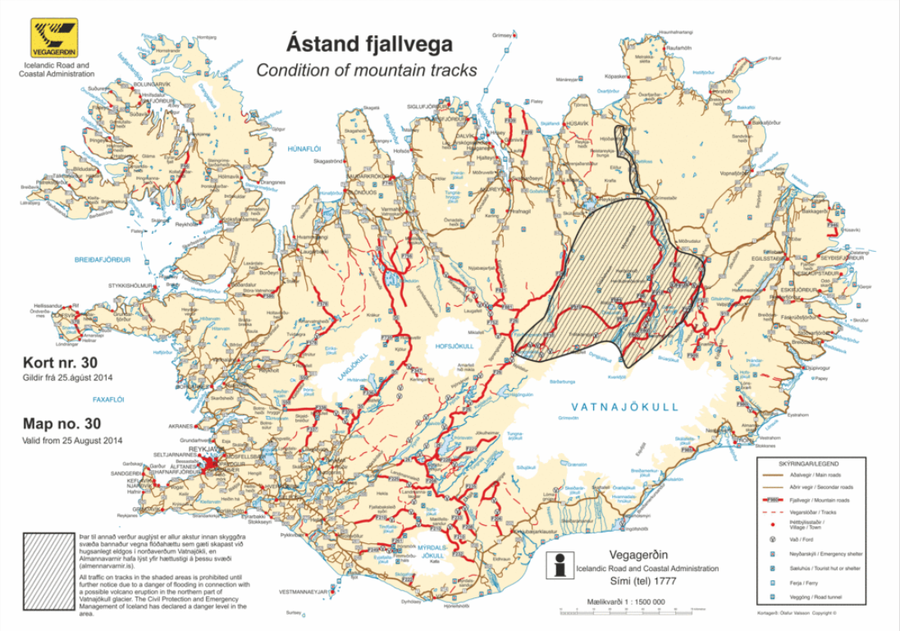
Official, Map in an information statement
Ástand fjallvega
(Condition of mountain tracks)
Icelandic Road and Coastal Administration. (2014). Condition of mountain tracks. Map no. 30, valid from 25 August 2014.