
Advanced Search for Maps
Showing 471-480 of 2217
Official, Map in an information statement
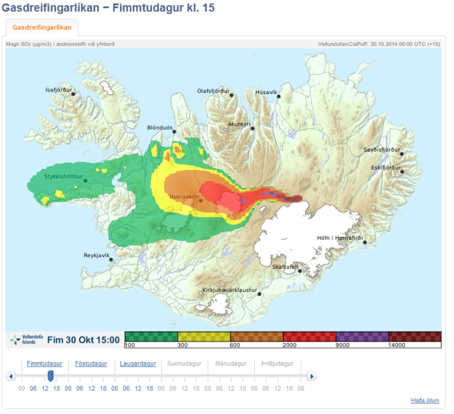
Gasdreifingarspá. Magn SO2 í andrúmslofti við yfirborð. Fim 30 Okt 15:00
(Gasdreifingarspá. Amount of SO2 in atmosphere at surface. Thu Oct 30 15:00)
Iceland Meteorological Office (IMO). (2014). Gasdreifingarspá. Magn SO2 í andrúmslofti við yfirborð. Fim 30 Okt 15:00
Official, Map in an information statement
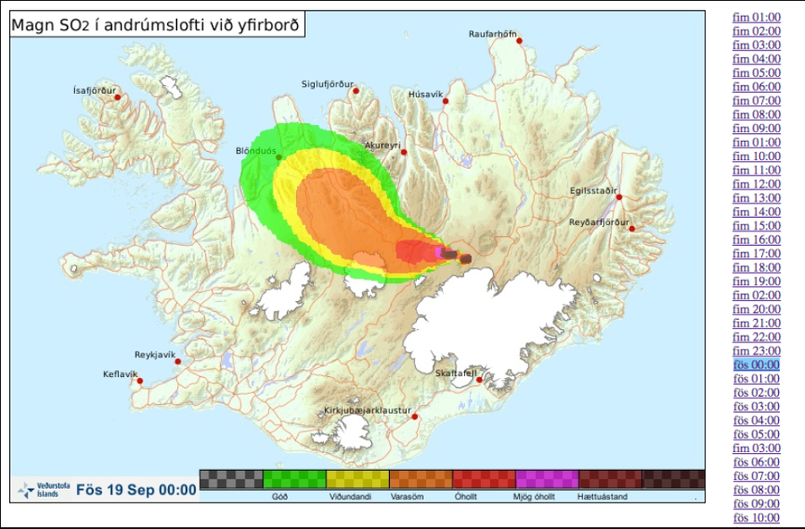
Gasdreifingarspá. Magn SO2 í andrúmslofti við yfirborð. Fös 19 Sept 00:00
(Gas distribution forecast. Amount of SO2 in atmosphere at surface. Fri 19 Sept 00:00)
Iceland Meteorological Office (IMO). (2014). Gasdreifingarspá. Magn SO2 í andrúmslofti við yfirborð. Fös 19 Sept 00:00
Official, Map in an information statement
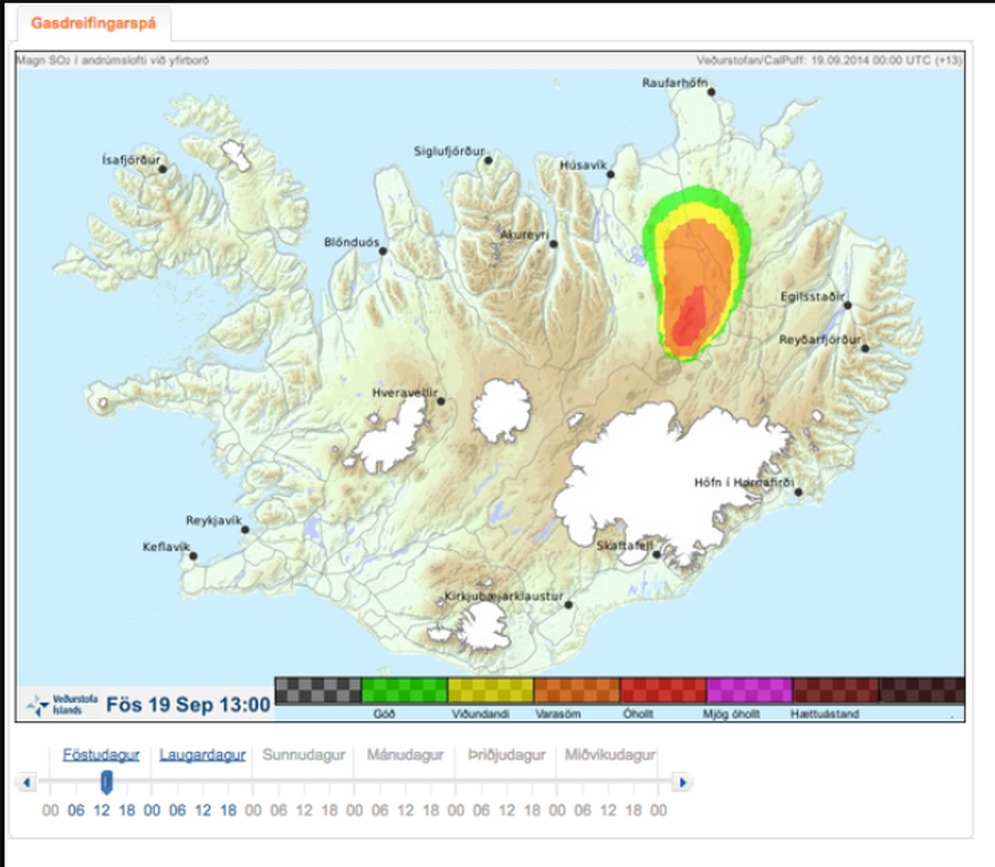
Gasdreifingarspá. Magn SO2 í andrúmslofti við yfirborð. Fös 19 Sept 13:00
(Gas distribution forecast. Amount of SO2 in atmosphere at surface. Fri 19 Sept 13:00)
Iceland Meteorological Office (IMO). (2014). Gasdreifingarspá. Magn SO2 í andrúmslofti við yfirborð. Fös 19 Sept 13:00
Official, Map in an information statement
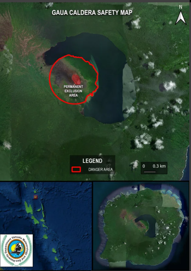
Gaua Caldera Safety Map
Vanuatu Meteorology & Geo-Hazards Department. (2025). Vanuatu Volcano Alert Bulletin n°01 - Gaua Activity (Thursday March 27th 2025). Government of Vanuatu, Vanuatu Meteorology & Geo-Hazards Department.
Official, Figure or insert in a report
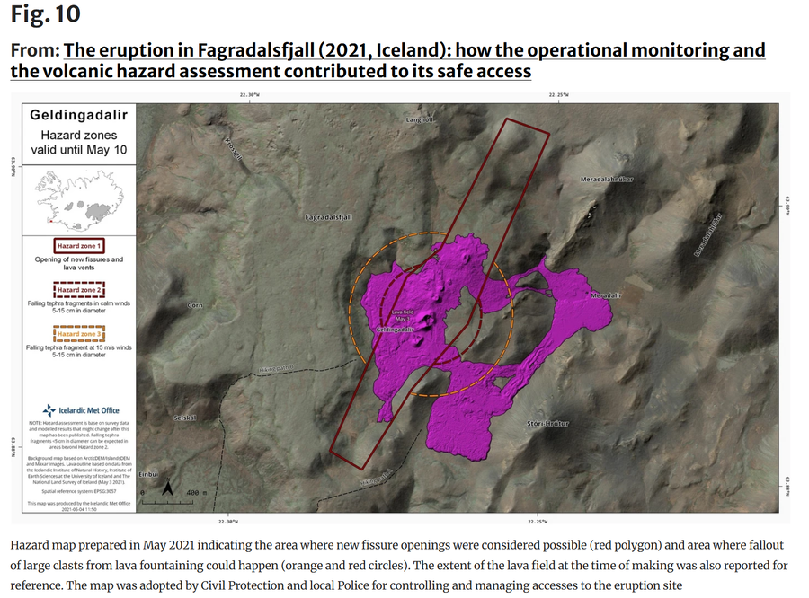
Geldingadalir Hazard Zones valid until May 10
Figure 10 in: Icelandic Meteorological Office (IMO). (2021). Geldingadalir Hazard Zones valid until May 10. (Reproduced in: Barsotti, S., Parks, M. M., Pfeffer, M. A., Óladóttir, B. A., Barnie, T., Titos, M. M., ... & Sigurðsson, E. M. (2023). The eruption in Fagradalsfjall (2021, Iceland): how the operational monitoring and the volcanic hazard assessment contributed to its safe access. Natural Hazards, 116(3), 3063-3092.)
Official, Figure in hazard assessment
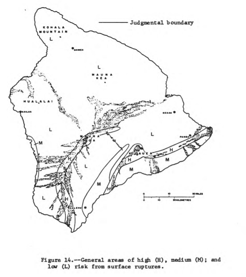
General areas of high (H), medium (M), and low (L) risk from surface ruptures
Figure 14 in: Mullineaux, D.R. & Peterson, D.W. (1974). Volcanic hazards on the Island of Hawaii. U.S. Geological Survey, Open-File Report 74-239. https://doi.org/10.3133/ofr74239
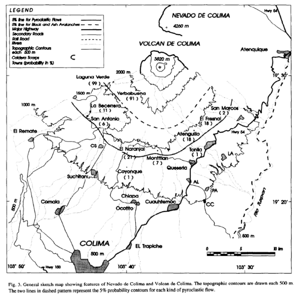
Figure in a journal article
General sketch map showing features of Nevado de Colima and Volcan de Colima
Figure 3 in: Sheridan, M.F., & Macías, J. (1995). Estimation of risk probability for gravity-driven pyroclastic flows at Volcan Colima, Mexico. Journal of Volcanology and Geothermal Research, 66(1-4), p. 251-256. https://doi.org/10.1016/0377-0273(94)00058-O
Official, Figure in hazard assessment
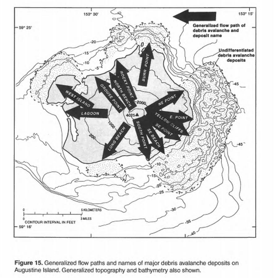
Generalized flow paths and names of major debris avalanche deposits on Augustine Island
Figure 15 in: Waythomas, C.F. & Waitt, R. (1998). Preliminary volcano-hazard assessment for Augustine Volcano, Alaska. U.S. Geological Survey, Open-File Report 98-106. https://doi.org/10.3133/ofr98106
Official, Insert/poster-size map with accompanying report
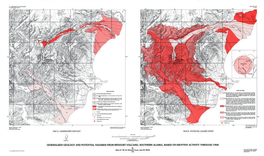
Generalized Geology and Potential Hazards from Redoubt Volcano, Southern Alaska, Based on Eruptive Activity Through 1968
Plate 1 in: Till, A.B., Yount, M.E., & Riehle, J.R. (1993). Redoubt Volcano, southern Alaska; a hazard assessment based on eruptive activity through 1968. U.S. Geological Survey, Bulletin 1996, 19 p., 1 plate. https://doi.org/10.3133/b1996
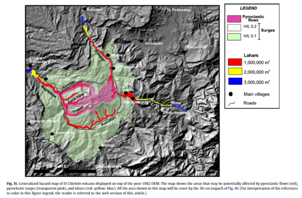
Figure in a journal article
Generalized hazard map of El Chichón volcano displayed on top of the post-1982 DEM
Figure 11 in: Macías, J. L., Capra, L., Arce, J. L., Espíndola, J. M., García-Palomo, A., & Sheridan, M. F. (2008). Hazard map of El Chichón volcano, Chiapas, México: Constraints posed by eruptive history and computer simulations. Journal of Volcanology and Geothermal Research, 175(4), 444-458. https://doi.org/10.1016/j.jvolgeores.2008.02.023