
Advanced Search for Maps
Showing 721-730 of 2217
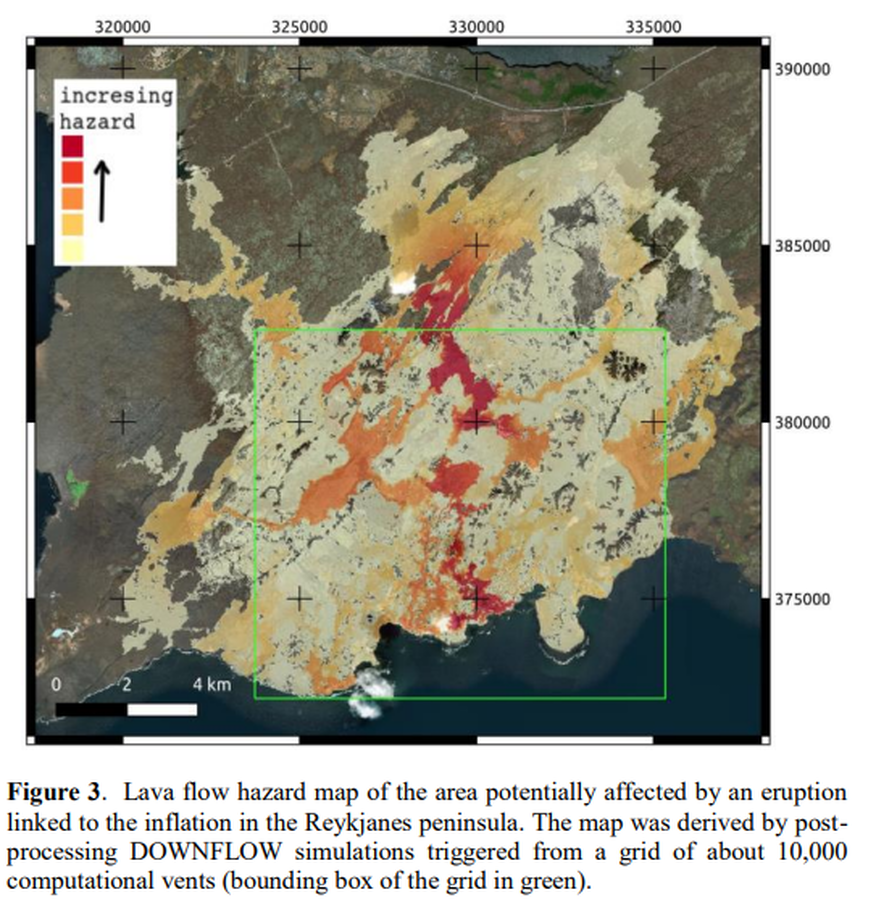
Figure in a conference presentation
Lava flow hazard map of the area potentially affected by an eruption linked to the inflation in the Reykjanes peninsula
Figure 3 in: Tarquini, S., Favalli, M., Pfeffer, M., de'Michieli Vitturi, M., Barsotti, S., Pedersen, G., Óladóttir, B., & Jensen, E. H. (2020). Assessing the impact of lava flows during the 2020 unrest of the Svartsengi volcanic system on the Reykjanes peninsula, Iceland. Geomorphometry, Perugia, Italy. https://doi.org/10.30437/GEOMORPHOMETRY2020
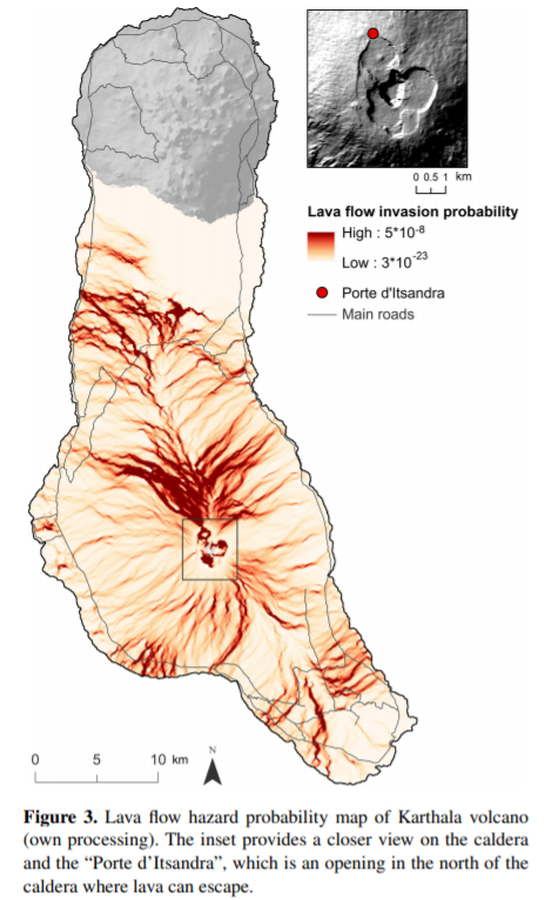
Figure in a journal article
Lava flow hazard probability map of Karthala volcano
Figure 3 in: Mossoux, S., Kervyn, M., & Canters, F. (2019). Assessing the impact of road segment obstruction on accessibility of critical services in case of a hazard. Natural Hazards & Earth System Sciences, 19(6). https://doi.org/10.5194/nhess-19-1251-2019
Official, Figure in hazard assessment
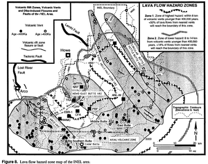
Lava flow hazard zone map of the INEL area
Figure 8 in: Hackett, W.R. & Smith, R.P. (1994). Volcanic hazards of the Idaho National Engineering Laboratory and adjacent areas (No. INEL--94/0276). Lockheed Martin Idaho Technologies Co..
Official, Figure in hazard assessment
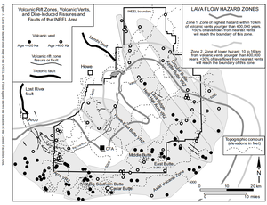
Lava Flow Hazard Zones
Figure 5 in: Hackett, W.R., Smith, R.P., & Khericha, S. (2002). Volcanic hazards of the Idaho National Engineering and Environmental Laboratory, southeast Idaho. In: Bonnichsen, B., White, C.M., and McCurry, M. (eds.). Tectonic and Magmatic Evolution of the Snake River Plain Volcanic Province. Idaho Geological Survey Bulletin 30, p. 461-482.
Official, Figure in hazard assessment
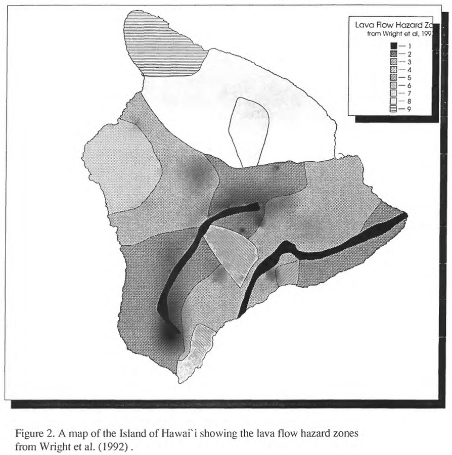
Lava Flow Hazard Zones
Figure 2 in: Kauahikaua, J. P., Moore, R. B., & Delaney, P. (1994). Volcanic activity and ground deformation hazard analysis for the Hawaii geothermal project environmental impact statement. US Geological Survey, Open File Report 94-553. 44 p. https://doi.org/10.3133/ofr94553 (Modified from: Wright et al. 1992)
Official, Map in a booklet, long fact-sheet, or handbook
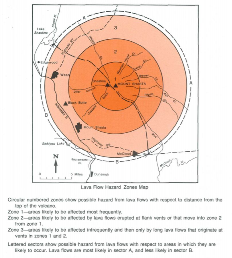
Lava Flow Hazard Zones Map
Page 17 in: Crandell, D.R. & Nichols, D.R. (1989). Volcanic hazards at Mount Shasta, California. U.S. Geological Survey, General Information Product, 22 p. https://doi.org/10.3133/70039409
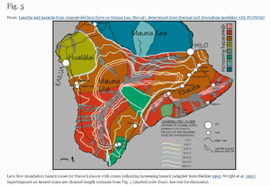
Figure in a journal article
Lava flow inundation hazard zones for Hawai‘i shown with colors indicating increasing hazard (adapted from Heliker 1990; Wright et al. 1992). Superimposed on hazard zones are channel-length contours from Fig. 4 (dashed color lines).
Figure 5 in: Rowland, S. K., Garbeil, H., & Harris, A. J. (2005). Lengths and hazards from channel-fed lava flows on Mauna Loa, Hawai ‘i, determined from thermal and downslope modeling with FLOWGO. Bulletin of Volcanology, 67(7), 634-647. https://doi.org/10.1007/s00445-004-0399-x
Official, Figure in hazard assessment
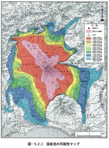
Lava flow possibility map
Figure 5.2.1 in: Mt. Fuji Hazard Map Review Committee. (2004). Mt. Fuji Hazard Map Review Committee Report. June 2004. https://www.bousai.go.jp/kazan/fuji_map/pdf/report_200406.pdf
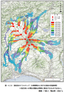
Official, Figure in hazard assessment
Lava flow scenario map (arrival time of lava for large-scale eruptions)
Figure 4.2.8 in: Mt. Fuji Hazard Map Review Committee. (2004). Mt. Fuji Hazard Map Review Committee Report. June 2004. https://www.bousai.go.jp/kazan/fuji_map/pdf/report_200406.pdf
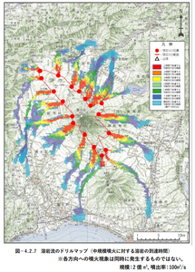
Official, Figure in hazard assessment
Lava flow scenario map (arrival time of lava for medium-scale eruptions)
Figure 4.2.7 in: Mt. Fuji Hazard Map Review Committee. (2004). Mt. Fuji Hazard Map Review Committee Report. June 2004. https://www.bousai.go.jp/kazan/fuji_map/pdf/report_200406.pdf