
Advanced Search for Maps
Showing 11-20 of 349
Official, Interactive web-based map
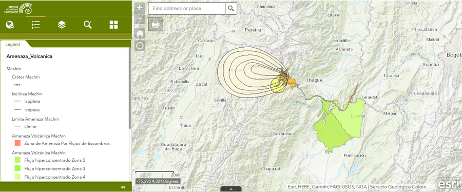
Amenaza Machín
(Machín Hazards)
Servicio Geológico Colombiano (SGC). Amenaza Machín.
Official, Unknown format
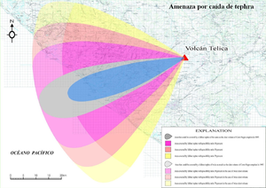
Amenaza por caída de tephra
(Threat due to falling tephra)
Instituto Nicaragüense de Estudios Territoriales (INETER). (2006). Amenaza por caída de tephra.
Official, Interactive web-based map
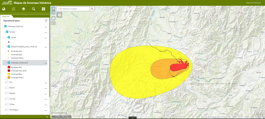
Amenaza Puracé
(Puracé Hazards)
Servicio Geológico Colombiano (SGC). Amenaza Puracé.
Official (foreign agency), Insert/poster-size map with accompanying report
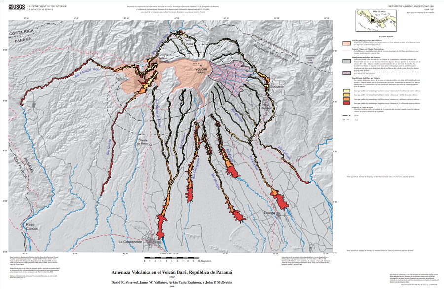
Amenaza Volcánica en el Volcán Barú, República de Panamá
(Volcano Hazards of Volcán Barú, Republic of Panamá)
Plate 1 (Spanish) in: Sherrod, D. R., Vallance, J. W., Espinosa, A. T., & McGeehin, J. P. (2007). Volcan Baru—eruptive history and volcano-hazards assessment. U.S. Geological Survey, Open-File Report, 2007-1401.
Official, Figure in hazard assessment
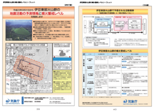
Area where the crater may appear and area where eruptions may affect
Page 18 in: Shizuoka Prefecture and Volcano Disaster Prevention Measure Deliberation Committee at Izu-Tobu Volcanoes. (2011). Volcano disaster prevention measure deliberation committee report at Izu-Tobu Volcanoes. Emergency Management Information Division, Shizuoka Prefecture.
Official, Figure in hazard assessment
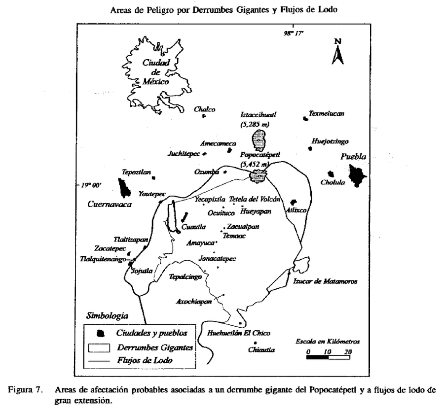
Areas de Peligro por Derrumbes Gigantes y Flujos de Lodo
(Hazard Areas for Giant Landslides and Mudflows)
Figure 7 in: Macías J.L., Carrasco, G. Siebe, C. (1995). Zonificación de peligros volcánicos del Popocatepetl. Capitulo III Riesgos y Mapeo.
Official, Insert/poster-size map with accompanying report
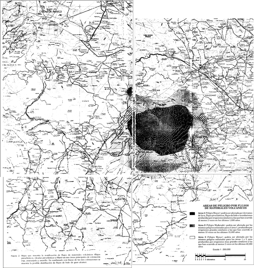
Areas de Peligro por Flujos de Materiales Volcanicos
(Hazard Areas for Flows of Volcanic Materials)
Figure 2 in: Macías J.L., Carrasco, G. Siebe, C. (1995). Zonificación de peligros volcánicos del Popocatepetl. Capitulo III Riesgos y Mapeo.
Official, Figure in hazard assessment
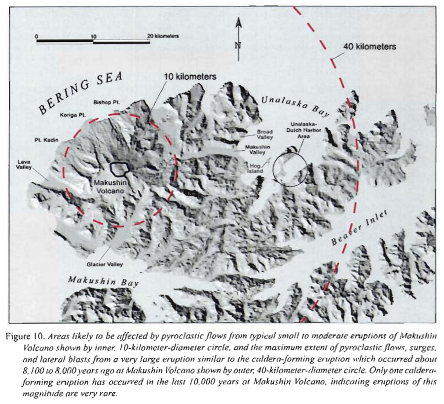
Areas likely to be affected by pyroclastic flows from typical small to moderate eruptions of Makushin
Figure 10 in: Beget, J.E., Nye, C.J. & Bean, K.W. (2000). Preliminary volcano-hazard assessment for Makushin Volcano, Alaska. Alaska Division of Geological & Geophysical Surveys, Report of Investigation 2000-4, 22 p., 1 sheet, scale 1:100,000.
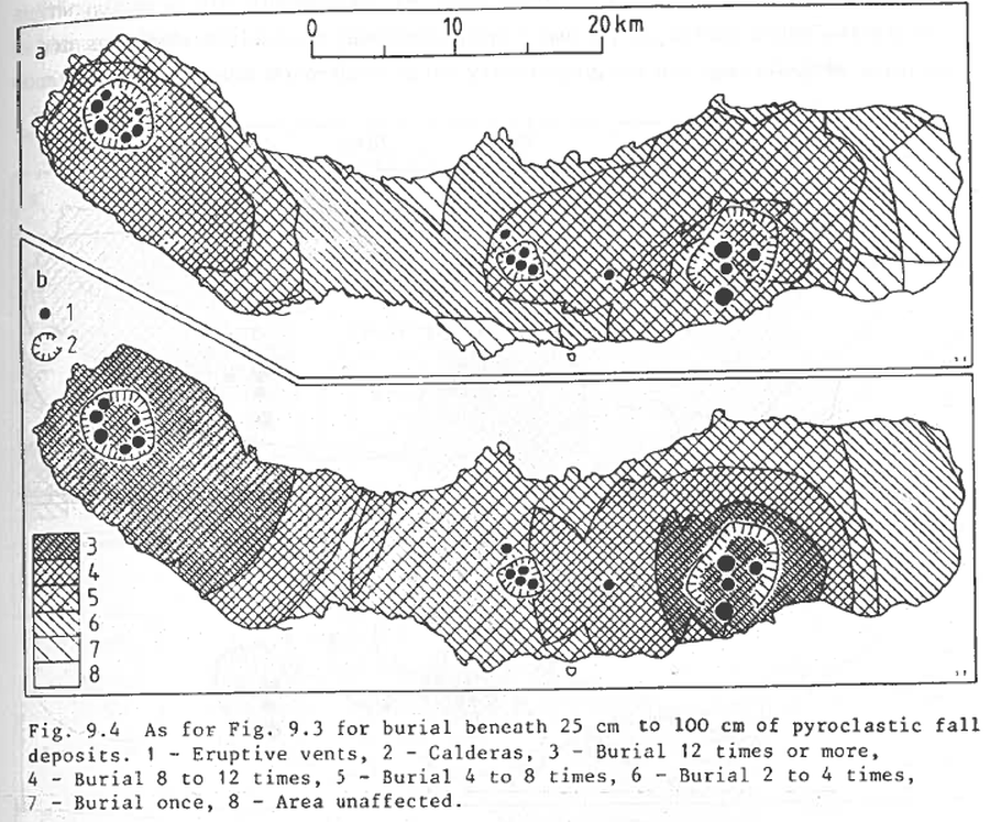
Figure in a journal article
As for Fig. 9.3 for burial beneath 25 to 100 cm of pyroclastic fall deposits
Figure 9.4 in: Booth, B., Croasdale, R., & Walker, G.L. (1983). Volcanic hazard on Sao Miguel, Azores. In: Tazieff, H. & Sabroux, J.C. (eds.). Forecasting Volcanic Events. Elsevier, Amsterdam. p. 99-109.
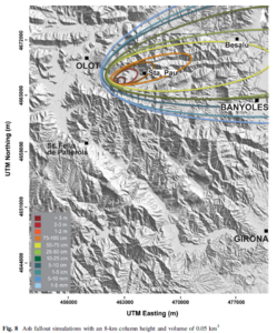
Figure in a journal article
Ash fallout simulations with an 8-km column height and volume of 0.05 km³
Figure 8 in: Bartolini, S., Bolós, X., Martí, J., Pedra, E. R., & Planagumà, L. (2015). Hazard assessment at the quaternary La Garrotxa volcanic field (NE Iberia). Natural Hazards, 78(2), 1349-1367. https://doi.org/10.1007/s11069-015-1774-y