
Advanced Search for Maps
Showing 801-810 of 2217
Official, Insert/poster-size map with accompanying report
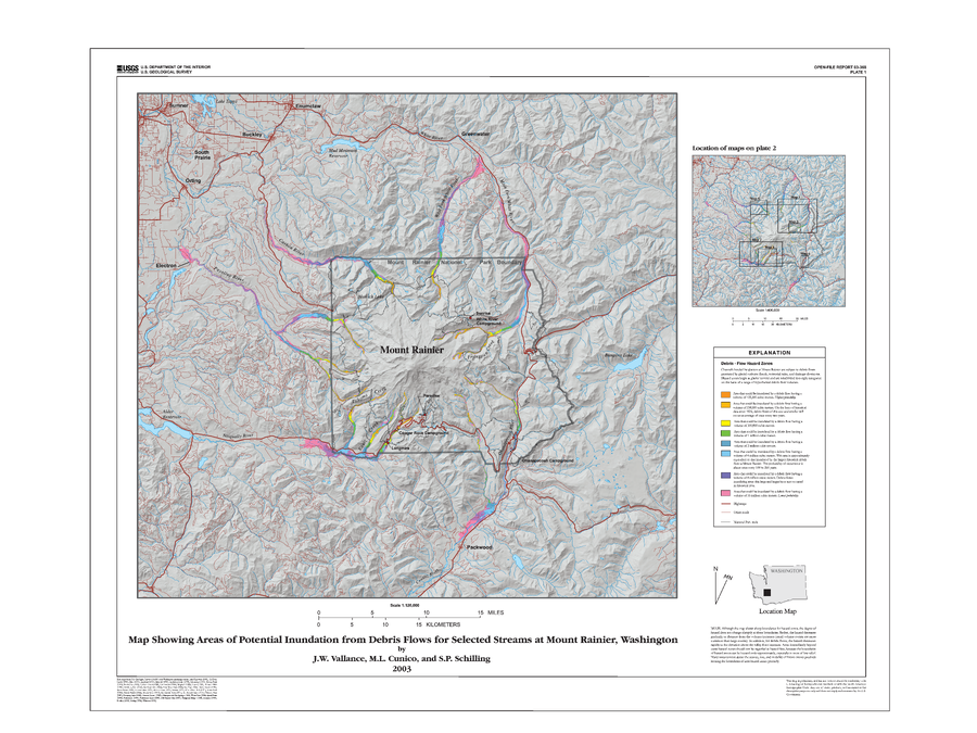
Map Showing Areas of Potential Inundation from Debris Flows for Selected Streams at Mount Rainier, Washington
Plate 1 in: Vallance, J.W., Cunico, M.L. & Schilling, S.P. (2003). Debris-flow hazards caused by hydrologic events at Mount Rainier, Washington. U.S. Geological Survey, Open-File Report 03-368, 4 p., 2 plates. https://doi.org/10.3133/ofr03368
Official, Insert/poster-size map with accompanying report
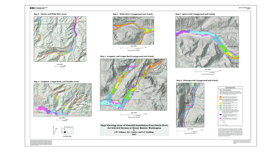
Map Showing Areas of Potential Inundation from Debris Flows for Selected Streams at Mount Rainier, Washington
Plate 2 in: Vallance, J.W., Cunico, M.L. & Schilling, S.P. (2003). Debris-flow hazards caused by hydrologic events at Mount Rainier, Washington. U.S. Geological Survey, Open-File Report 03-368, 4 p., 2 plates. https://doi.org/10.3133/ofr03368
Official, Insert/poster-size map with accompanying report
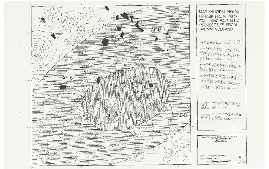
Map Showing Areas of Risk from Airfall and Ballistic Projectiles from Pacaya Volcano
Map 5 in: Banks, N. (1987). Preliminary Assessment Of The Volcano Hazards Of Pacaya Volcano Guatemala. USGS/INSIVUMEH. 8pp. https://pdf.usaid.gov/pdf_docs/pnaec775.pdf
Official, Insert/poster-size map with accompanying report
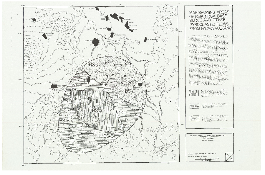
Map Showing Areas of Risk from Base Surge and Other Pryoclastic Flows from Pacaya Volcano
Map 2 in: Banks, N. (1987). Preliminary Assessment Of The Volcano Hazards Of Pacaya Volcano Guatemala. USGS/INSIVUMEH. 8pp. https://pdf.usaid.gov/pdf_docs/pnaec775.pdf
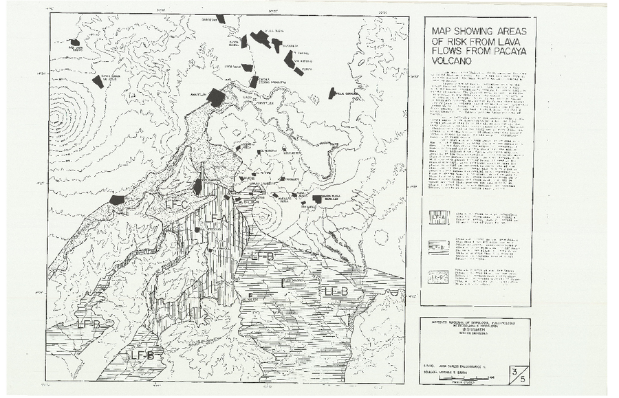
Official, Insert/poster-size map with accompanying report
Map Showing Areas of Risk from Lava Flows from Pacaya Volcano
Map 3 in: Banks, N. (1987). Preliminary Assessment Of The Volcano Hazards Of Pacaya Volcano Guatemala. USGS/INSIVUMEH. 8pp. https://pdf.usaid.gov/pdf_docs/pnaec775.pdf

Official, Insert/poster-size map with accompanying report
Map Showing Areas of Risk from Mud Flows from Pacaya Volcano
Map 4 in: Banks, N. (1987). Preliminary Assessment Of The Volcano Hazards Of Pacaya Volcano Guatemala. USGS/INSIVUMEH. 8pp. https://pdf.usaid.gov/pdf_docs/pnaec775.pdf
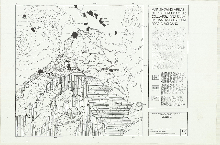
Official, Insert/poster-size map with accompanying report
Map Showing Areas of Risk from Sector Collapse and Debris Avalanches from Pacaya Volcano
Map 1 in: Banks, N. (1987). Preliminary Assessment Of The Volcano Hazards Of Pacaya Volcano Guatemala. USGS/INSIVUMEH. 8pp. https://pdf.usaid.gov/pdf_docs/pnaec775.pdf

Official, Figure on website
Map showing caldera features and caldera-related hazards at Medicine Lake volcano
U.S. Geological Survey (USGS). (2008). Map showing caldera features and caldera-related hazards at Medicine Lake volcano. U.S. Geological Survey. Medicine Lake Hazards. https://www.usgs.gov/volcanoes/medicine-lake/hazards (Modified from: Scientitic Investigations Report 2007-5174-A)

Official, Figure in hazard assessment
Map showing caldera features and caldera-related hazards at Medicine Lake volcano
Figure 13 in: Donnelly-Nolan, J.M., Nathenson, M., Champion, D.E., Ramsey, D.W., Lowenstern, J.B., & Ewert, J.W. (2007). Volcano Hazards Assessment for Medicine Lake Volcano, Northern California. Scientitic Investigations Report 2007-5174-A. Plate 1. https://doi.org/10.3133/sir20075174A
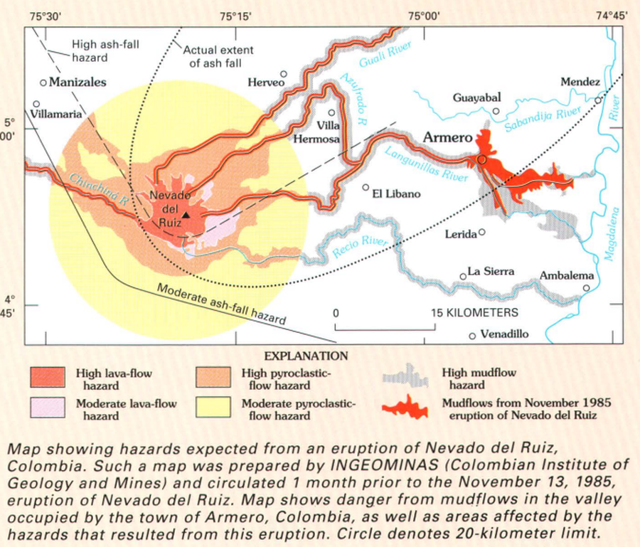
Official (foreign agency), Figure in hazard assessment
Map showing hazards expected from an eruption of Nevado del Ruiz, Colombia
Page 21 in: Wright, T. L., & Pierson, T. C. (1992). Living with volcanoes. US Geological Survey, Circular 1073. https://doi.org/10.3133/cir1073