
Advanced Search for Maps
Showing 1-10 of 728
Official, Map sheet or poster
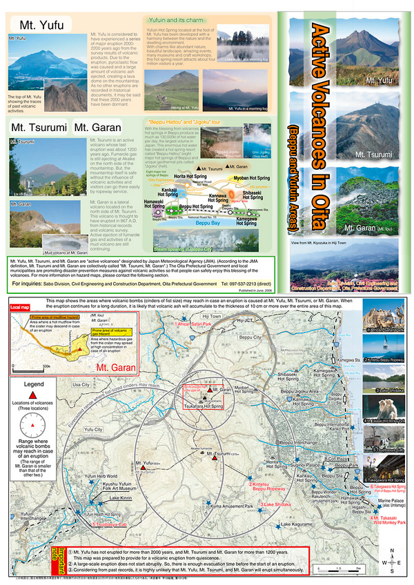
Active Volcanoes in Oita
Oita Prefectural Government. (2006). Active Volcanoes in Oita (Beppu and Yufuin Areas). Sabo Division, Civil Engineering and Construction Department, Oita Prefectural Government.
Official, Flyer, brochure, short fact-sheet, or handout
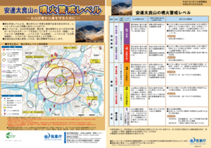
Adatarayama Volcanic Alert Levels
Japan Meteorological Agency. (2019). Adatarayama Volcanic Alert Levels. Volcano Monitoring and Warning Center, Volcano Division, Earthquake and Volcano Department.
Official, Map sheet or poster
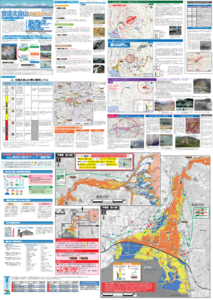
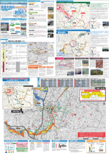
Adatarayama Volcano Disaster Prevention Map [Fukushima City]
Inawashiro Town. (2016). Adatarayama Volcano Disaster Prevention Map [Inawashiro Town].
Official, Map sheet or poster
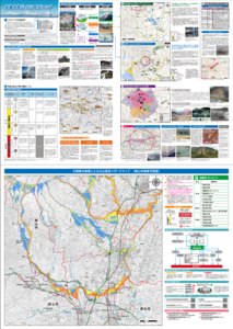
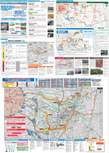
Adatarayama Volcano Disaster Prevention Map [Koriyama City]
Koriyama City. (2016). Adatarayama Volcano Disaster Prevention Map [Koriyama City].
Official, Map sheet or poster
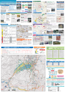
Adatarayama Volcano Disaster Prevention Map [Motomiya City]
Motomiya City. (2016). Adatarayama Volcano Disaster Prevention Map [Motomiya City].
Official, Map sheet or poster
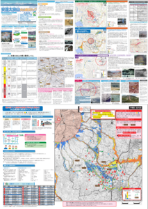
Adatarayama Volcano Disaster Prevention Map [Nihonmatsu City]
Nihonmatsu City. (2016). Adatarayama Volcano Disaster Prevention Map [Nihonmatsu City].
Official, Map sheet or poster
Adatarayama Volcano Disaster Prevention Map [Otama Village]
Fukushima City. (2016). Adatarayama Volcano Disaster Prevention Map [Fukushima City].
Official, Map sheet or poster
Adatarayama Volcano Disaster Prevention Map [Otama Village]
Otama Village. (2016). Adatarayama Volcano Disaster Prevention Map [Otama Village].
Official, Figure in hazard assessment
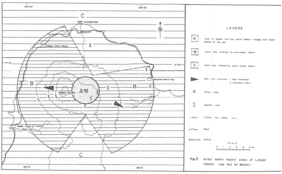
Airfall tephra hazard zones at Langila Volcano
Figure 5 in: Talai, B. (1987). Volcanic hazards at Langila volcano. Geological Survey of Papua New Guinea, Report 87/25
Official, Figure in hazard assessment
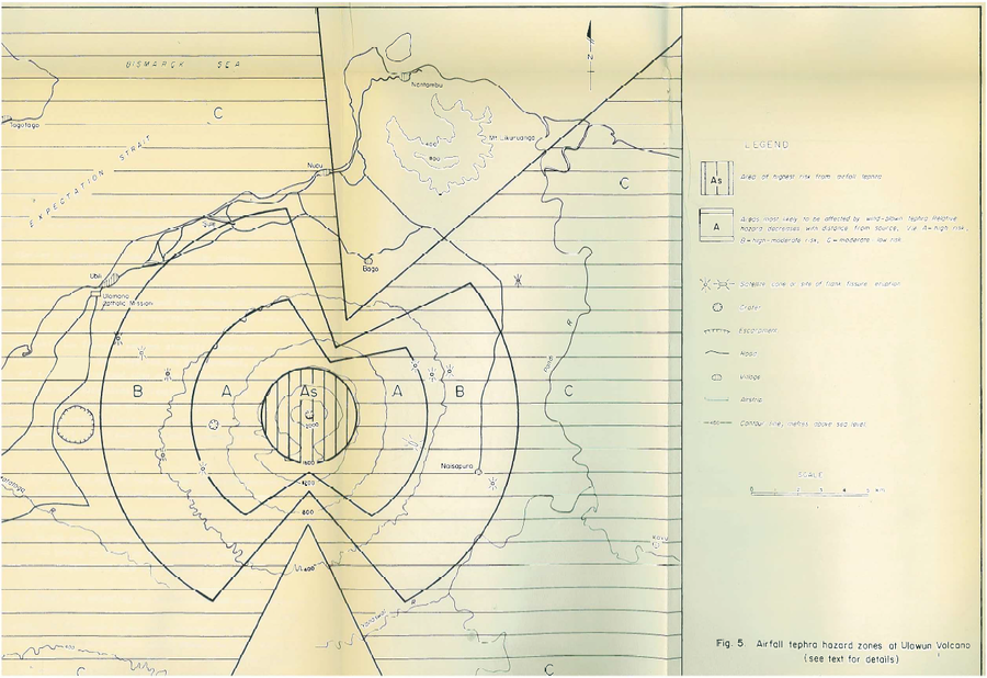
Airfall tephra hazard zones at Ulawun Volcano
Figure 5 in: McKee, C.O. (1983). Volcanic hazards at Uluwan volcano. Geological Survey of Papua New Guinea, Report 83/13, 1:100,000