
Advanced Search for Maps
Showing 41-50 of 78

Official, Map in an information statement
Predicted Ashfall Area for a Tongariro eruption at 0600 Wednesday 15 August 2012
GNS Science. (2012). Volcanic Alert Bulletin TON2012-20.
Official, Map in an information statement
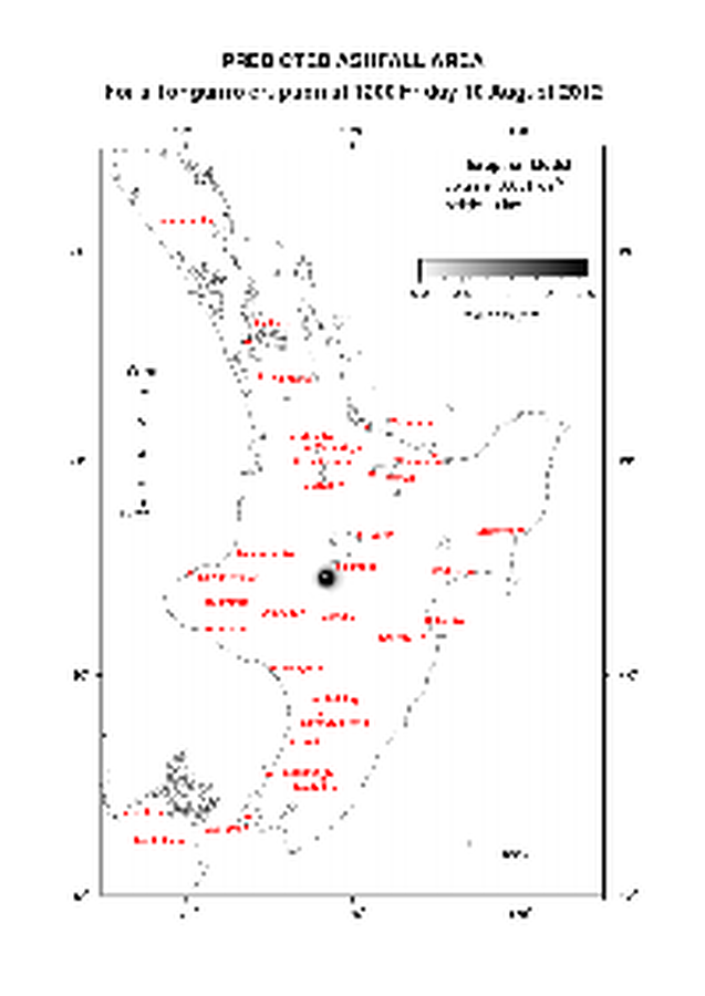
Predicted Ashfall Area for a Tongariro eruption at 1200 Friday 10 August 2012
GNS Science. (2012). Volcanic Alert Bulletin TON2012-13.

Official, Map in an information statement
Predicted Ashfall Area for a Tongariro eruption at 1200 Thursday 09 August 2012
GNS Science. (2012). Volcanic Alert Bulletin TON2012-12.
Official, Map in an information statement
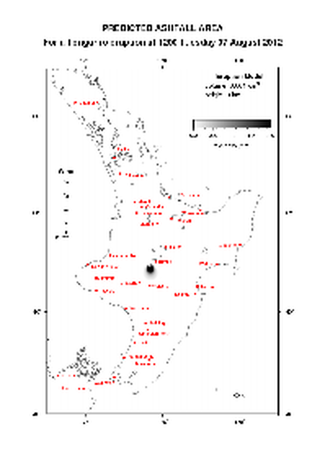
Predicted Ashfall Area for a Tongariro eruption at 1200 Tuesday 07 August 2012
GNS Science. (2012). Volcanic Alert Bulletin TON2012-08.

Official, Map in an information statement
Predicted Ashfall Area for a Tongariro eruption at 1200 Wednesday 08 August 2012
GNS Science. (2012). Volcanic Alert Bulletin TON2012-09.

Official, Map in an information statement
Predicted Ashfall Area for a Tongariro eruption at 1500 Monday 13 August 2012
GNS Science. (2012). Volcanic Alert Bulletin TON2012-18.
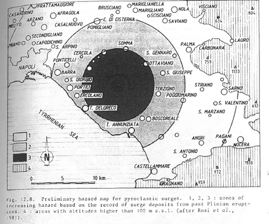
Figure in a journal article
Preliminary hazard map for pyroclastic surges
Figure 12.8 in: Barberi, F., Rosi, M., Santacroce, R., & Sheridan, M.F. (1983). Volcanic hazard zonation: Mt. Vesuvius. In: Tazieff, H. & Sabroux, J.-C. (Eds.) Forecasting Volcanic Events, Elsevier, Amsterdam, p. 149-161.
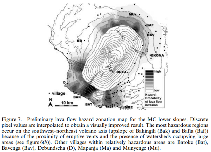
Figure in a journal article
Preliminary lava flow hazard zonation map for the MC lower slopes
Figure 7 in: Bonne, K., Kervyn, M., Cascone, L., Njome, S., Van Ranst, E., Suh, E., Ayonghe, S., & Ernst, G. (2008). A new approach to assess long‐term lava flow hazard and risk using GIS and low‐cost remote sensing: the case of Mount Cameroon, West Africa. International Journal of Remote Sensing, 29(22), 6539-6564. https://doi.org/10.1080/01431160802167873
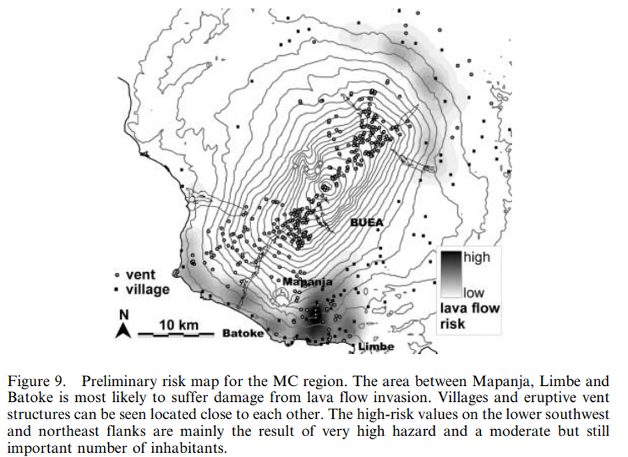
Figure in a journal article
Preliminary risk map for the MC region
Figure 9 in: Bonne, K., Kervyn, M., Cascone, L., Njome, S., Van Ranst, E., Suh, E., Ayonghe, S., & Ernst, G. (2008). A new approach to assess long‐term lava flow hazard and risk using GIS and low‐cost remote sensing: the case of Mount Cameroon, West Africa. International Journal of Remote Sensing, 29(22), 6539-6564. https://doi.org/10.1080/01431160802167873
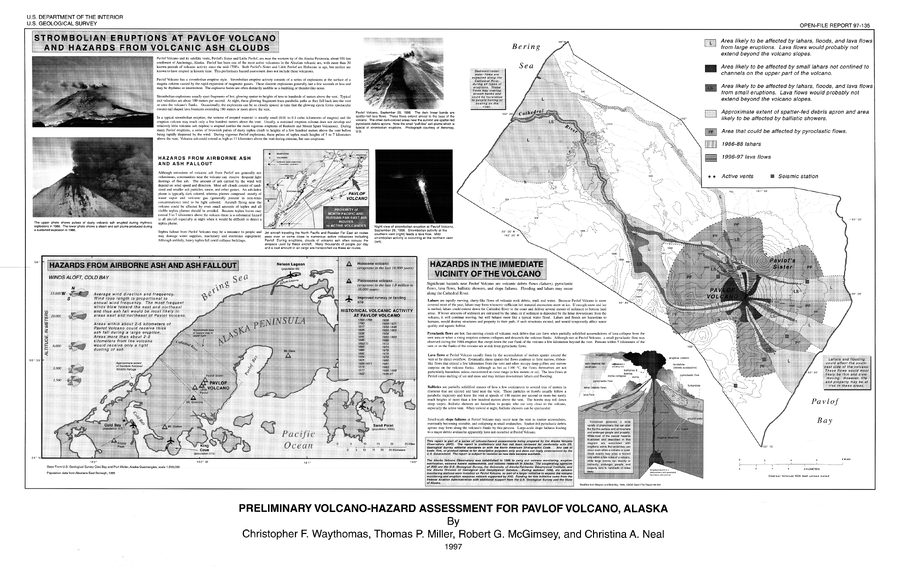
Official, Map sheet or poster
Preliminary Volcano-Hazard Assessment for Pavlof Volcano, Alaska
Plate 1 in: Waythomas, C.F., Miller, T.P., McGimsey, R.G. & Neal, C.A. (1997). Preliminary volcanic-hazard assessment for Pavlof Volcano, Alaska. U.S. Geological Survey, Open-File Report 97-135, 1 plate. https://doi.org/10.3133/ofr97135