
Advanced Search for Maps
Showing 31-40 of 78
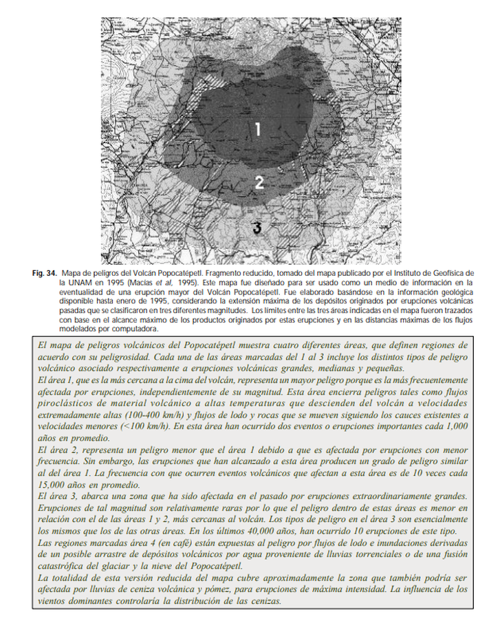
Official, Figure in hazard assessment
Mapa de peligros del Volcán Popocatépetl
(Popocatepetl Volcano hazard map)
Figure 34 in: de la Cruz Reyna, S. (2008). Volcanes. Peligro y Riesgo Volcánico en México. Serie Fascículos. Secretaria de Gobernación. CENAPRED, México. (Simplified from: Macías et al. 1995)
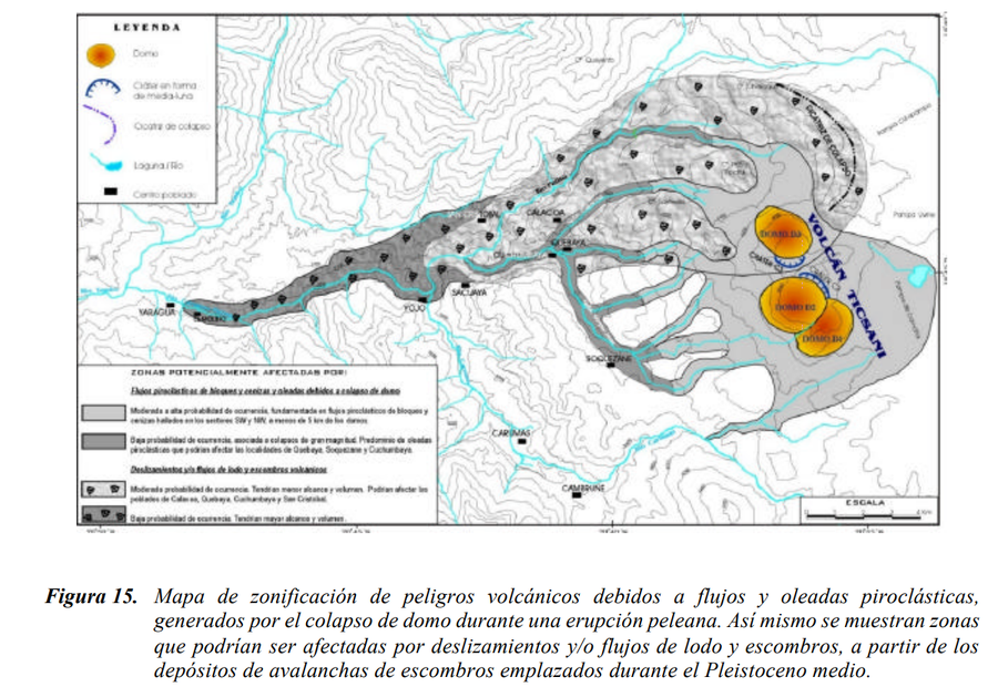
Official, Figure in hazard assessment
Mapa de zonificación de peligros volcánicos debidos a flujos y oleadas piroclásticas, generados por el colapso de domo durante una erupción peleana
(Zoning map of volcanic hazards due to pyroclastic flows and surges, generated by the collapse of the dome during a Pelean eruption)
Figure 15 in: Mariño Salazar, J. & Thouret, J.-C. (2003). Geología, Historia Eruptiva y Evaluación de Peligros del Volcán Ticsani (Sur del Perú). Instituto Geofísico del Perú (IGP).
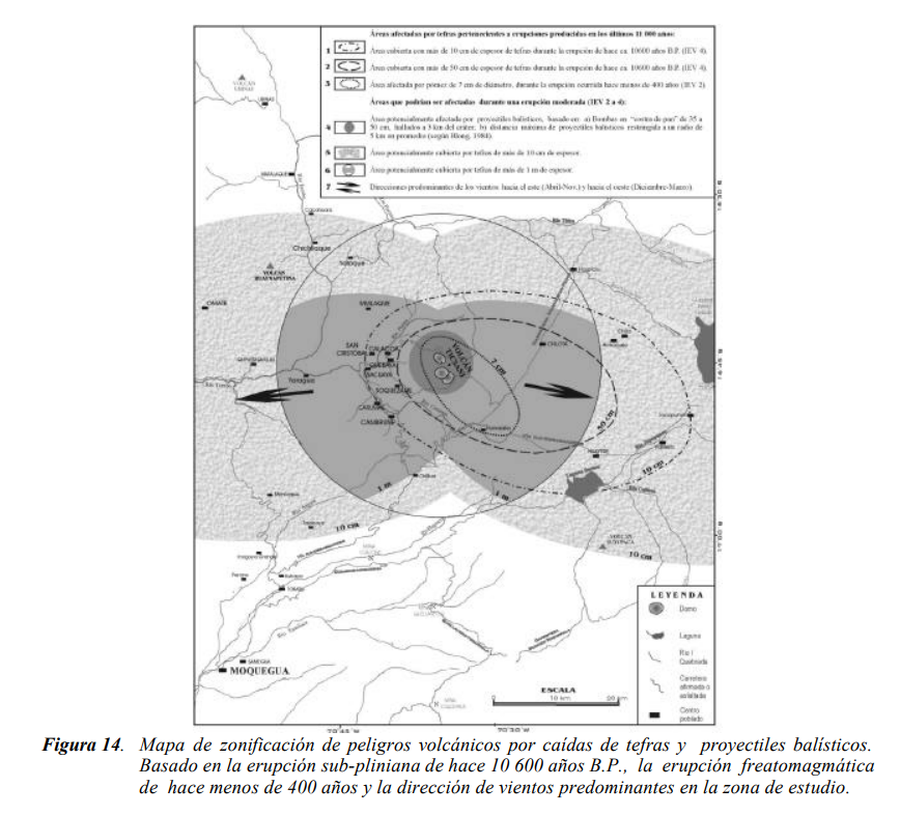
Official, Figure in hazard assessment
Mapa de zonificación de peligros volcánicos por caídas de tefras y proyectiles balísticos
(Zoning map of volcanic hazards from falling tephra and ballistic projectiles)
Figure 14 in: Mariño Salazar, J. & Thouret, J.-C. (2003). Geología, Historia Eruptiva y Evaluación de Peligros del Volcán Ticsani (Sur del Perú). Instituto Geofísico del Perú (IGP).
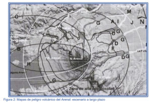
Figure in a journal article
Mapas de peligro volcánico del Arenal: escenario a largo plazo
(Arenal volcanic hazard maps: long-term scenario)
Figure 2 in: Soto, G.J. & Sjöbohm, L. (2007). Los Peligros volcánicos del Arenal. En torno a la Prevencion. Revista No. 4, Junio 2007. Comisión Nacional de Prevención de Riesgos y Atención de Emergencias (CNE).
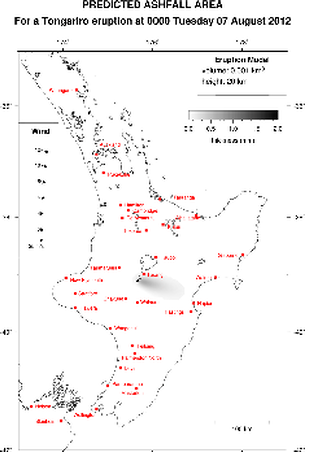
Official, Map in an information statement
Predicted Ashfall Area for a Tongariro eruption at 0000 Tuesday 07 August 2012
GNS Science. (2012). Volcanic Alert Bulletin TON2012-06.
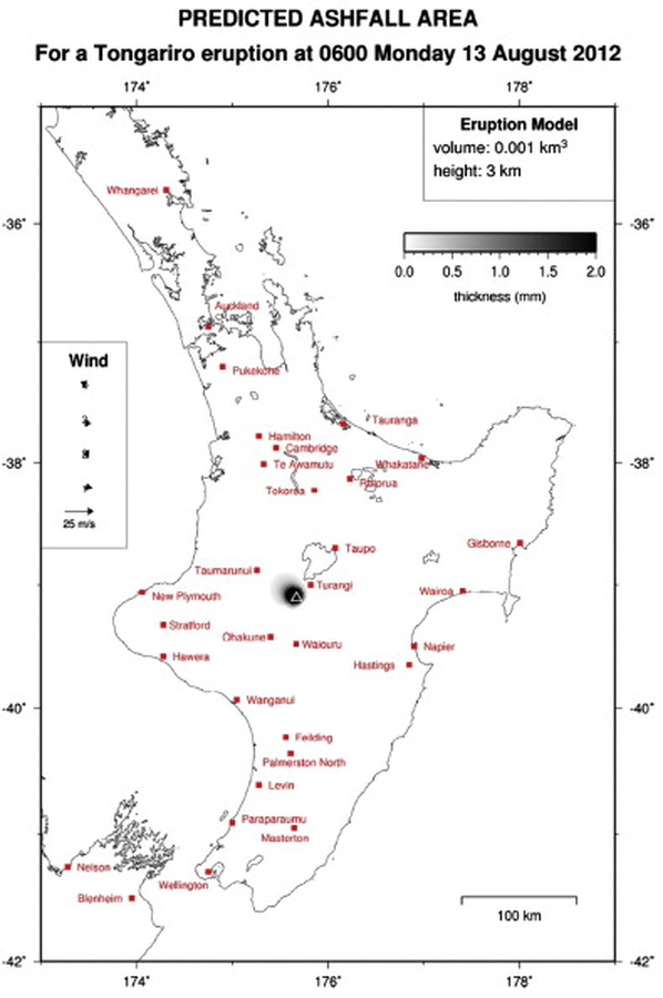
Official, Map in an information statement
Predicted Ashfall Area for a Tongariro eruption at 0600 Monday 13 August 2012
GNS Science. (2012). Volcanic Alert Bulletin TON2012-17. (Reprinted in: Leonard, G. S., Stewart, C., Wilson, T. M., Procter, J. N., Scott, B. J., Keys, H. J., Jolly, G.E., Wardman, J.B., Cronin. S.J. & McBride, S. K. (2014). Integrating multidisciplinary science, modelling and impact data into evolving, syn-event volcanic hazard mapping and communication: a case study from the 2012 Tongariro eruption crisis, New Zealand. Journal of Volcanology and Geothermal Research, 286, p. 208-232. https://doi.org/10.1016/j.jvolgeores.2014.08.018)
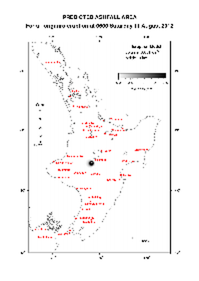
Official, Map in an information statement
Predicted Ashfall Area for a Tongariro eruption at 0600 Saturday 11 August 2012
GNS Science. (2012). Volcanic Alert Bulletin TON2012-14.
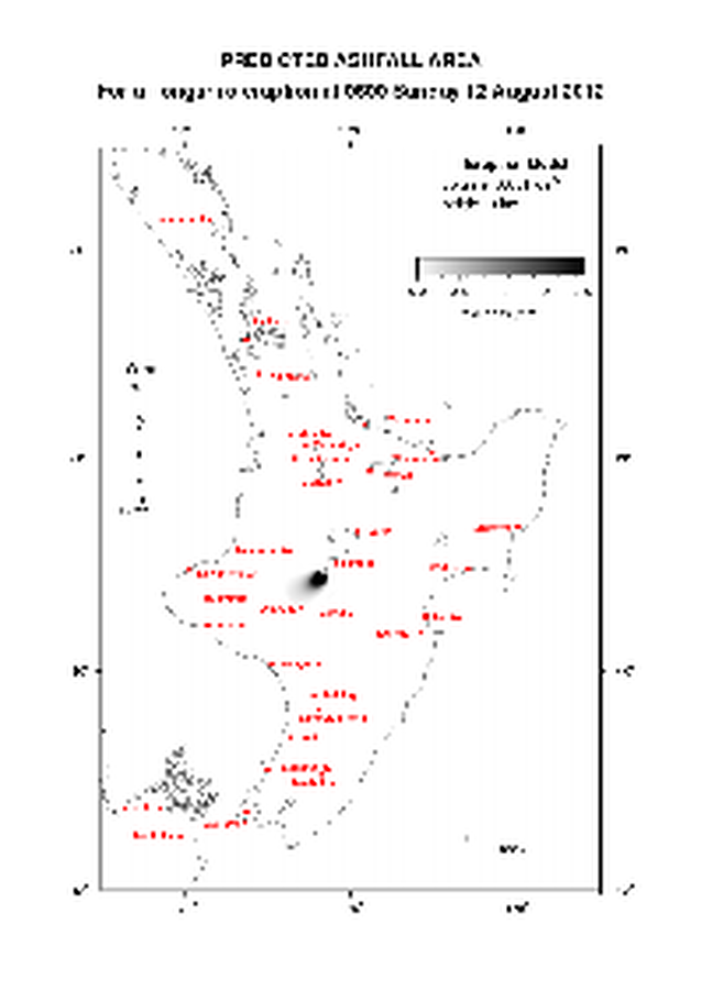
Official, Map in an information statement
Predicted Ashfall Area for a Tongariro eruption at 0600 Sunday 12 August 2012
GNS Science. (2012). Volcanic Alert Bulletin TON2012-16.
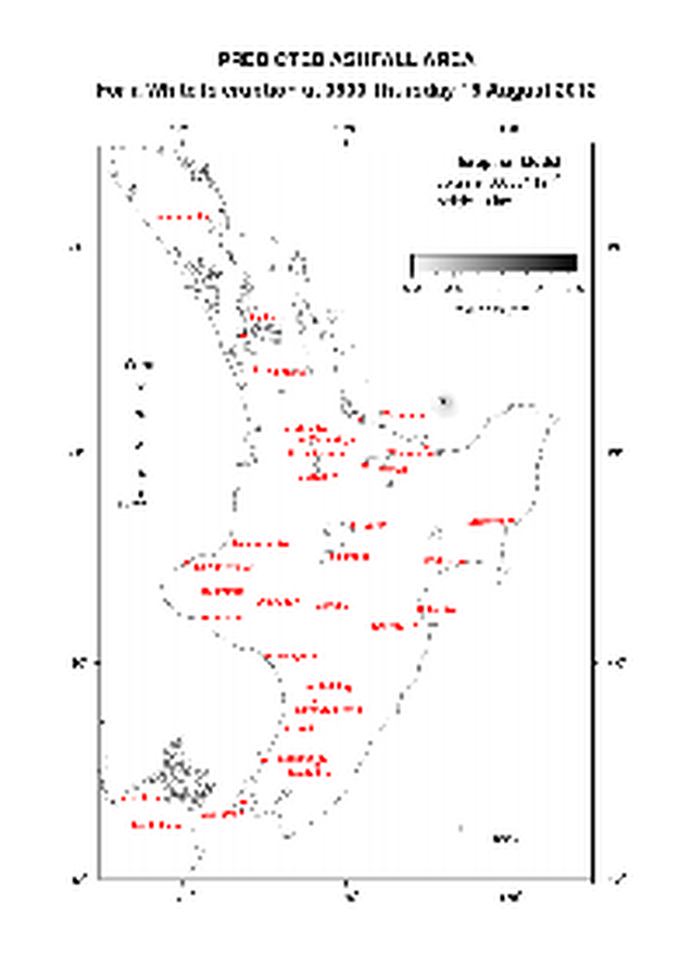
Official, Map in an information statement
Predicted Ashfall Area for a Tongariro eruption at 0600 Thursday 16 August 2012
GNS Science. (2012). Volcanic Alert Bulletin TON2012-21.

Official, Map in an information statement
Predicted Ashfall Area for a Tongariro eruption at 0600 Tuesday 14 August 2012
GNS Science. (2012). Volcanic Alert Bulletin TON2012-19.