
Advanced Search for Maps
Showing 21-30 of 132
Official, Figure on website
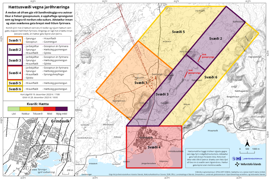
Hættusvæði vegna jarðhræringa
(Danger zone due to earthquakes)
Icelandic Meteorological Office (IMO). (2023). Hættusvæði vegna jarðhræringa, 19. desember 2023.
Official, Figure on website
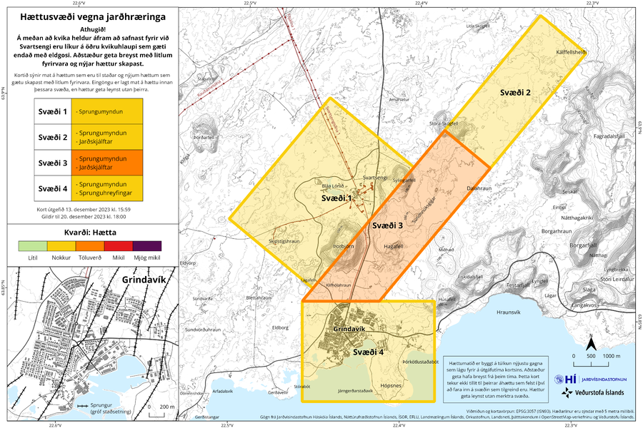
Hættusvæði vegna jarðhræringa
(Danger zone due to earthquakes)
Icelandic Meteorological Office (IMO). (2023). Hættusvæði vegna jarðhræringa, 13. desember 2023.
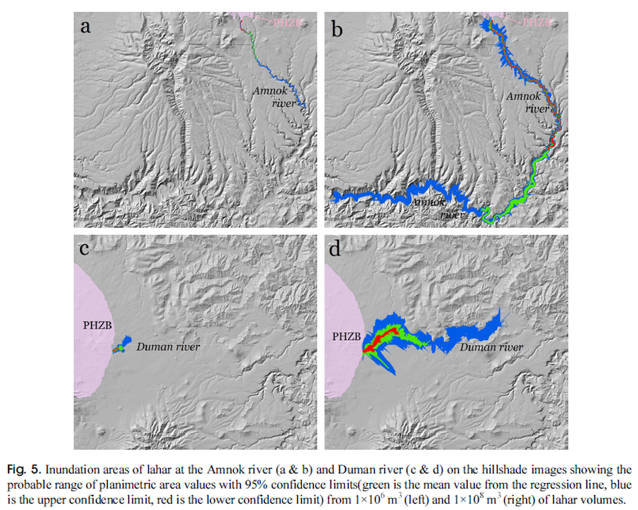
Figure in a journal article
Inundation areas of lahar at the Amnok river and Duman river
Figure 5 in: Yun, S. H. & Chang, C. (2017). Prediction of Lahar Flow Inundation Areas Using LAHARZ_py Program: Application for the Mt. Baekdu Volcano. Economic and Environmental Geology, 50(4), 277-286. https://doi.org/10.9719/EEG.2017.50.4.277
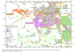
Figure in a journal article
Inundation map for the Petit Puy de Dome (orange) and Grave Noire (purple) events overlain on the GDACS GIS
Figure 7 in: Latutrie, B., Andredakis, I., De Groeve, T., Harris, A. J. L., Langlois, E., de Vries, B. V. W., Saubin, E., Bilotta, G., Cappello, A., Crisci, G.M., D'ambrosio, D., Del Negro, C., Favalli, M., Fujita, E., Iovine, G., Kelfoun, K., Rongo, R., Spataro, W., Tarquini, S., Coppola, D., Ganci, G., Marchese, F., Pergola, N., & Tramutoli, V. (2016). Testing a geographical information system for damage and evacuation assessment during an effusive volcanic crisis. In: Harris, A.J.L., De Groeve, T., & Carn, S.A. (Eds.) Detecting, Modelling and Responding to Effusive Eruptions. Geological Society, London, Special Publications, 426(1), p. 649-672. https://doi.org/10.1144/SP426.19
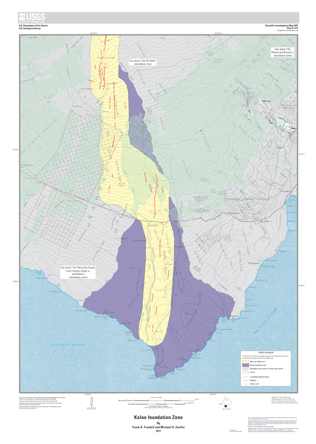
Official, Insert/poster-size map with accompanying report
Kalae Inundation Zone
Sheet 6 in: Trusdell, F.A. & Zoeller, M.H. (2017). Lava inundation zone maps for Mauna Loa, Island of Hawaiʻi, Hawaii. U.S. Geological Survey, Scientific Investigations Map 3387, 12 p., 10 sheets. https://doi.org/10.3133/sim3387
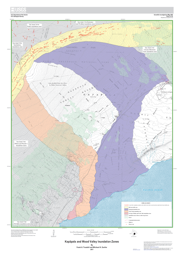
Official, Insert/poster-size map with accompanying report
Kapāpala and Wood Valley Inundation Zones
Sheet 3 in: Trusdell, F.A. & Zoeller, M.H. (2017). Lava inundation zone maps for Mauna Loa, Island of Hawaiʻi, Hawaii. U.S. Geological Survey, Scientific Investigations Map 3387, 12 p., 10 sheets. https://doi.org/10.3133/sim3387
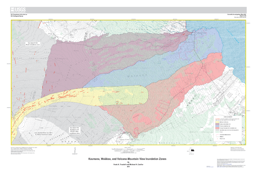
Official, Insert/poster-size map with accompanying report
Kaumana, Waiākea, and Volcano-Mountain View Inundation Zones
Sheet 2 in: Trusdell, F.A. & Zoeller, M.H. (2017). Lava inundation zone maps for Mauna Loa, Island of Hawaiʻi, Hawaii. U.S. Geological Survey, Scientific Investigations Map 3387, 12 p., 10 sheets. https://doi.org/10.3133/sim3387
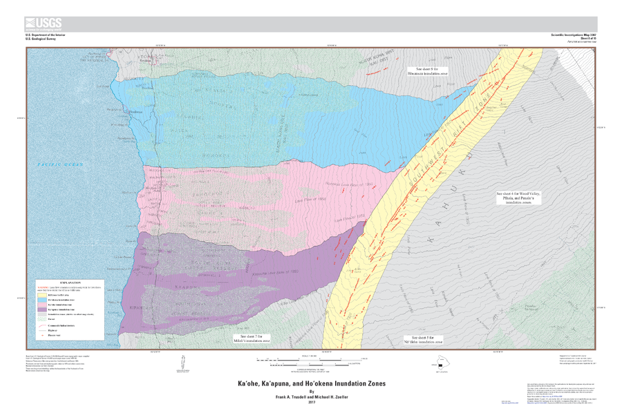
Official, Insert/poster-size map with accompanying report
Kaʻohe, Kaʻapuna, and Hoʻokena Inundation Zones
Sheet 8 in: Trusdell, F.A. & Zoeller, M.H. (2017). Lava inundation zone maps for Mauna Loa, Island of Hawaiʻi, Hawaii. U.S. Geological Survey, Scientific Investigations Map 3387, 12 p., 10 sheets. https://doi.org/10.3133/sim3387
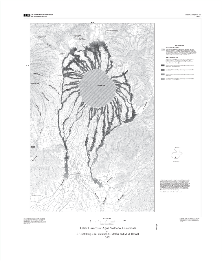
Official (foreign agency), Insert/poster-size map with accompanying report
Lahar Hazards at Agua Volcano, Guatemala
Plate 1 in: Schilling, S.P., Vallance, J.W., Matías, O., & Howell, M.M. (2001). Lahar Hazards at Agua Volcano, Guatemala. U.S. Geological Survey, Open-File Report 01-432, 16 p., 1 plate. https://doi.org/10.3133/ofr01432
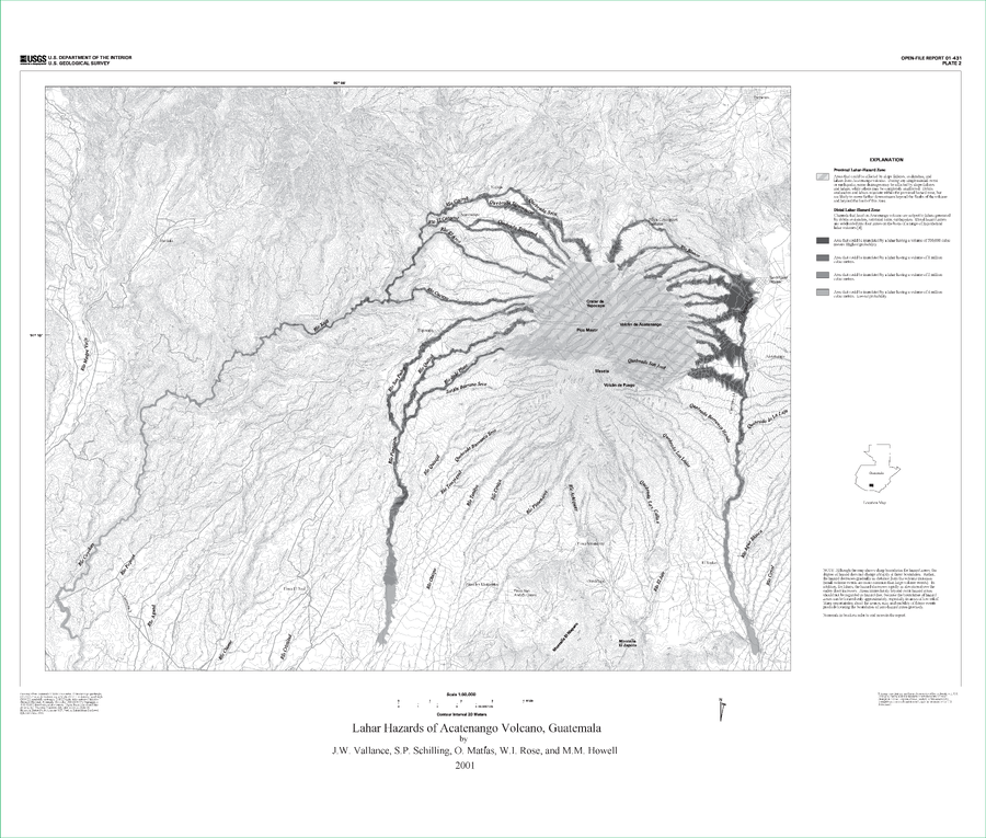
Official (foreign agency), Insert/poster-size map with accompanying report
Lahar Hazards of Acatenango Volcano, Guatemala
Plate 2 in: Vallance, J.W., Schilling, S.P., Matías, O., Rose, W.I. & Howell, M.M. (2001). Volcano Hazards at Fuego and Acatenango, Guatemala. U.S. Geological Survey, Open-File Report 01-431. https://doi.org/10.3133/ofr01431