
Advanced Search for Maps
Showing 31-40 of 98
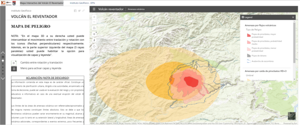
Official, Interactive web-based map
Mapa Interactivo del Volcán el Reventador
(Reventador Volcano Interactive Map)
Instituto Geofísico de la Escuela Politecnica Nacional (IG-EPN). (2019). Mapa Interactivo del Volcán El Reventador.
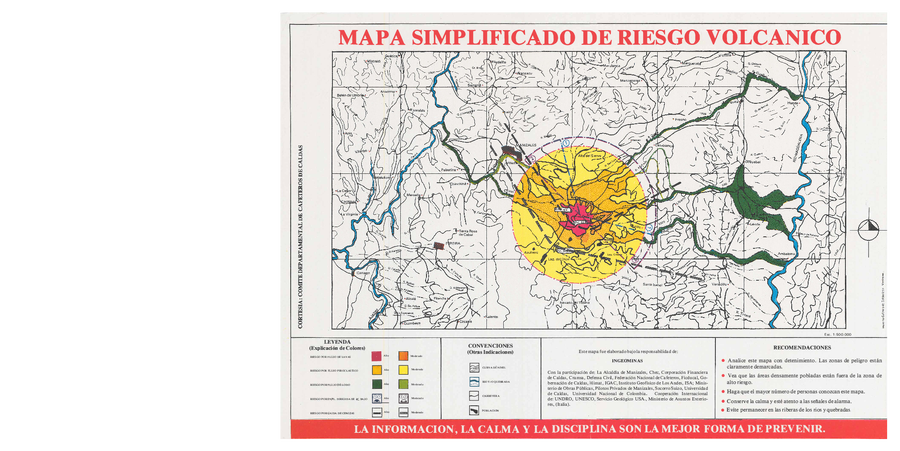
Official, Sign or billboard
Mapa Simplificado de Riesgo Volcanico
(Simplified Map of Volcanic Risk)
Instituto Colombiano de Geología y Minería (INGEOMINAS). (1985?). Mapa Simplificado de Riesgo Volcanico. Comite Departmental de Cafeteros de Calda, Manizales.
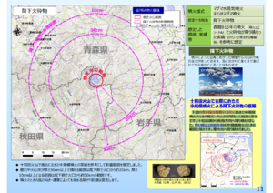
Official, Map in a booklet, long fact-sheet, or handbook
Medium-scale eruption (assuming hundreds of millions of cubic meters of magma eruption) pyroclastic fall
Page 11 in: Towada Volcanic Hazards Mitigation Committee. (2018). Towada Volcano Hazard Expected Impact Area Map. Omori Prefecture Disaster Risk Management Division, Akita Prefecture Disaster Prevention Division, Nagano City General Affairs Division, Kosaka Town General Affairs Division.
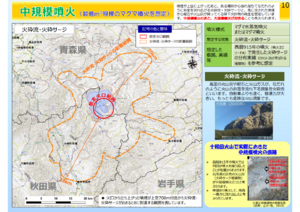
Official, Map in a booklet, long fact-sheet, or handbook
Medium-scale eruption (assuming hundreds of millions of cubic meters of magma eruption) pyroclastic flow/pyroclastic surge
Page 10 in: Towada Volcanic Hazards Mitigation Committee. (2018). Towada Volcano Hazard Expected Impact Area Map. Omori Prefecture Disaster Risk Management Division, Akita Prefecture Disaster Prevention Division, Nagano City General Affairs Division, Kosaka Town General Affairs Division.
Official, Map in a booklet, long fact-sheet, or handbook
Melting snow-type volcanic flow (assumed to occur during a large-scale eruption during the snow season)
Page 14 in: Towada Volcanic Hazards Mitigation Committee. (2018). Towada Volcano Hazard Expected Impact Area Map. Omori Prefecture Disaster Risk Management Division, Akita Prefecture Disaster Prevention Division, Nagano City General Affairs Division, Kosaka Town General Affairs Division.
Official, Map sheet or poster
Midagahara Volcanic Hazard Map
Midagahara Volcano Disaster Prevention Council. (2018). Midagahara Volcanic Hazard Map. Toyama Prefecture Disaster Prevention Crisis and Science Division.
Official, Sign or billboard
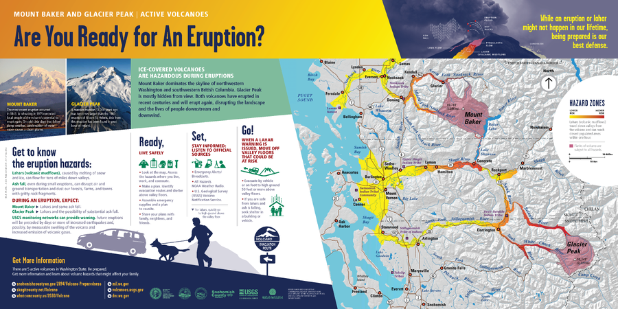
Mount Baker and Glacier Peak | Active Volcanoes. Are You Ready for An Eruption?
Washington Department of Natural Resources. (2014). Mount Baker and Glacier Peak, Active Volcanoes, Are You Ready for An Eruption? Mount Baker And Glacier Peak Combined Hazard Map. (Simplified from: Waitt et al. 1995 and Gardner et al. 1995)
Official, Sign or billboard
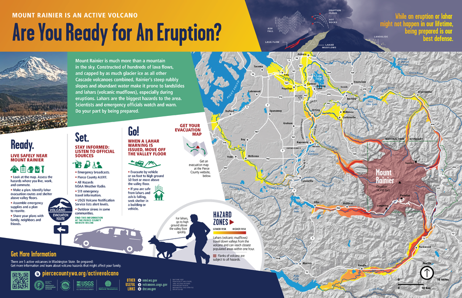
Mount Rainier is An Active Volcano, Are You Ready for An Eruption?
Washington Department of Natural Resources. (2014). Mount Rainier is An Active Volcano, Are You Ready for An Eruption? (Simplified from: Hoblitt et al. 1998)

Official, Map sheet or poster
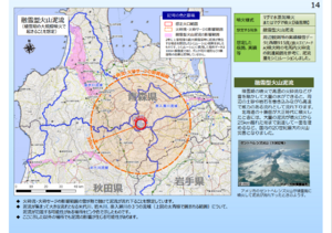
Mt. Iwate Volcanic Disaster Prevention Map
The Counter-measures Investigation Committee on Volcanic Disasters at Mt. Iwate. (1998). Mt. Iwate Volcanic Disaster Prevention Map.

Official, Map in a booklet, long fact-sheet, or handbook
Mudflow Hazard Zones Map
Page 18 in: Crandell, D.R. & Nichols, D.R. (1989). Volcanic hazards at Mount Shasta, California. U.S. Geological Survey, General Information Product, 22 p. https://doi.org/10.3133/70039409