
Advanced Search for Maps
Showing 41-50 of 98
Nakanoshima, Japan
Official, Figure in hazard assessment
Nakanoshima volcanic disaster area prediction map
Figure 5-4-6 (pg. 5-4-3) in: Kagoshima Prefecture. (1996). Kagoshima Prefecture regional plan for disaster prevention.
Official, Figure in hazard assessment
Nakanoshima volcanic disaster area prediction map
Figure 5-4-6 (pg. 5-4-3) in: Kagoshima Prefecture. (1996). Kagoshima Prefecture regional plan for disaster prevention.
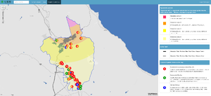
Official, Interactive web-based map
Nanae Town Eruption/Earthquake [Interactive Map]
Nanae Town. (2022). Nanae Town Eruption/Earthquake [Interactive Map]. http://www2.town.nanae.hokkaido.jp/bousai/hazardmap/map.html?lay=funka
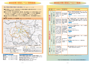
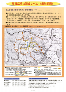
Official, Map in a booklet, long fact-sheet, or handbook
Nasudake volcanic alert level and regulation range
Page 11 in: Nasudake Volcano Disaster Prevention Council. (2014). Nasudake Volcano Disaster Prevention Handbook.
Official, Map in a booklet, long fact-sheet, or handbook
Nasudake volcanic alert level and regulation range
Page 11 in: Nasudake Volcano Disaster Prevention Council. (2010). Volcanic disaster prevention handbook of Mt. Nasudake.
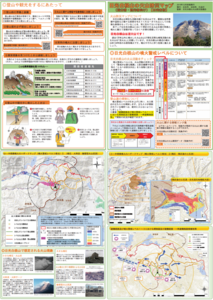
Official, Hiking or trail map
Nikko-Shiranesan Volcanic Disaster Prevention Map
Nikko City, Numata City, & Katashina Village. (2019). Nikko-Shiranesan Volcanic Disaster Prevention Map
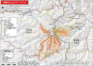
Official, Map sheet or poster
Norikuradake volcanic disaster hazard map
Volcano Disaster Management Councils of Norikuradake. (2020). Norikura volcano disaster prevention evacuation plan.

Official, Interactive web-based map
Oregon HazVu: Statewise Geohazards Viewer
Oregon Department of Geology and Moneral Industries (DOGAMI). (2012). Oregon HazVu: Statewide Geohazards Viewer.
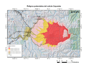
Official, Figure on website
Peligros potenciales del volcán Cayambe
(Potential hazards of Cayambe volcano)
Instituto Geofísico de la Escuela Politecnica Nacional (IG-EPN). (2022). Peligros potenciales del volcán Cayambe. Complejo Volcánico Cayambe. https://www.igepn.edu.ec/amenaza-volcanica/mapa-amenaza-cayambe

Official, Figure on website
Peligros potenciales del volcán Cotopaxi
(Potential hazards of Cotopaxi volcano)
Instituto Geofísico de la Escuela Politecnica Nacional (IG-EPN). (2022). Peligros potenciales del volcán Cotopaxi. Volcán Cotopaxi. https://www.igepn.edu.ec/amenaza-volcanica/mapa-amenaza-cotopaxi
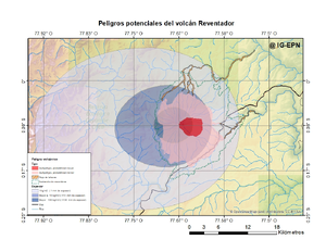
Official, Figure on website
Peligros potenciales del volcán Reventador
(Potential hazards of Reventador volcano)
Instituto Geofísico de la Escuela Politecnica Nacional (IG-EPN). (2022). Peligros potenciales del volcán Reventador. Volcán El Reventador. https://www.igepn.edu.ec/amenaza-volcanica/mapa-amenaza-reventador