
Advanced Search for Maps
Showing 11-20 of 98

Figure in a journal article
Estimated Travel Time of Mudflows at Mount Hood, Oregon
Preppernau, C. A., & Jenny, B. (2016). Estimated travel time of mudflows at Mount Hood, Oregon. Journal of Maps, 12(5), p. 711-715. https://doi.org/10.1080/17445647.2015.1120244
Official, Map sheet or poster
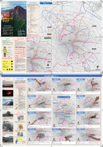
Fujisan Eruption Evacuation Route Map
Fujisan Eruption Evacuation Route Map
Official, Figure on website
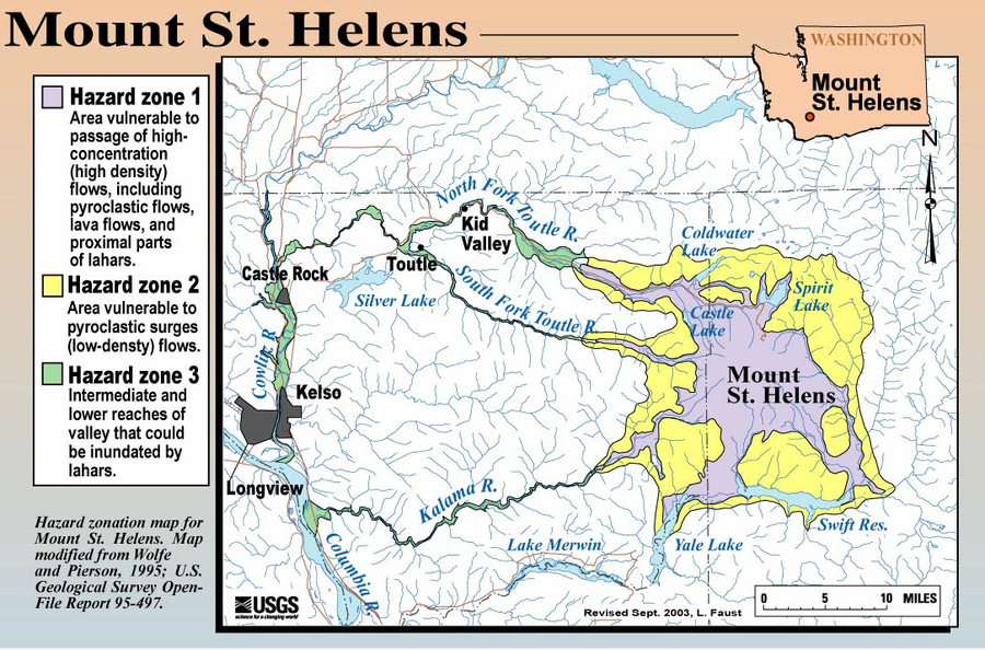
Hazard Zonation Map for Mount St. Helens
Faust, L. (2003). Hazard zonation map for Mount St. Helens. U.S. Geological Survey. (Simplified from: Wolfe & Pierson 1995) (Reprinted in: Bluth, G. (Year Unknown). Mt. St. Helens Activity Update (+ 2004 events). Michigan Technological University, GE4150 Lecture. https://pages.mtu.edu/~gbluth/Teaching/GE4150/lecture_pdfs/L11_msh_seismic.pdf#page=2)

Official, Map in a booklet, long fact-sheet, or handbook
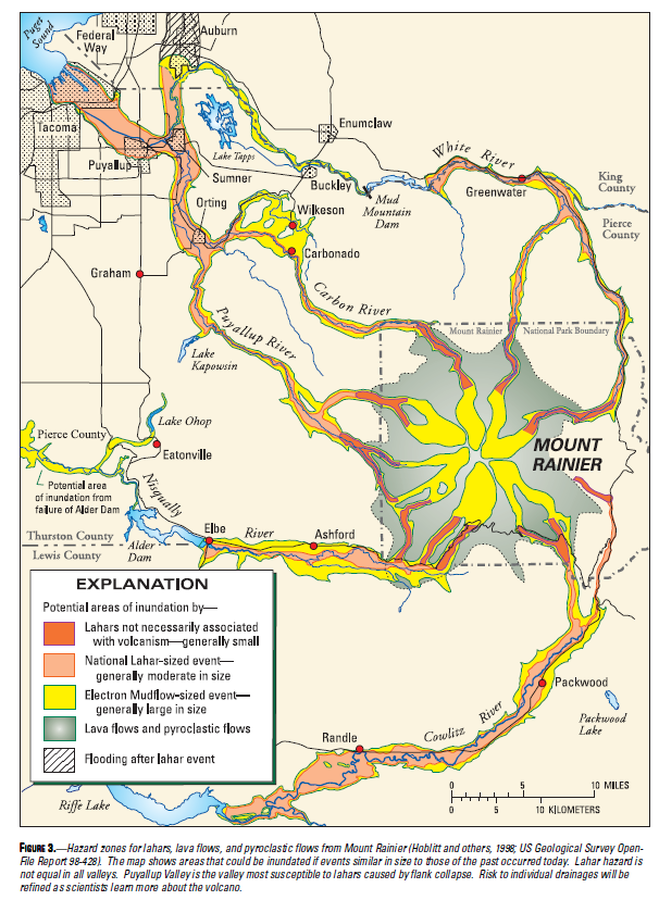
Hazard zones for debris flows, lahars, lava flows, and pyroclastic flows from Mount Rainier
Page 3 in: Driedger, C.L. & Scott, W.E. (2008). Mount Rainier: living safely with a volcano in your backyard. U.S. Geological Survey, Fact Sheet 2008-3062, 4 p. https://doi.org/10.3133/fs20083062
Official, Map in a booklet, long fact-sheet, or handbook
Hazard zones for lahars, lava flows, and pyroclastic flows from Mount Rainier
Figure 3 in: Driedger, C.L. & Scott, K.M. (2002). Mount Rainier: learning to live with volcanic risk. U.S. Geological Survey, Fact Sheet 034-02, 4 p. https://doi.org/10.3133/fs03402
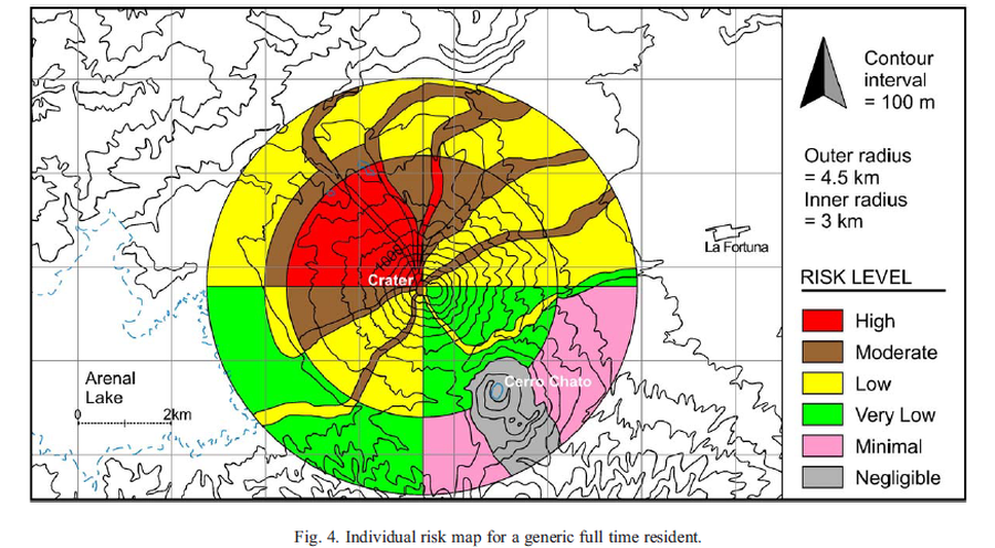
Figure in a journal article
Individual risk map for a generic full time resident
Figure 4 in: Meloy, A.F. (2006). Arenal-type pyroclastic flows: a probabilistic event tree risk analysis. Journal of Volcanology and Geothermal Research, 157(1-3), 121-134. https://doi.org/10.1016/j.jvolgeores.2006.03.048
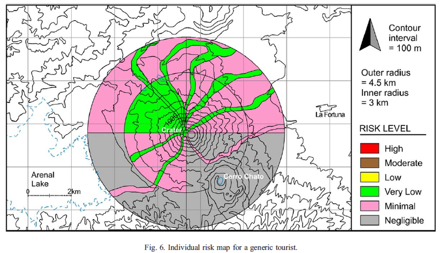
Figure in a journal article
Individual risk map for a generic tourist
Figure 6 in: Meloy, A. F. (2006). Arenal-type pyroclastic flows: a probabilistic event tree risk analysis. Journal of Volcanology and Geothermal Research, 157(1-3), 121-134. https://doi.org/10.1016/j.jvolgeores.2006.03.048
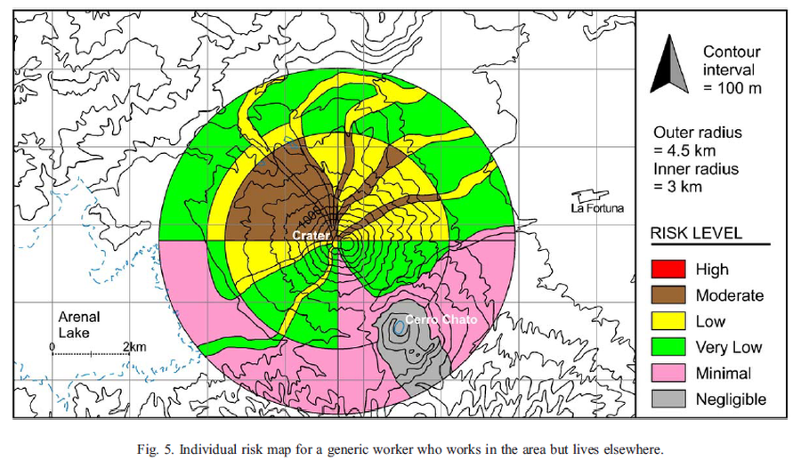
Figure in a journal article
Individual risk map for a generic worker who works in the area but lives elsewhere
Figure 5 in: Meloy, A. F. (2006). Arenal-type pyroclastic flows: a probabilistic event tree risk analysis. Journal of Volcanology and Geothermal Research, 157(1-3), 121-134. https://doi.org/10.1016/j.jvolgeores.2006.03.048
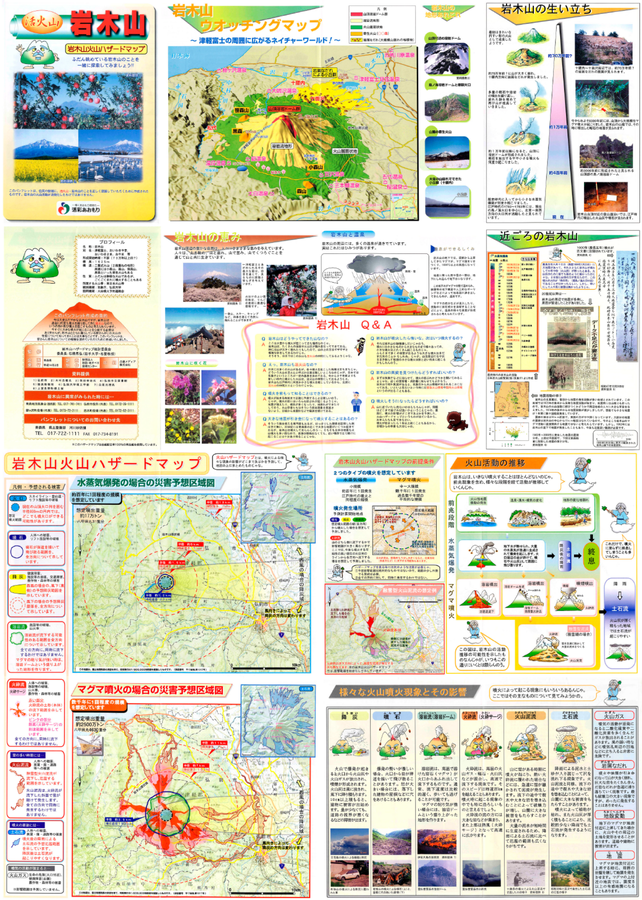
Official, Map sheet or poster
Iwakisan Volcano Hazard Map
Aomori Prefecture. (2002). Active Volcano Iwakisan - Iwakisan Volcanic Hazard Map.
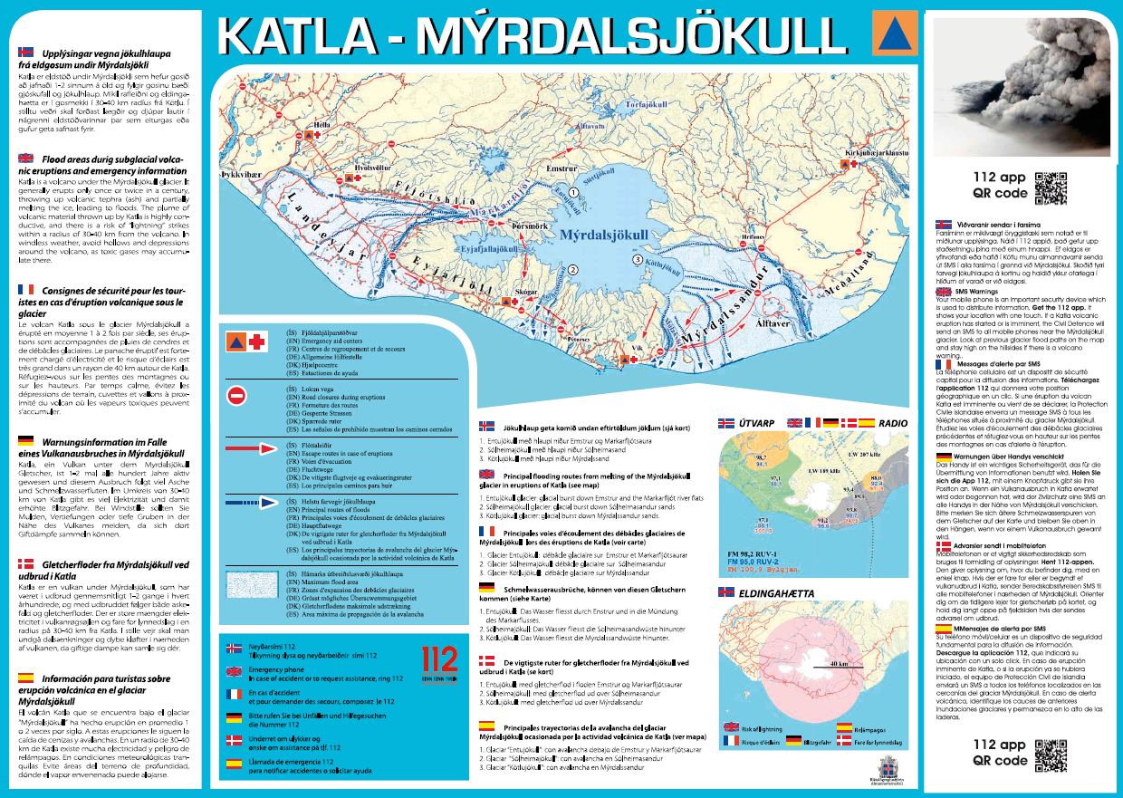
Official, Sign or billboard
Katla – Mýrdalsjökull
Almannavarnir. (2017). Katla – Mýrdalsjökull.