
Advanced Search for Maps
Showing 61-70 of 213
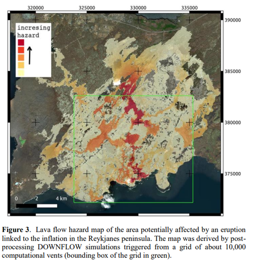
Figure in a conference presentation
Lava flow hazard map of the area potentially affected by an eruption linked to the inflation in the Reykjanes peninsula
Figure 3 in: Tarquini, S., Favalli, M., Pfeffer, M., de'Michieli Vitturi, M., Barsotti, S., Pedersen, G., Óladóttir, B., & Jensen, E. H. (2020). Assessing the impact of lava flows during the 2020 unrest of the Svartsengi volcanic system on the Reykjanes peninsula, Iceland. Geomorphometry, Perugia, Italy. https://doi.org/10.30437/GEOMORPHOMETRY2020
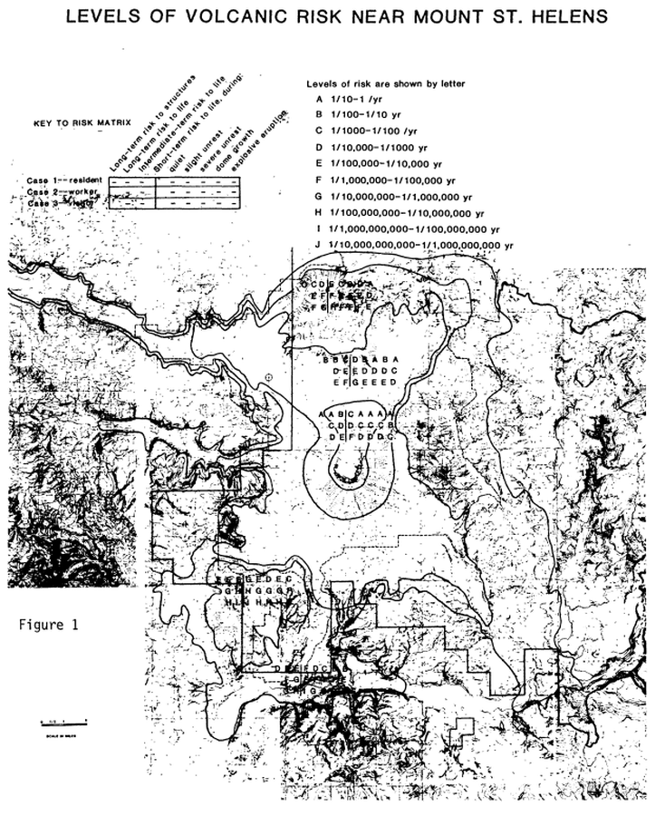
Official, Figure in hazard assessment
Levels of Volcanic Risk Near Mount St. Helens
Figure 1 in: Newhall, C.G. (1984). Semi-quantitative assessment of changing volcanic risk at Mount St. Helens, Washington. U.S. Geological Survey, Open-File Report 84-272, 30 p. doi:10.3133/ofr84272
Official, Map in an information statement
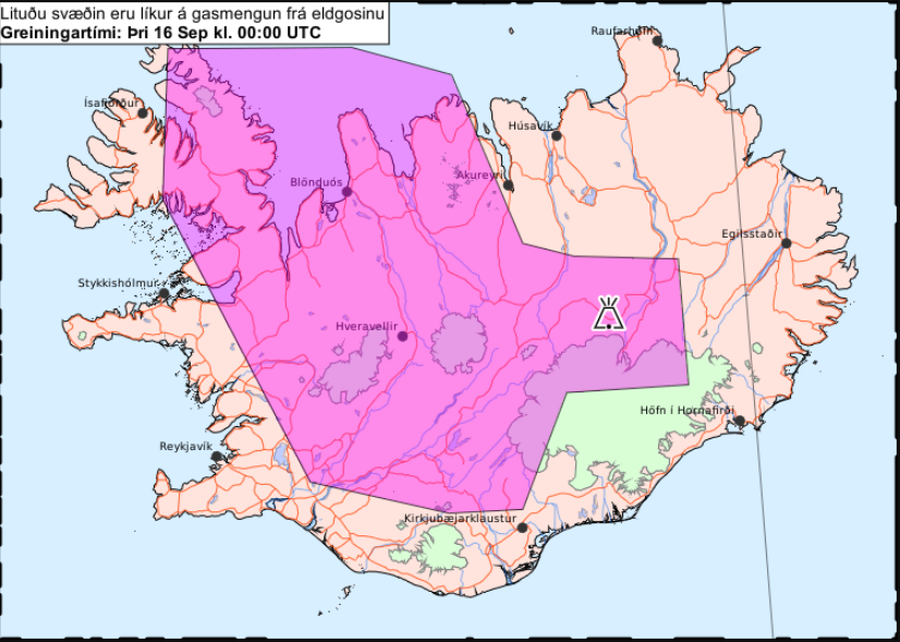
Litaða svæðið sýnir líklega gasmengun á morgun, fimmtudaginn 18. september
(The colored area is likely to show gas pollution tomorrow, Thursday 18 September.)
Iceland Meteorological Office (IMO). (2014). Litaða svæðið sýnir líklega gasmengun á morgun, fimmtudaginn 18. september.
Official, Map in an information statement
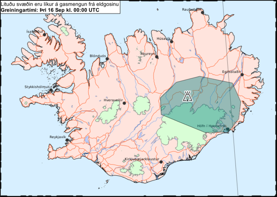
Litaða svæðið sýnir líklega gasmengun í miðvikudaginn 17. september
(The colored area is likely to show gas pollution on Wednesday, September 17.)
Iceland Meteorological Office (IMO). (2014). Litaða svæðið sýnir líklega gasmengun í miðvikudaginn 17. september.
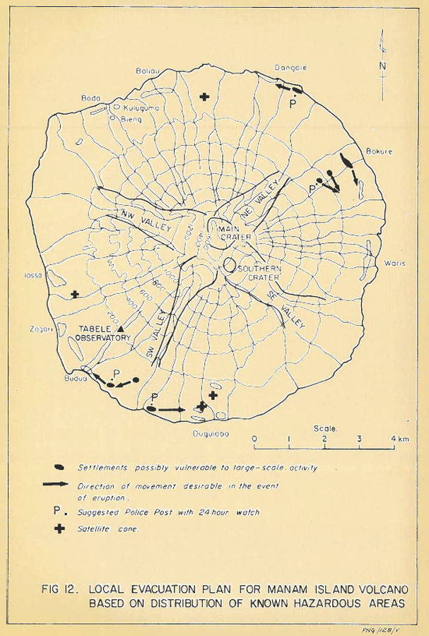
Official, Figure in hazard assessment
Local evacuation plan for Manam Island Volcano based on distribution of known hazardous areas
Figure 12 in: Lowenstein, P.L. (1982). Problems of volcanic hazards in Papua New Guinea. Geological Survey of Papua New Guinea, Report 82/7, 62 p.
Unknown format
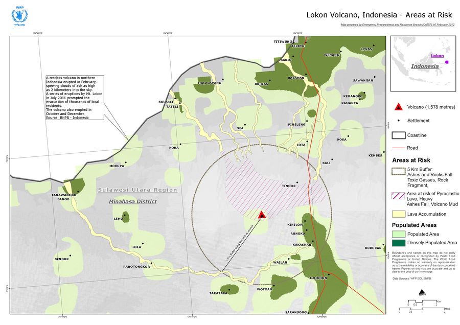
Lokon Volcano, Indonesia - Areas at Risk
World Food Programme. (2012). Lokon Volcano, Indonesia - Areas at Risk. World Food Prgramme, Emergency Preparedness an Response Branch (OMEP).
Holuhraun (Askja) & Bárdarbunga, Iceland
Official, Map in an information statement
Lokunarsvæði og hættusvæði vegna eldgoss í Holuhrauni og jarðhræringa í Bárðarbungu 13.02.2015
(Closures and danger zone due to eruption in Holuhraun and earthquakes in Bárðarbunga 13.02.2015)
Almannavarnir. (2015). Lokunarsvæði og hættusvæði vegna eldgoss í Holuhrauni og jarðhræringa í Bárðarbungu. 13.02.2015
Holuhraun (Askja) & Bárdarbunga, Iceland
Official, Map in an information statement
Lokunarsvæði og hættusvæði vegna eldgoss í Holuhrauni og jarðhræringa í Bárðarbungu 17.10.2014
(Closures and danger zone due to eruption in Holuhraun and earthquakes in Bárðarbunga 17.10.2014)
Almannavarnir. (2014). Lokunarsvæði og hættusvæði vegna eldgoss í Holuhrauni og jarðhræringa í Bárðarbungu. 17.10.2014
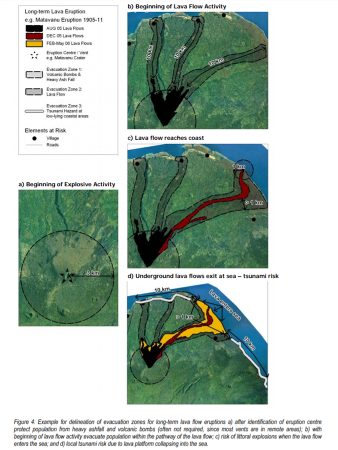
Official, Figure in hazard assessment
Long-term Lava Eruption e.g. Matavanu Eruption 1905-11
Figure 4 in: Cronin, S., Bonte-Grapentin, M. & Nemeth, K. (2006). Samoa technical report - Review of volcanic hazard maps for Savai'i and Upolu. Pacific Islands Applied Geoscience Commission (SOPAC) Project Report 59.
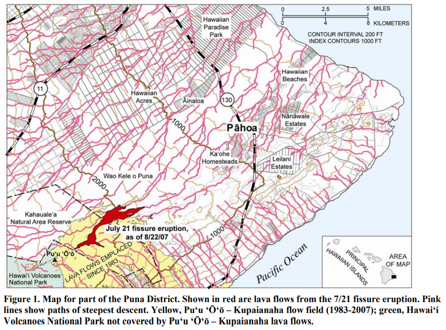
Official, Figure in hazard assessment
Map for part of the Puna District
Figure 1 in: Kauahikaua, J. (2007). Lava flow hazard assessment, as of August 2007, for Kīlauea east rift zone eruptions, Hawai‘i Island. U.S. Geological Survey Open-File Report 2007-1264, 9 p.