
Advanced Search for Maps
Showing 1-10 of 98
Official, Map sheet or poster
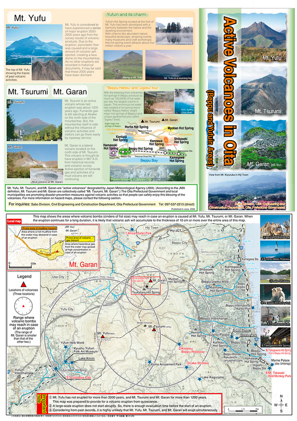
Active Volcanoes in Oita
Oita Prefectural Government. (2006). Active Volcanoes in Oita (Beppu and Yufuin Areas). Sabo Division, Civil Engineering and Construction Department, Oita Prefectural Government.
Official, Map in a booklet, long fact-sheet, or handbook
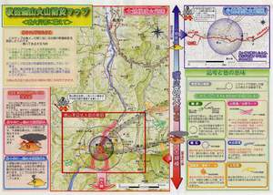
Akita-Yakeyama Volcanic Disaster Prevention Map
Akita Prefecture. (2002). Akita-Yakeyama Volcanic Disaster Prevention Map.
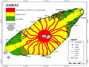
Figure in a journal article
Ambae
Cronin, S.J., Gaylord, D.R., Charley, D., Alloway, B.V., Wallez, S., & Esau, J.W. (2004). Participatory methods of incorporating scientific with traditional knowledge for volcanic hazard management on Ambae Island, Vanuatu. Bulletin of volcanology, 66(7), p. 652-668. https://doi.org/10.1007/s00445-004-0347-9. (Reprinted in: Cronin, S. J., & Németh, K., Stewart, R.B. (2006). Volcanic hazards planning on rifting island and fissure volcanoes. Joint Conference of the Geological Society of New Zealand and the New Zealand Geophysical Society.)
Official, Map in a booklet, long fact-sheet, or handbook
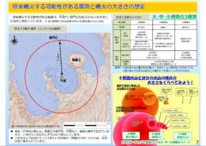
Assumed future eruption location and magnitude of eruption
Page 7 in: Towada Volcanic Hazards Mitigation Committee. (2018). Towada Volcano Hazard Expected Impact Area Map. Omori Prefecture Disaster Risk Management Division, Akita Prefecture Disaster Prevention Division, Nagano City General Affairs Division, Kosaka Town General Affairs Division.
Official, Interactive web-based map
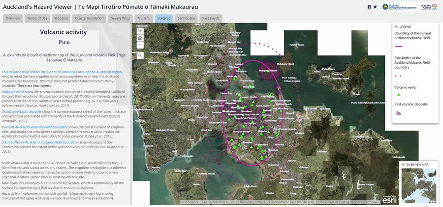
Auckland's Hazard Viewer Volcanic Activity
Auckland Council. Auckland's Hazard Viewer: Volcanic Activity.
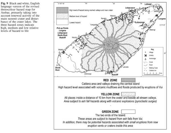
Figure in a journal article
Black and white, English language version of the revised three-colour hazard map for Ambae, primarily taking into account renewed activity of the main summit crater and disturbance of the crater lakes
Figure 9 in: Cronin, S.J., Gaylord, D.R., Charley, D., Alloway, B.V., Wallez, S., & Esau, J.W. (2004). Participatory methods of incorporating scientific with traditional knowledge for volcanic hazard management on Ambae Island, Vanuatu. Bulletin of volcanology, 66(7), p. 652-668. https://doi.org/10.1007/s00445-004-0347-9
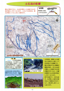
Official, Map in a booklet, long fact-sheet, or handbook
Debris flow dangerous area prediction map
Page 8 in: Nasudake Volcano Disaster Prevention Council. (2014). Nasudake Volcano Disaster Prevention Handbook.
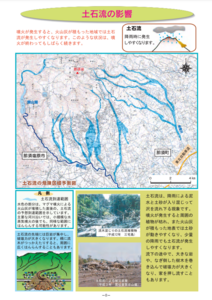
Official, Map in a booklet, long fact-sheet, or handbook
Debris flow dangerous area prediction map
Page 8 in: Nasudake Volcano Disaster Prevention Council. (2010). Volcanic disaster prevention handbook of Mt. Nasudake.
Official, Map in a booklet, long fact-sheet, or handbook
Enlarged view around Yakeyama
Akita Prefecture. (2002). Akita-Yakeyama Volcanic Disaster Prevention Map.
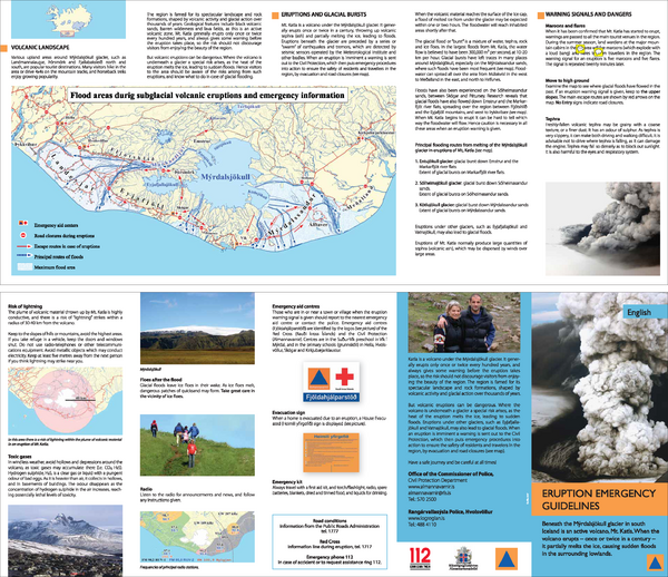
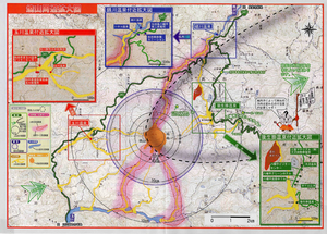
Official, Flyer, brochure, short fact-sheet, or handout
Eruption emergency guidelines – Katla in Mýrdalsjökull: English
Almannavarnir. (2017). Eruption emergency guidelines - Katla in Mýrdalsjökull.